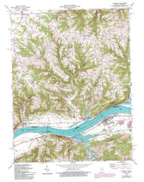
Florence Topo Map Indiana
To zoom in, hover over the map of Florence
USGS Topo Quad 38084g8 - 1:24,000 scale
| Topo Map Name: | Florence |
| USGS Topo Quad ID: | 38084g8 |
| Print Size: | ca. 21 1/4" wide x 27" high |
| Southeast Coordinates: | 38.75° N latitude / 84.875° W longitude |
| Map Center Coordinates: | 38.8125° N latitude / 84.9375° W longitude |
| U.S. States: | IN, KY |
| Filename: | o38084g8.jpg |
| Download Map JPG Image: | Florence topo map 1:24,000 scale |
| Map Type: | Topographic |
| Topo Series: | 7.5´ |
| Map Scale: | 1:24,000 |
| Source of Map Images: | United States Geological Survey (USGS) |
| Alternate Map Versions: |
Florence IN 1943 Download PDF Buy paper map Florence IN 1951, updated 1953 Download PDF Buy paper map Florence IN 1966, updated 1968 Download PDF Buy paper map Florence IN 1966, updated 1979 Download PDF Buy paper map Florence IN 1966, updated 1981 Download PDF Buy paper map Florence IN 1966, updated 1994 Download PDF Buy paper map Florence IN 2010 Download PDF Buy paper map Florence IN 2013 Download PDF Buy paper map Florence IN 2016 Download PDF Buy paper map |
1:24,000 Topo Quads surrounding Florence
> Back to 38084e1 at 1:100,000 scale
> Back to 38084a1 at 1:250,000 scale
> Back to U.S. Topo Maps home
Florence topo map: Gazetteer
Florence: Dams
Markland Dam elevation 131m 429′Markland Locks and Dam elevation 137m 449′
Florence: Populated Places
Antioch elevation 266m 872′East Enterprise elevation 269m 882′
Ethridge elevation 147m 482′
Florence elevation 145m 475′
Markland elevation 141m 462′
Quercus Grove elevation 266m 872′
Warsaw elevation 151m 495′
Florence: Ridges
Beatty Ridge elevation 245m 803′Bethel Ridge elevation 245m 803′
Hominy Ridge elevation 260m 853′
McCreary Ridge elevation 251m 823′
Pleasant Ridge elevation 234m 767′
Scott Ridge elevation 257m 843′
Florence: Streams
Bryant Creek elevation 137m 449′Craigs Creek elevation 141m 462′
Dry Creek elevation 137m 449′
Log Lick Creek elevation 128m 419′
Mill Creek elevation 146m 479′
Snake Creek elevation 140m 459′
Stephens Creek elevation 130m 426′
Thurston Creek elevation 154m 505′
Turtle Creek elevation 138m 452′
Two Lick Creek elevation 136m 446′
Vera Cruz Branch elevation 137m 449′
Wiley Branch elevation 137m 449′
Florence: Summits
Johnson Hill elevation 224m 734′Florence digital topo map on disk
Buy this Florence topo map showing relief, roads, GPS coordinates and other geographical features, as a high-resolution digital map file on DVD:


