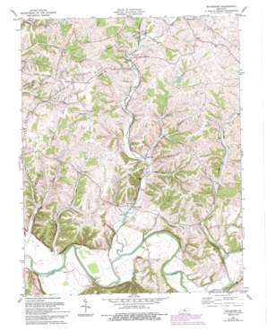
Waterford Topo Map Kentucky
To zoom in, hover over the map of Waterford
USGS Topo Quad 38085a4 - 1:24,000 scale
| Topo Map Name: | Waterford |
| USGS Topo Quad ID: | 38085a4 |
| Print Size: | ca. 21 1/4" wide x 27" high |
| Southeast Coordinates: | 38° N latitude / 85.375° W longitude |
| Map Center Coordinates: | 38.0625° N latitude / 85.4375° W longitude |
| U.S. State: | KY |
| Filename: | o38085a4.jpg |
| Download Map JPG Image: | Waterford topo map 1:24,000 scale |
| Map Type: | Topographic |
| Topo Series: | 7.5´ |
| Map Scale: | 1:24,000 |
| Source of Map Images: | United States Geological Survey (USGS) |
| Alternate Map Versions: |
Waterford KY 1951 Download PDF Buy paper map Waterford KY 1960, updated 1961 Download PDF Buy paper map Waterford KY 1981, updated 1981 Download PDF Buy paper map Waterford KY 1981, updated 1987 Download PDF Buy paper map Waterford KY 1981, updated 1994 Download PDF Buy paper map Waterford KY 2010 Download PDF Buy paper map Waterford KY 2013 Download PDF Buy paper map Waterford KY 2016 Download PDF Buy paper map |
1:24,000 Topo Quads surrounding Waterford
> Back to 38085a1 at 1:100,000 scale
> Back to 38084a1 at 1:250,000 scale
> Back to U.S. Topo Maps home
Waterford topo map: Gazetteer
Waterford: Crossings
Formans Ford (historical) elevation 132m 433′Lucas Ford (historical) elevation 130m 426′
Waterford: Populated Places
Crenshaw elevation 183m 600′Waterford elevation 146m 479′
Whitfield elevation 220m 721′
Waterford: Post Offices
Crenshaw Post Office (historical) elevation 148m 485′Waterford Post Office (historical) elevation 133m 436′
Waterford: Streams
Chadbourn Branch elevation 136m 446′Drakes Branch elevation 189m 620′
Elk Creek elevation 140m 459′
Goose Creek elevation 131m 429′
Little Dutchman Creek elevation 143m 469′
Little Plum Creek elevation 154m 505′
Plum Creek elevation 134m 439′
Waterford: Valleys
Feather Bed Hollow elevation 149m 488′Waterford digital topo map on disk
Buy this Waterford topo map showing relief, roads, GPS coordinates and other geographical features, as a high-resolution digital map file on DVD:


