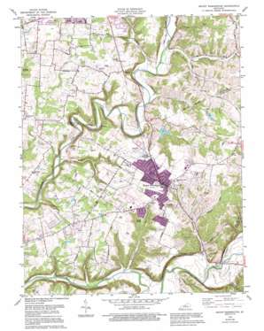
Mount Washington Topo Map Kentucky
To zoom in, hover over the map of Mount Washington
USGS Topo Quad 38085a5 - 1:24,000 scale
| Topo Map Name: | Mount Washington |
| USGS Topo Quad ID: | 38085a5 |
| Print Size: | ca. 21 1/4" wide x 27" high |
| Southeast Coordinates: | 38° N latitude / 85.5° W longitude |
| Map Center Coordinates: | 38.0625° N latitude / 85.5625° W longitude |
| U.S. State: | KY |
| Filename: | o38085a5.jpg |
| Download Map JPG Image: | Mount Washington topo map 1:24,000 scale |
| Map Type: | Topographic |
| Topo Series: | 7.5´ |
| Map Scale: | 1:24,000 |
| Source of Map Images: | United States Geological Survey (USGS) |
| Alternate Map Versions: |
Mount Washington KY 1951 Download PDF Buy paper map Mount Washington KY 1959, updated 1960 Download PDF Buy paper map Mount Washington KY 1959, updated 1972 Download PDF Buy paper map Mount Washington KY 1982, updated 1982 Download PDF Buy paper map Mount Washington KY 1982, updated 1990 Download PDF Buy paper map Mount Washington KY 1982, updated 1995 Download PDF Buy paper map Mount Washington KY 2010 Download PDF Buy paper map Mount Washington KY 2013 Download PDF Buy paper map Mount Washington KY 2016 Download PDF Buy paper map |
1:24,000 Topo Quads surrounding Mount Washington
> Back to 38085a1 at 1:100,000 scale
> Back to 38084a1 at 1:250,000 scale
> Back to U.S. Topo Maps home
Mount Washington topo map: Gazetteer
Mount Washington: Populated Places
Fairmount elevation 198m 649′Mount Washington elevation 215m 705′
Smithville elevation 148m 485′
Thixton elevation 195m 639′
Mount Washington: Post Offices
Mount Washington Post Office elevation 215m 705′Mount Washington: Streams
Back Run elevation 153m 501′Bethel Branch elevation 132m 433′
Big Run elevation 144m 472′
Broad Run elevation 148m 485′
Bull Branch elevation 134m 439′
Dutchman Creek elevation 131m 429′
Hough Run elevation 148m 485′
McCullough Run elevation 131m 429′
Mulberry Run elevation 154m 505′
Old Mans Run elevation 155m 508′
Turkey Run elevation 184m 603′
Wells Run elevation 132m 433′
Wheelers Run elevation 168m 551′
Whittaker Run elevation 127m 416′
Mount Washington digital topo map on disk
Buy this Mount Washington topo map showing relief, roads, GPS coordinates and other geographical features, as a high-resolution digital map file on DVD:


