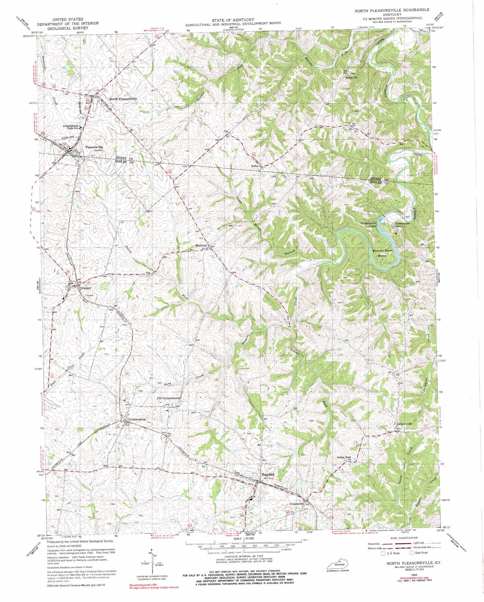
North Pleasureville Topo Map Kentucky
To zoom in, hover over the map of North Pleasureville
USGS Topo Quad 38085c1 - 1:24,000 scale
| Topo Map Name: | North Pleasureville |
| USGS Topo Quad ID: | 38085c1 |
| Print Size: | ca. 21 1/4" wide x 27" high |
| Southeast Coordinates: | 38.25° N latitude / 85° W longitude |
| Map Center Coordinates: | 38.3125° N latitude / 85.0625° W longitude |
| U.S. State: | KY |
| Filename: | o38085c1.jpg |
| Download Map JPG Image: | North Pleasureville topo map 1:24,000 scale |
| Map Type: | Topographic |
| Topo Series: | 7.5´ |
| Map Scale: | 1:24,000 |
| Source of Map Images: | United States Geological Survey (USGS) |
| Alternate Map Versions: |
North Pleasureville KY 1954, updated 1955 Download PDF Buy paper map North Pleasureville KY 1954, updated 1977 Download PDF Buy paper map North Pleasureville KY 1954, updated 1992 Download PDF Buy paper map North Pleasureville KY 2010 Download PDF Buy paper map North Pleasureville KY 2013 Download PDF Buy paper map North Pleasureville KY 2016 Download PDF Buy paper map |
1:24,000 Topo Quads surrounding North Pleasureville
Bedford |
Campbellsburg |
Worthville |
New Liberty |
Owenton |
Smithfield |
New Castle |
Franklinton |
Gratz |
Monterey |
Ballardsville |
Eminence |
North Pleasureville |
Polsgrove |
Switzer |
Simpsonville |
Shelbyville |
Waddy |
Frankfort West |
Frankfort East |
Taylorsville |
Mount Eden |
Glensboro |
Lawrenceburg |
Tyrone |
> Back to 38085a1 at 1:100,000 scale
> Back to 38084a1 at 1:250,000 scale
> Back to U.S. Topo Maps home
North Pleasureville topo map: Gazetteer
North Pleasureville: Bends
Beaver Dam Bend elevation 229m 751′North Pleasureville: Populated Places
Bagdad elevation 278m 912′Christianburg elevation 275m 902′
Consolation elevation 276m 905′
Cropper elevation 275m 902′
Defoe elevation 268m 879′
Elmburg elevation 269m 882′
Jacksonville elevation 275m 902′
North Benson Hills (historical) elevation 264m 866′
North Pleasureville elevation 274m 898′
Old Christianburg elevation 263m 862′
Pleasureville elevation 272m 892′
North Pleasureville: Post Offices
Boulware Post Office (historical) elevation 270m 885′Christiansburgh Post Office (historical) elevation 275m 902′
Consolation Post Office (historical) elevation 274m 898′
Cropper Post Office (historical) elevation 276m 905′
Defoe Post Office (historical) elevation 266m 872′
Elmburg Post Office (historical) elevation 269m 882′
Mitchell Post Office (historical) elevation 208m 682′
North Pleasureville Post Office (historical) elevation 275m 902′
Zilpa Post Office (historical) elevation 274m 898′
North Pleasureville: Reservoirs
Cedarmore Lake elevation 195m 639′North Pleasureville: Springs
Oakland Spring elevation 230m 754′North Pleasureville: Streams
Beaver Dam Creek elevation 201m 659′Burg Creek elevation 225m 738′
Dutch Fork elevation 213m 698′
Goose Creek elevation 223m 731′
Indian Fork elevation 206m 675′
Sweet Home Branch elevation 201m 659′
North Pleasureville digital topo map on disk
Buy this North Pleasureville topo map showing relief, roads, GPS coordinates and other geographical features, as a high-resolution digital map file on DVD: