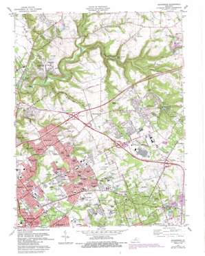
Anchorage Topo Map Kentucky
To zoom in, hover over the map of Anchorage
USGS Topo Quad 38085c5 - 1:24,000 scale
| Topo Map Name: | Anchorage |
| USGS Topo Quad ID: | 38085c5 |
| Print Size: | ca. 21 1/4" wide x 27" high |
| Southeast Coordinates: | 38.25° N latitude / 85.5° W longitude |
| Map Center Coordinates: | 38.3125° N latitude / 85.5625° W longitude |
| U.S. State: | KY |
| Filename: | o38085c5.jpg |
| Download Map JPG Image: | Anchorage topo map 1:24,000 scale |
| Map Type: | Topographic |
| Topo Series: | 7.5´ |
| Map Scale: | 1:24,000 |
| Source of Map Images: | United States Geological Survey (USGS) |
| Alternate Map Versions: |
Anchorage KY 1951 Download PDF Buy paper map Anchorage KY 1955, updated 1956 Download PDF Buy paper map Anchorage KY 1960, updated 1961 Download PDF Buy paper map Anchorage KY 1965, updated 1966 Download PDF Buy paper map Anchorage KY 1965, updated 1972 Download PDF Buy paper map Anchorage KY 1981, updated 1982 Download PDF Buy paper map Anchorage KY 1981, updated 1987 Download PDF Buy paper map Anchorage KY 2010 Download PDF Buy paper map Anchorage KY 2013 Download PDF Buy paper map Anchorage KY 2016 Download PDF Buy paper map |
1:24,000 Topo Quads surrounding Anchorage
> Back to 38085a1 at 1:100,000 scale
> Back to 38084a1 at 1:250,000 scale
> Back to U.S. Topo Maps home
Anchorage topo map: Gazetteer
Anchorage: Airports
Lyndon Fire Protection District Heliport elevation 175m 574′Stutz Field elevation 223m 731′
Anchorage: Lakes
Cow Lake elevation 199m 652′Putneys Pond elevation 133m 436′
Anchorage: Parks
E P Tom Sawyer State Park elevation 207m 679′Hounz Lane County Park elevation 189m 620′
Anchorage: Populated Places
Anchorage elevation 217m 711′Ballardsville elevation 221m 725′
Bancroft elevation 183m 600′
Barbourmeade elevation 192m 629′
Bellemeade elevation 182m 597′
Berrytown elevation 223m 731′
Briarwood elevation 190m 623′
Broeck Pointe elevation 200m 656′
Brownsboro Farm elevation 194m 636′
Coldstream elevation 230m 754′
Creekside elevation 205m 672′
Fincastle elevation 218m 715′
Fraziertown elevation 222m 728′
Freys Hill elevation 208m 682′
Graymoor-Devondale elevation 179m 587′
Green Spring elevation 188m 616′
Griffytown elevation 223m 731′
Hickory Hill elevation 206m 675′
Hills and Dales elevation 183m 600′
Keeneland elevation 205m 672′
Lake Louisvilla elevation 219m 718′
Lakeland elevation 211m 692′
Langdon Place elevation 203m 666′
Lyndon elevation 177m 580′
Manor Creek elevation 186m 610′
Meadow Vale elevation 203m 666′
Meadowbrook Farm elevation 196m 643′
Moorland elevation 191m 626′
Murray Hill elevation 196m 643′
Norwood elevation 168m 551′
O'Bannon elevation 233m 764′
Old Brownsboro Place elevation 190m 623′
Orchard Grass Hills elevation 192m 629′
Plantation elevation 193m 633′
Prospect elevation 143m 469′
River Bluff elevation 194m 636′
Rolling Hills elevation 198m 649′
Spring Valley elevation 189m 620′
Springdale elevation 187m 613′
Ten Broeck elevation 187m 613′
Westwood elevation 195m 639′
Whipps Millgate elevation 202m 662′
Worthington elevation 214m 702′
Worthington Hills elevation 226m 741′
Anchorage: Post Offices
Anchorage Post Office elevation 216m 708′Lyndon Post Office elevation 173m 567′
Prospect Post Office elevation 150m 492′
Anchorage: Reservoirs
Lake Louisvilla elevation 188m 616′Sleepy Hollow Lake elevation 148m 485′
Anchorage: Streams
Hite Creek elevation 143m 469′South Fork Harrods Creek elevation 133m 436′
Wolf Pen Branch elevation 129m 423′
Anchorage digital topo map on disk
Buy this Anchorage topo map showing relief, roads, GPS coordinates and other geographical features, as a high-resolution digital map file on DVD:


