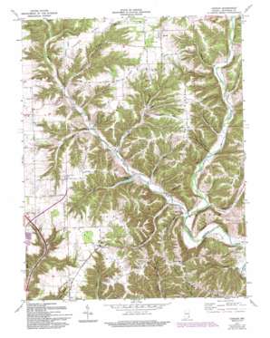
Canaan Topo Map Indiana
To zoom in, hover over the map of Canaan
USGS Topo Quad 38085g3 - 1:24,000 scale
| Topo Map Name: | Canaan |
| USGS Topo Quad ID: | 38085g3 |
| Print Size: | ca. 21 1/4" wide x 27" high |
| Southeast Coordinates: | 38.75° N latitude / 85.25° W longitude |
| Map Center Coordinates: | 38.8125° N latitude / 85.3125° W longitude |
| U.S. State: | IN |
| Filename: | o38085g3.jpg |
| Download Map JPG Image: | Canaan topo map 1:24,000 scale |
| Map Type: | Topographic |
| Topo Series: | 7.5´ |
| Map Scale: | 1:24,000 |
| Source of Map Images: | United States Geological Survey (USGS) |
| Alternate Map Versions: |
Canaan IN 1956, updated 1958 Download PDF Buy paper map Canaan IN 1971, updated 1973 Download PDF Buy paper map Canaan IN 1971, updated 1981 Download PDF Buy paper map Canaan IN 1971, updated 1993 Download PDF Buy paper map Canaan IN 2010 Download PDF Buy paper map Canaan IN 2013 Download PDF Buy paper map Canaan IN 2016 Download PDF Buy paper map |
1:24,000 Topo Quads surrounding Canaan
> Back to 38085e1 at 1:100,000 scale
> Back to 38084a1 at 1:250,000 scale
> Back to U.S. Topo Maps home
Canaan topo map: Gazetteer
Canaan: Populated Places
Canaan elevation 289m 948′Central elevation 278m 912′
China elevation 174m 570′
Manville elevation 149m 488′
Canaan: Reservoirs
Jefferson Lake elevation 168m 551′Canaan: Ridges
Bacon Ridge elevation 281m 921′Copeland Ridge elevation 275m 902′
Halls Ridge elevation 286m 938′
Pleasant Ridge elevation 274m 898′
Rykers Ridge elevation 276m 905′
Canaan: Streams
Brushy Fork elevation 146m 479′Dog Run elevation 142m 465′
Dry Fork elevation 161m 528′
Razor Fork elevation 172m 564′
Schnapps Creek elevation 157m 515′
Seals Fork elevation 163m 534′
Toddys Branch elevation 186m 610′
Turkey Run elevation 151m 495′
West Fork Indian Kentucky Creek elevation 143m 469′
Wolf Run elevation 147m 482′
Canaan: Valleys
Blacksnake Hollow elevation 165m 541′Greasy Hollow elevation 138m 452′
Owl Hollow elevation 172m 564′
Sweetwater Hollow elevation 162m 531′
White Eye Hollow elevation 170m 557′
Canaan digital topo map on disk
Buy this Canaan topo map showing relief, roads, GPS coordinates and other geographical features, as a high-resolution digital map file on DVD:


