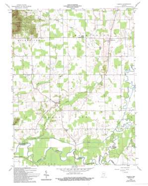
Tampico Topo Map Indiana
To zoom in, hover over the map of Tampico
USGS Topo Quad 38085g8 - 1:24,000 scale
| Topo Map Name: | Tampico |
| USGS Topo Quad ID: | 38085g8 |
| Print Size: | ca. 21 1/4" wide x 27" high |
| Southeast Coordinates: | 38.75° N latitude / 85.875° W longitude |
| Map Center Coordinates: | 38.8125° N latitude / 85.9375° W longitude |
| U.S. State: | IN |
| Filename: | o38085g8.jpg |
| Download Map JPG Image: | Tampico topo map 1:24,000 scale |
| Map Type: | Topographic |
| Topo Series: | 7.5´ |
| Map Scale: | 1:24,000 |
| Source of Map Images: | United States Geological Survey (USGS) |
| Alternate Map Versions: |
Tampico IN 1959, updated 1960 Download PDF Buy paper map Tampico IN 1959, updated 1965 Download PDF Buy paper map Tampico IN 1959, updated 1994 Download PDF Buy paper map Tampico IN 2010 Download PDF Buy paper map Tampico IN 2013 Download PDF Buy paper map Tampico IN 2016 Download PDF Buy paper map |
1:24,000 Topo Quads surrounding Tampico
> Back to 38085e1 at 1:100,000 scale
> Back to 38084a1 at 1:250,000 scale
> Back to U.S. Topo Maps home
Tampico topo map: Gazetteer
Tampico: Canals
Breitfield Ditch elevation 167m 547′Smart Ditch elevation 158m 518′
Tampico: Crossings
Hendersons Ferry (historical) elevation 160m 524′Tampico: Populated Places
Dudleytown elevation 183m 600′Tampico elevation 169m 554′
Tampico: Streams
Grassy Creek elevation 158m 518′Grassy Fork elevation 155m 508′
Horse Lick elevation 168m 551′
Nobusiness Creek elevation 155m 508′
Vernon Fork Muscatatuck River elevation 153m 501′
Tampico digital topo map on disk
Buy this Tampico topo map showing relief, roads, GPS coordinates and other geographical features, as a high-resolution digital map file on DVD:


