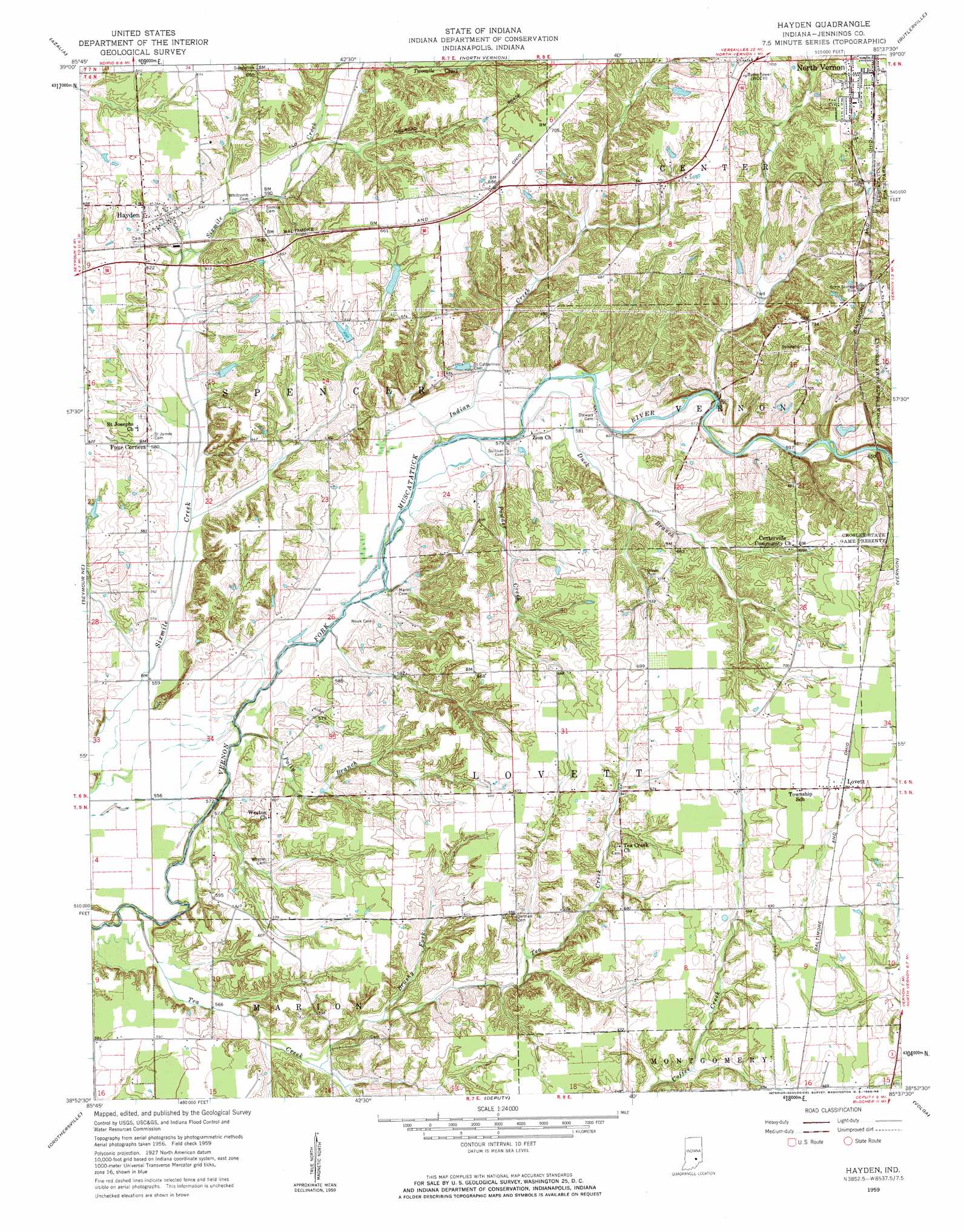
Hayden Topo Map Indiana
To zoom in, hover over the map of Hayden
USGS Topo Quad 38085h6 - 1:24,000 scale
| Topo Map Name: | Hayden |
| USGS Topo Quad ID: | 38085h6 |
| Print Size: | ca. 21 1/4" wide x 27" high |
| Southeast Coordinates: | 38.875° N latitude / 85.625° W longitude |
| Map Center Coordinates: | 38.9375° N latitude / 85.6875° W longitude |
| U.S. State: | IN |
| Filename: | o38085h6.jpg |
| Download Map JPG Image: | Hayden topo map 1:24,000 scale |
| Map Type: | Topographic |
| Topo Series: | 7.5´ |
| Map Scale: | 1:24,000 |
| Source of Map Images: | United States Geological Survey (USGS) |
| Alternate Map Versions: |
Hayden IN 1959, updated 1960 Download PDF Buy paper map Hayden IN 1959, updated 1960 Download PDF Buy paper map Hayden IN 1959, updated 1993 Download PDF Buy paper map Hayden IN 2010 Download PDF Buy paper map Hayden IN 2013 Download PDF Buy paper map Hayden IN 2016 Download PDF Buy paper map |
1:24,000 Topo Quads surrounding Hayden
Columbus |
Elizabethtown |
Grammer |
Westport |
Millhousen |
Jonesville |
Azalia |
North Vernon |
Butlerville |
Holton |
Seymour |
Chestnut Ridge |
Hayden |
Vernon |
San Jacinto |
Tampico |
Crothersville |
Deputy |
Volga |
Clifty Falls |
Little York |
Scottsburg |
Blocher |
Kent |
Madison West |
> Back to 38085e1 at 1:100,000 scale
> Back to 38084a1 at 1:250,000 scale
> Back to U.S. Topo Maps home
Hayden topo map: Gazetteer
Hayden: Dams
Van Voorhies Lake Dam elevation 213m 698′Hayden: Mines
Hayden Quarry elevation 182m 597′Hayden: Parks
Muscatatuck County Park elevation 220m 721′Hayden: Populated Places
Four Corners elevation 176m 577′Hayden elevation 189m 620′
Lovett elevation 214m 702′
Hayden: Reservoirs
Tanglewood Lake elevation 213m 698′Hayden: Streams
Brushy Fork elevation 175m 574′Duck Branch elevation 172m 564′
Indian Creek elevation 171m 561′
Polly Branch elevation 168m 551′
Powder Creek elevation 170m 557′
Tea Creek elevation 167m 547′
Hayden digital topo map on disk
Buy this Hayden topo map showing relief, roads, GPS coordinates and other geographical features, as a high-resolution digital map file on DVD: