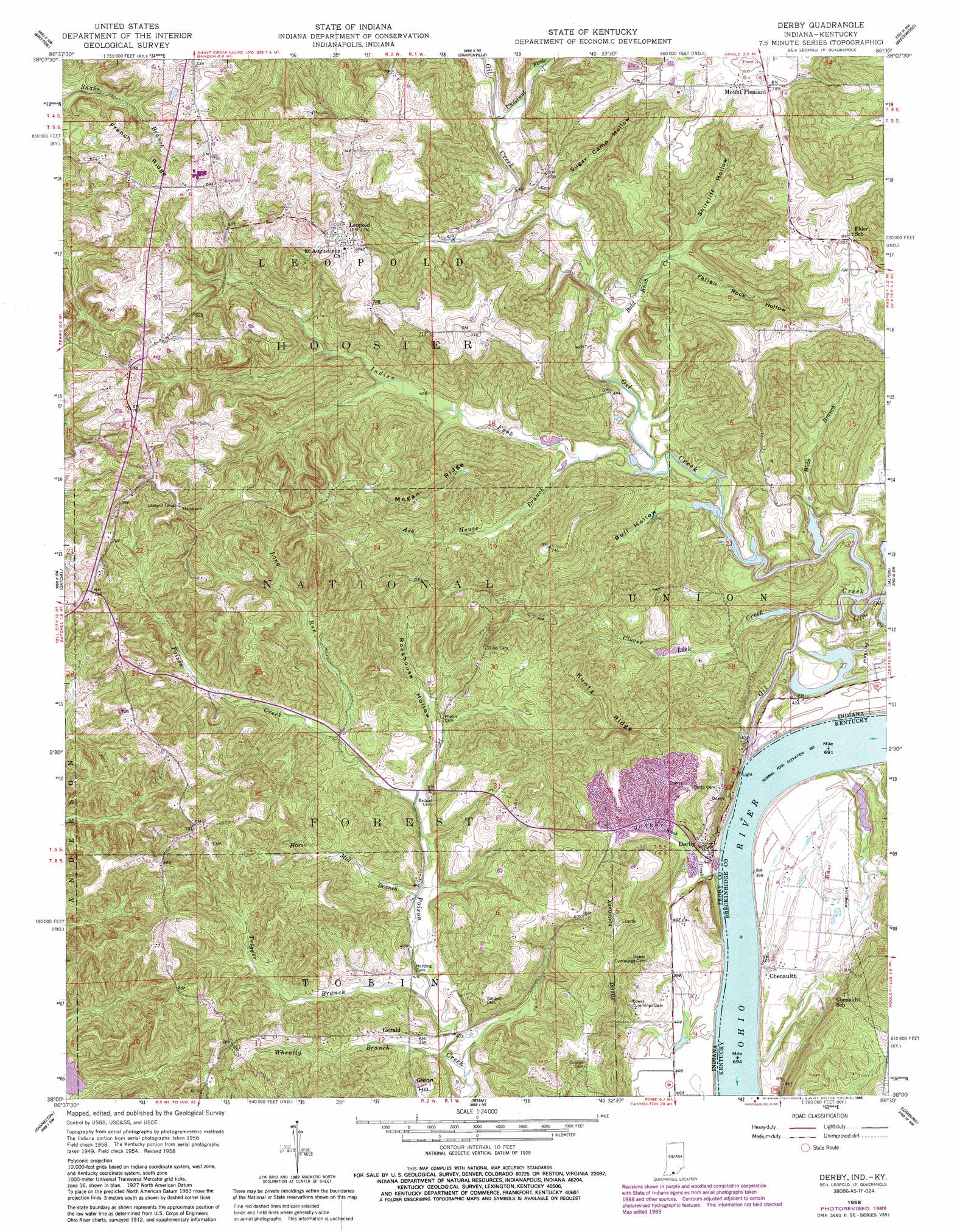
Derby Topo Map Indiana
To zoom in, hover over the map of Derby
USGS Topo Quad 38086a5 - 1:24,000 scale
| Topo Map Name: | Derby |
| USGS Topo Quad ID: | 38086a5 |
| Print Size: | ca. 21 1/4" wide x 27" high |
| Southeast Coordinates: | 38° N latitude / 86.5° W longitude |
| Map Center Coordinates: | 38.0625° N latitude / 86.5625° W longitude |
| U.S. States: | IN, KY |
| Filename: | o38086a5.jpg |
| Download Map JPG Image: | Derby topo map 1:24,000 scale |
| Map Type: | Topographic |
| Topo Series: | 7.5´ |
| Map Scale: | 1:24,000 |
| Source of Map Images: | United States Geological Survey (USGS) |
| Alternate Map Versions: |
Derby IN 1954, updated 1955 Download PDF Buy paper map Derby IN 1958, updated 1959 Download PDF Buy paper map Derby IN 1958, updated 1959 Download PDF Buy paper map Derby IN 1958, updated 1972 Download PDF Buy paper map Derby IN 1958, updated 1981 Download PDF Buy paper map Derby IN 1958, updated 1989 Download PDF Buy paper map Derby IN 1993, updated 1998 Download PDF Buy paper map Derby IN 2010 Download PDF Buy paper map Derby IN 2013 Download PDF Buy paper map Derby IN 2016 Download PDF Buy paper map |
| FStopo: | US Forest Service topo Derby is available: Download FStopo PDF Download FStopo TIF |
1:24,000 Topo Quads surrounding Derby
Saint Anthony |
Birdseye |
Taswell |
English |
Milltown |
Saint Meinrad |
Bristow |
Branchville |
Beechwood |
Leavenworth |
Fulda |
Gatchel |
Derby |
Alton |
New Amsterdam |
Tell City |
Cannelton |
Rome |
Lodiburg |
Irvington |
Pellville |
Cloverport |
Mattingly |
Hardinsburg |
Garfield |
> Back to 38086a1 at 1:100,000 scale
> Back to 38086a1 at 1:250,000 scale
> Back to U.S. Topo Maps home
Derby topo map: Gazetteer
Derby: Populated Places
Chenaultt elevation 127m 416′Derby elevation 137m 449′
Gerald elevation 130m 426′
Leopold elevation 221m 725′
Mount Pleasant elevation 240m 787′
Derby: Reservoirs
Derby Pond elevation 169m 554′Harding Pond elevation 212m 695′
Derby: Ridges
Kuntz Ridge elevation 233m 764′Mogan Ridge elevation 224m 734′
Derby: Streams
Ash House Branch elevation 117m 383′Bald Knob Creek elevation 116m 380′
Chestnut Fork elevation 123m 403′
Clover Lick Creek elevation 116m 380′
Horse Mill Branch elevation 125m 410′
Indian Fork elevation 116m 380′
Knob Creek elevation 121m 396′
Little Oil Creek elevation 116m 380′
Long Run elevation 138m 452′
Oil Creek elevation 116m 380′
Trigger Branch elevation 122m 400′
Webb Branch elevation 118m 387′
Wheatly Branch elevation 118m 387′
Derby: Summits
Glenn Hill elevation 171m 561′Derby: Valleys
Bull Hollow elevation 116m 380′Fallen Rock Hollow elevation 129m 423′
Rockhouse Hollow elevation 141m 462′
Shircliff Hollow elevation 137m 449′
Sugar Camp Hollow elevation 121m 396′
Derby digital topo map on disk
Buy this Derby topo map showing relief, roads, GPS coordinates and other geographical features, as a high-resolution digital map file on DVD: