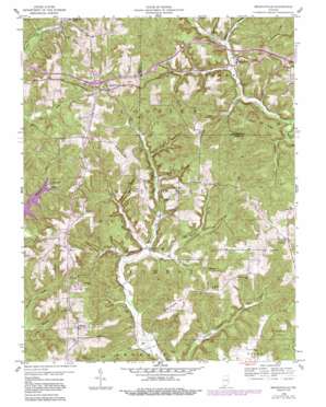
Branchville Topo Map Indiana
To zoom in, hover over the map of Branchville
USGS Topo Quad 38086b5 - 1:24,000 scale
| Topo Map Name: | Branchville |
| USGS Topo Quad ID: | 38086b5 |
| Print Size: | ca. 21 1/4" wide x 27" high |
| Southeast Coordinates: | 38.125° N latitude / 86.5° W longitude |
| Map Center Coordinates: | 38.1875° N latitude / 86.5625° W longitude |
| U.S. State: | IN |
| Filename: | o38086b5.jpg |
| Download Map JPG Image: | Branchville topo map 1:24,000 scale |
| Map Type: | Topographic |
| Topo Series: | 7.5´ |
| Map Scale: | 1:24,000 |
| Source of Map Images: | United States Geological Survey (USGS) |
| Alternate Map Versions: |
Branchville IN 1958, updated 1959 Download PDF Buy paper map Branchville IN 1958, updated 1959 Download PDF Buy paper map Branchville IN 1958, updated 1981 Download PDF Buy paper map Branchville IN 1958, updated 1989 Download PDF Buy paper map Branchville IN 1993, updated 1996 Download PDF Buy paper map Branchville IN 2010 Download PDF Buy paper map Branchville IN 2013 Download PDF Buy paper map Branchville IN 2016 Download PDF Buy paper map |
| FStopo: | US Forest Service topo Branchville is available: Download FStopo PDF Download FStopo TIF |
1:24,000 Topo Quads surrounding Branchville
> Back to 38086a1 at 1:100,000 scale
> Back to 38086a1 at 1:250,000 scale
> Back to U.S. Topo Maps home
Branchville topo map: Gazetteer
Branchville: Crossings
Interchange 80 elevation 206m 675′Branchville: Populated Places
Bandon elevation 221m 725′Branchville elevation 132m 433′
Celina elevation 165m 541′
Oriole elevation 251m 823′
Saint Croix elevation 221m 725′
West Fork elevation 157m 515′
Branchville: Ridges
Doan Ridge elevation 228m 748′Fairview Ridge elevation 241m 790′
German Ridge elevation 228m 748′
McKensie Ridge elevation 253m 830′
Branchville: Streams
Dry Run elevation 125m 410′Ewing Creek elevation 134m 439′
Jubin Creek elevation 131m 429′
Potts Creek elevation 149m 488′
Reasor Branch elevation 152m 498′
Sprinkle Creek elevation 140m 459′
Branchville: Valleys
Bear Hollow elevation 152m 498′Goldman Hollow elevation 143m 469′
Happy Hollow elevation 137m 449′
Jake Hollow elevation 151m 495′
Peter Cave Hollow elevation 155m 508′
Rich Cave Hollow elevation 145m 475′
Smith Hollow elevation 164m 538′
Branchville digital topo map on disk
Buy this Branchville topo map showing relief, roads, GPS coordinates and other geographical features, as a high-resolution digital map file on DVD:


