Dale Topo Map Indiana
To zoom in, hover over the map of Dale
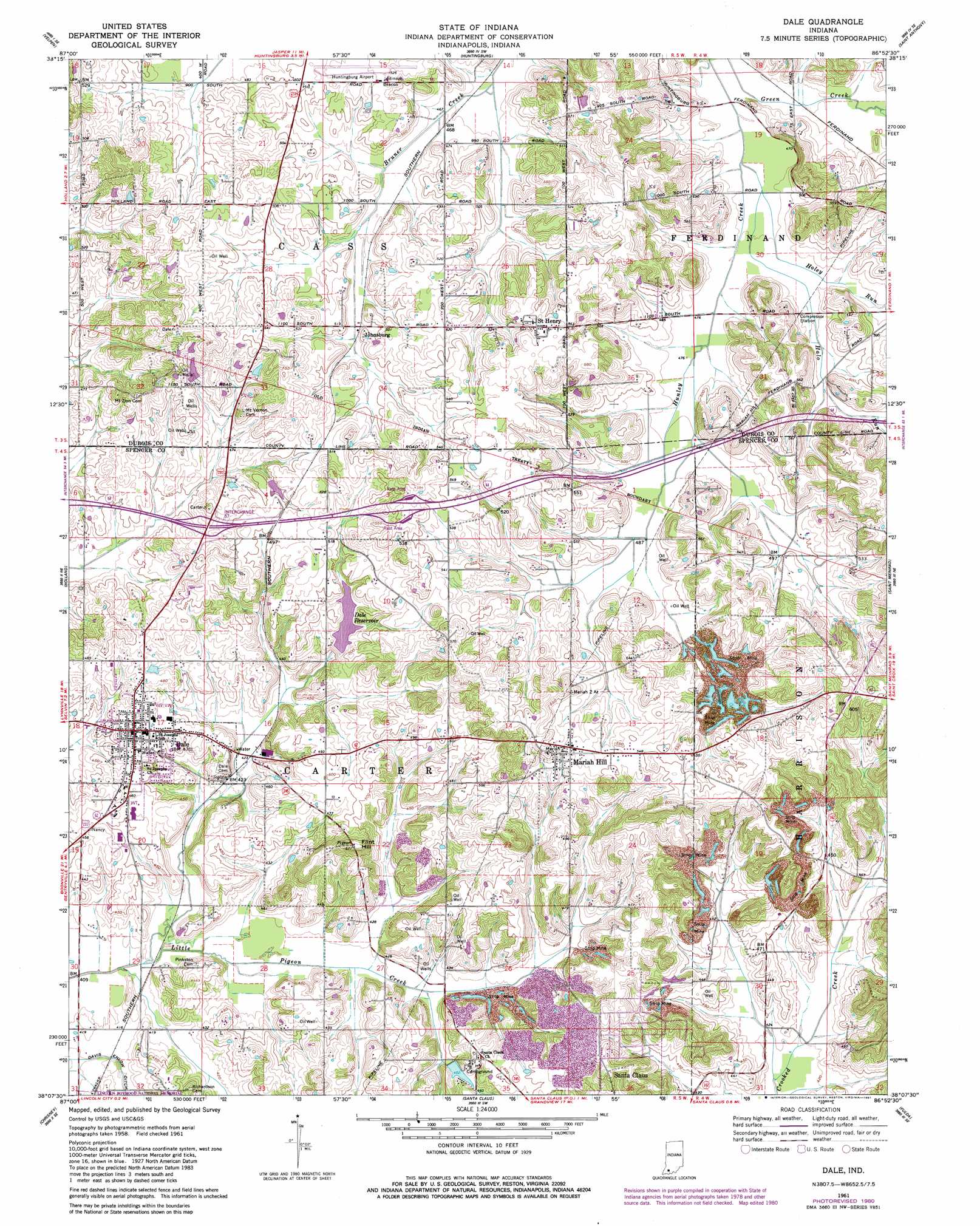
USGS Topo Quad 38086b8 - 1:24,000 scale
| Topo Map Name: | Dale |
| USGS Topo Quad ID: | 38086b8 |
| Print Size: | ca. 21 1/4" wide x 27" high |
| Southeast Coordinates: | 38.125° N latitude / 86.875° W longitude |
| Map Center Coordinates: | 38.1875° N latitude / 86.9375° W longitude |
| U.S. State: | IN |
| Filename: | o38086b8.jpg |
| Download Map JPG Image: | Dale topo map 1:24,000 scale |
| Map Type: | Topographic |
| Topo Series: | 7.5´ |
| Map Scale: | 1:24,000 |
| Source of Map Images: | United States Geological Survey (USGS) |
| Alternate Map Versions: |
Dale IN 1961, updated 1963 Download PDF Buy paper map Dale IN 1961, updated 1981 Download PDF Buy paper map Dale IN 2010 Download PDF Buy paper map Dale IN 2013 Download PDF Buy paper map Dale IN 2016 Download PDF Buy paper map |
1:24,000 Topo Quads surrounding Dale
Winslow |
Otwell |
Jasper |
Dubois |
Cuzco |
Augusta |
Velpen |
Huntingburg |
Saint Anthony |
Birdseye |
Folsomville |
Holland |
Dale |
Saint Meinrad |
Bristow |
De Gonia Springs |
Chrisney |
Santa Claus |
Fulda |
Gatchel |
Richland City |
Rockport |
Lewisport |
Tell City |
Cannelton |
> Back to 38086a1 at 1:100,000 scale
> Back to 38086a1 at 1:250,000 scale
> Back to U.S. Topo Maps home
Dale topo map: Gazetteer
Dale: Airports
Huntingburg Airport elevation 159m 521′Dale: Crossings
Interchange 57 elevation 149m 488′Dale: Populated Places
Dale elevation 142m 465′Johnsburg elevation 148m 485′
Mariah Hill elevation 159m 521′
Saint Henry elevation 172m 564′
Dale: Reservoirs
Dale Reservoir elevation 146m 479′Santa Claus Lake elevation 138m 452′
Dale: Streams
Cross Drain elevation 145m 475′Halo Run elevation 142m 465′
Holey Run elevation 143m 469′
Dale: Summits
Flint Hill elevation 176m 577′Dale digital topo map on disk
Buy this Dale topo map showing relief, roads, GPS coordinates and other geographical features, as a high-resolution digital map file on DVD: