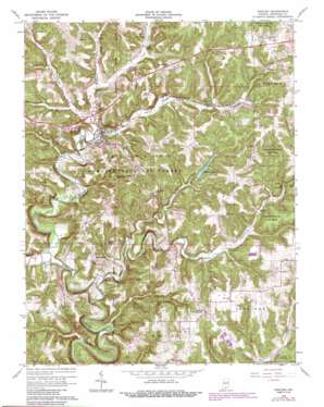
English Topo Map Indiana
To zoom in, hover over the map of English
USGS Topo Quad 38086c4 - 1:24,000 scale
| Topo Map Name: | English |
| USGS Topo Quad ID: | 38086c4 |
| Print Size: | ca. 21 1/4" wide x 27" high |
| Southeast Coordinates: | 38.25° N latitude / 86.375° W longitude |
| Map Center Coordinates: | 38.3125° N latitude / 86.4375° W longitude |
| U.S. State: | IN |
| Filename: | o38086c4.jpg |
| Download Map JPG Image: | English topo map 1:24,000 scale |
| Map Type: | Topographic |
| Topo Series: | 7.5´ |
| Map Scale: | 1:24,000 |
| Source of Map Images: | United States Geological Survey (USGS) |
| Alternate Map Versions: |
English IN 1950, updated 1953 Download PDF Buy paper map English IN 1966, updated 1968 Download PDF Buy paper map English IN 1966, updated 1985 Download PDF Buy paper map English IN 1966, updated 1989 Download PDF Buy paper map English IN 1993, updated 1996 Download PDF Buy paper map English IN 2010 Download PDF Buy paper map English IN 2013 Download PDF Buy paper map English IN 2016 Download PDF Buy paper map |
| FStopo: | US Forest Service topo English is available: Download FStopo PDF Download FStopo TIF |
1:24,000 Topo Quads surrounding English
> Back to 38086a1 at 1:100,000 scale
> Back to 38086a1 at 1:250,000 scale
> Back to U.S. Topo Maps home
English topo map: Gazetteer
English: Lakes
Bluegill Pond elevation 250m 820′Grant Lake elevation 160m 524′
English: Parks
Hilands Overlook State Park elevation 233m 764′English: Populated Places
Curby elevation 232m 761′English elevation 154m 505′
Grantsburg elevation 187m 613′
Riddle elevation 231m 757′
Switzer Crossroads elevation 224m 734′
Temple elevation 177m 580′
English: Reservoirs
English Reservoir elevation 176m 577′English Water Supply Dam elevation 176m 577′
English: Streams
Bird Hollow Creek elevation 152m 498′Bogard Creek elevation 137m 449′
Brownstown Creek elevation 155m 508′
Brushy Creek elevation 141m 462′
Camp Fork Creek elevation 155m 508′
Dog Creek elevation 158m 518′
Otter Creek elevation 137m 449′
English: Summits
Seton Knob elevation 242m 793′English digital topo map on disk
Buy this English topo map showing relief, roads, GPS coordinates and other geographical features, as a high-resolution digital map file on DVD:


