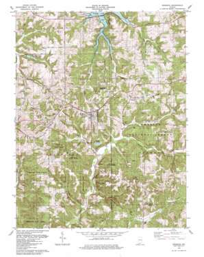
Birdseye Topo Map Indiana
To zoom in, hover over the map of Birdseye
USGS Topo Quad 38086c6 - 1:24,000 scale
| Topo Map Name: | Birdseye |
| USGS Topo Quad ID: | 38086c6 |
| Print Size: | ca. 21 1/4" wide x 27" high |
| Southeast Coordinates: | 38.25° N latitude / 86.625° W longitude |
| Map Center Coordinates: | 38.3125° N latitude / 86.6875° W longitude |
| U.S. State: | IN |
| Filename: | o38086c6.jpg |
| Download Map JPG Image: | Birdseye topo map 1:24,000 scale |
| Map Type: | Topographic |
| Topo Series: | 7.5´ |
| Map Scale: | 1:24,000 |
| Source of Map Images: | United States Geological Survey (USGS) |
| Alternate Map Versions: |
Birdseye IN 1957, updated 1959 Download PDF Buy paper map Birdseye IN 1957, updated 1968 Download PDF Buy paper map Birdseye IN 1980, updated 1981 Download PDF Buy paper map Birdseye IN 1993, updated 1996 Download PDF Buy paper map Birdseye IN 2010 Download PDF Buy paper map Birdseye IN 2013 Download PDF Buy paper map Birdseye IN 2016 Download PDF Buy paper map |
| FStopo: | US Forest Service topo Birdseye is available: Download FStopo PDF Download FStopo TIF |
1:24,000 Topo Quads surrounding Birdseye
> Back to 38086a1 at 1:100,000 scale
> Back to 38086a1 at 1:250,000 scale
> Back to U.S. Topo Maps home
Birdseye topo map: Gazetteer
Birdseye: Dams
Carmichael Lake Dam elevation 208m 682′Idle Hour Lake Dam elevation 216m 708′
Schnellville Conservation Lake Dam elevation 201m 659′
Birdseye: Populated Places
Birdseye elevation 220m 721′Mentor elevation 226m 741′
Riceville elevation 215m 705′
Wickliffe elevation 221m 725′
Birdseye: Post Offices
Birdseye Post Office elevation 220m 721′Ditney Hill Post Office (historical) elevation 222m 728′
Birdseye: Reservoirs
Carmichael Lake elevation 208m 682′Idle Hour Lake elevation 216m 708′
Schnellville Lake elevation 167m 547′
Whispering Pines Pond elevation 201m 659′
Birdseye: Ridges
Fox Ridge elevation 235m 770′Birdseye: Streams
Mitchell Creek elevation 146m 479′Riceville Creek elevation 163m 534′
Taylor Hollow elevation 138m 452′
Waddle Brook elevation 143m 469′
Birdseye digital topo map on disk
Buy this Birdseye topo map showing relief, roads, GPS coordinates and other geographical features, as a high-resolution digital map file on DVD:


