Paoli Topo Map Indiana
To zoom in, hover over the map of Paoli
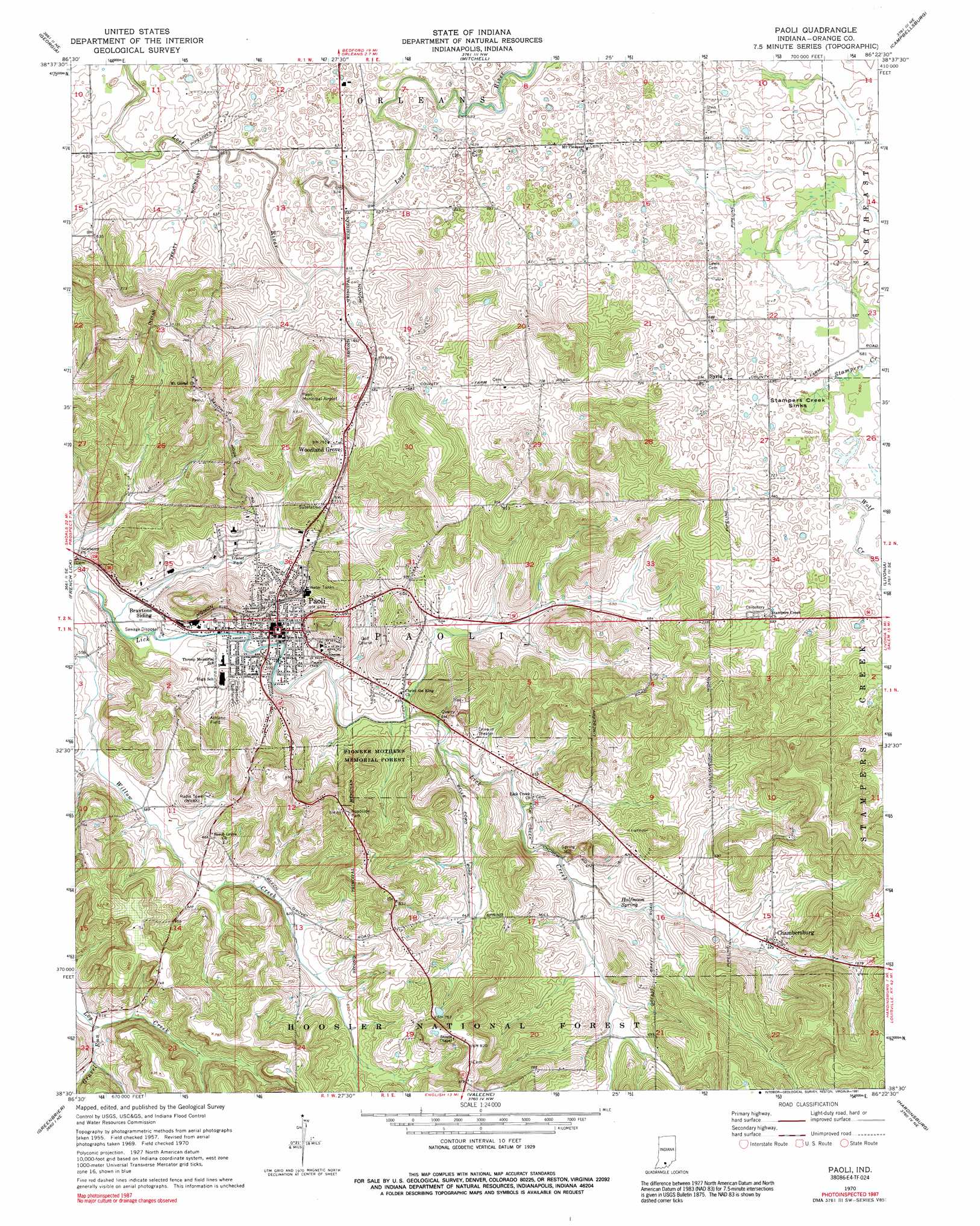
USGS Topo Quad 38086e4 - 1:24,000 scale
| Topo Map Name: | Paoli |
| USGS Topo Quad ID: | 38086e4 |
| Print Size: | ca. 21 1/4" wide x 27" high |
| Southeast Coordinates: | 38.5° N latitude / 86.375° W longitude |
| Map Center Coordinates: | 38.5625° N latitude / 86.4375° W longitude |
| U.S. State: | IN |
| Filename: | o38086e4.jpg |
| Download Map JPG Image: | Paoli topo map 1:24,000 scale |
| Map Type: | Topographic |
| Topo Series: | 7.5´ |
| Map Scale: | 1:24,000 |
| Source of Map Images: | United States Geological Survey (USGS) |
| Alternate Map Versions: |
Paoli IN 1957, updated 1958 Download PDF Buy paper map Paoli IN 1970, updated 1972 Download PDF Buy paper map Paoli IN 1970, updated 1972 Download PDF Buy paper map Paoli IN 1970, updated 1991 Download PDF Buy paper map Paoli IN 1993, updated 1996 Download PDF Buy paper map Paoli IN 2010 Download PDF Buy paper map Paoli IN 2013 Download PDF Buy paper map Paoli IN 2016 Download PDF Buy paper map |
| FStopo: | US Forest Service topo Paoli is available: Download FStopo PDF Download FStopo TIF |
1:24,000 Topo Quads surrounding Paoli
Williams |
Bedford West |
Bedford East |
Tunnelton |
Medora |
Huron |
Georgia |
Mitchell |
Campbellsburg |
Smedley |
Hillham |
French Lick |
Paoli |
Livonia |
Becks Mill |
Cuzco |
Greenbrier |
Valeene |
Hardinsburg |
Fredericksburg |
Birdseye |
Taswell |
English |
Milltown |
Depauw |
> Back to 38086e1 at 1:100,000 scale
> Back to 38086a1 at 1:250,000 scale
> Back to U.S. Topo Maps home
Paoli topo map: Gazetteer
Paoli: Airports
Paoli Municipal Airport elevation 240m 787′Paoli: Basins
Stampers Creek Sinks elevation 207m 679′Paoli: Forests
Pioneer Mothers Memorial Forest elevation 214m 702′Paoli: Parks
Pioneer Mothers State Wayside elevation 254m 833′Paoli: Populated Places
Braxtons Siding elevation 176m 577′Chambersburg elevation 201m 659′
Lost River elevation 195m 639′
Paoli elevation 190m 623′
Stampers Creek elevation 226m 741′
Syria elevation 207m 679′
Woodlawn Grove elevation 232m 761′
Paoli: Springs
Halfmoon Springs elevation 185m 606′Paoli: Streams
Gravel Run elevation 182m 597′Stampers Creek elevation 205m 672′
Wolf Creek elevation 207m 679′
Paoli digital topo map on disk
Buy this Paoli topo map showing relief, roads, GPS coordinates and other geographical features, as a high-resolution digital map file on DVD: