Georgia Topo Map Indiana
To zoom in, hover over the map of Georgia
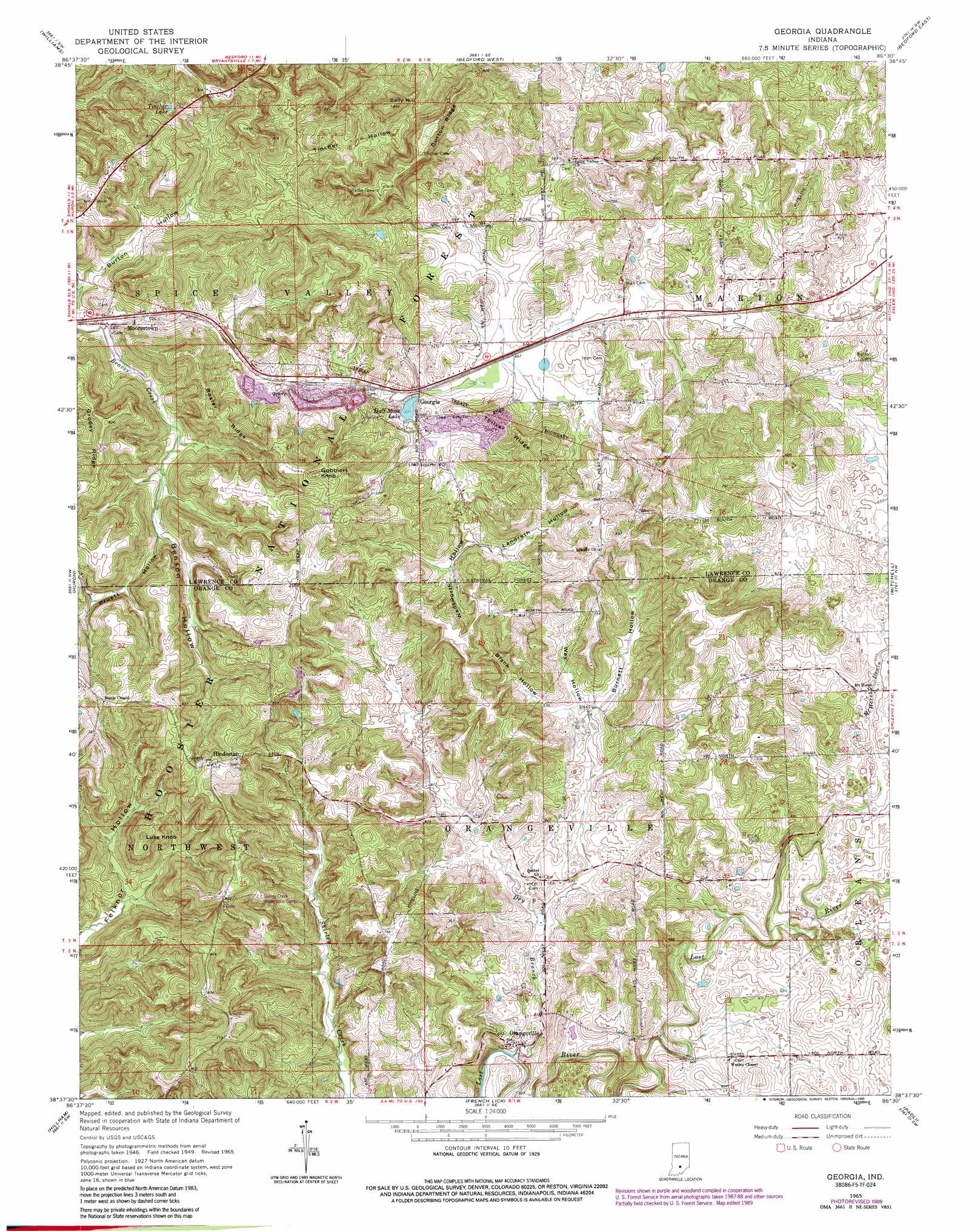
USGS Topo Quad 38086f5 - 1:24,000 scale
| Topo Map Name: | Georgia |
| USGS Topo Quad ID: | 38086f5 |
| Print Size: | ca. 21 1/4" wide x 27" high |
| Southeast Coordinates: | 38.625° N latitude / 86.5° W longitude |
| Map Center Coordinates: | 38.6875° N latitude / 86.5625° W longitude |
| U.S. State: | IN |
| Filename: | o38086f5.jpg |
| Download Map JPG Image: | Georgia topo map 1:24,000 scale |
| Map Type: | Topographic |
| Topo Series: | 7.5´ |
| Map Scale: | 1:24,000 |
| Source of Map Images: | United States Geological Survey (USGS) |
| Alternate Map Versions: |
Georgia IN 1949, updated 1962 Download PDF Buy paper map Georgia IN 1951 Download PDF Buy paper map Georgia IN 1965, updated 1966 Download PDF Buy paper map Georgia IN 1965, updated 1990 Download PDF Buy paper map Georgia IN 1993, updated 1996 Download PDF Buy paper map Georgia IN 2011 Download PDF Buy paper map Georgia IN 2013 Download PDF Buy paper map Georgia IN 2016 Download PDF Buy paper map |
| FStopo: | US Forest Service topo Georgia is available: Download FStopo PDF Download FStopo TIF |
1:24,000 Topo Quads surrounding Georgia
Koleen |
Owensburg |
Oolitic |
Bartlettsville |
Norman |
Indian Springs |
Williams |
Bedford West |
Bedford East |
Tunnelton |
Shoals |
Huron |
Georgia |
Mitchell |
Campbellsburg |
Rusk |
Hillham |
French Lick |
Paoli |
Livonia |
Dubois |
Cuzco |
Greenbrier |
Valeene |
Hardinsburg |
> Back to 38086e1 at 1:100,000 scale
> Back to 38086a1 at 1:250,000 scale
> Back to U.S. Topo Maps home
Georgia topo map: Gazetteer
Georgia: Canals
Mount Horeb Drain elevation 178m 583′Georgia: Lakes
Half Moon Lake elevation 194m 636′Tincher Lake elevation 218m 715′
Georgia: Parks
Hindostan Falls Public Fishing Area elevation 264m 866′Georgia: Populated Places
Georgia elevation 200m 656′Hindostan elevation 261m 856′
Moorestown elevation 179m 587′
Orangeville elevation 159m 521′
Georgia: Ridges
Bosler Ridge elevation 238m 780′Burton Ridge elevation 278m 912′
Grodey Ridge elevation 251m 823′
Toliver Ridge elevation 239m 784′
Georgia: Streams
Dry Branch elevation 149m 488′Georgia: Summits
Gobblers Knob elevation 276m 905′Luke Knob elevation 243m 797′
Sally Hill elevation 270m 885′
Georgia: Valleys
Benson Hollow elevation 183m 600′Black Hollow elevation 186m 610′
Burnett Hollow elevation 185m 606′
Burton Hollow elevation 177m 580′
Landreth Hollow elevation 205m 672′
Pruett Hollow elevation 183m 600′
Tincher Hollow elevation 193m 633′
Wadsworth Hollow elevation 196m 643′
Way Hollow elevation 185m 606′
Georgia digital topo map on disk
Buy this Georgia topo map showing relief, roads, GPS coordinates and other geographical features, as a high-resolution digital map file on DVD: