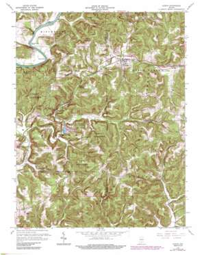
Huron Topo Map Indiana
To zoom in, hover over the map of Huron
USGS Topo Quad 38086f6 - 1:24,000 scale
| Topo Map Name: | Huron |
| USGS Topo Quad ID: | 38086f6 |
| Print Size: | ca. 21 1/4" wide x 27" high |
| Southeast Coordinates: | 38.625° N latitude / 86.625° W longitude |
| Map Center Coordinates: | 38.6875° N latitude / 86.6875° W longitude |
| U.S. State: | IN |
| Filename: | o38086f6.jpg |
| Download Map JPG Image: | Huron topo map 1:24,000 scale |
| Map Type: | Topographic |
| Topo Series: | 7.5´ |
| Map Scale: | 1:24,000 |
| Source of Map Images: | United States Geological Survey (USGS) |
| Alternate Map Versions: |
Huron IN 1948, updated 1960 Download PDF Buy paper map Huron IN 1950 Download PDF Buy paper map Huron IN 1965, updated 1966 Download PDF Buy paper map Huron IN 1965, updated 1977 Download PDF Buy paper map Huron IN 1965, updated 1990 Download PDF Buy paper map Huron IN 1993, updated 1998 Download PDF Buy paper map Huron IN 1993, updated 1998 Download PDF Buy paper map Huron IN 1993, updated 2001 Download PDF Buy paper map Huron IN 1993, updated 2001 Download PDF Buy paper map Huron IN 2011 Download PDF Buy paper map Huron IN 2013 Download PDF Buy paper map Huron IN 2016 Download PDF Buy paper map |
| FStopo: | US Forest Service topo Huron is available: Download FStopo PDF Download FStopo TIF |
1:24,000 Topo Quads surrounding Huron
> Back to 38086e1 at 1:100,000 scale
> Back to 38086a1 at 1:250,000 scale
> Back to U.S. Topo Maps home
Huron topo map: Gazetteer
Huron: Basins
Connelly Cave elevation 170m 557′Huron: Bends
Devils Elbow elevation 145m 475′Norman Rock Bend elevation 144m 472′
Huron: Cliffs
Old Mans Nose elevation 197m 646′Huron: Forests
Martin State Forest elevation 193m 633′Huron: Populated Places
Bonds elevation 230m 754′Huron elevation 167m 547′
Scarlet elevation 240m 787′
Willow Valley elevation 157m 515′
Huron: Reservoirs
Deep Cut Lake elevation 149m 488′Huron: Springs
Sulphur Spring elevation 144m 472′Tank Spring elevation 191m 626′
Huron: Streams
South Fork Beaver Creek elevation 146m 479′Huron: Tunnels
Willow Tunnel elevation 199m 652′Huron: Valleys
Felknor Hollow elevation 146m 479′Huron digital topo map on disk
Buy this Huron topo map showing relief, roads, GPS coordinates and other geographical features, as a high-resolution digital map file on DVD:


