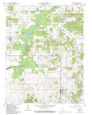
Chrisney Topo Map Indiana
To zoom in, hover over the map of Chrisney
USGS Topo Quad 38087a1 - 1:24,000 scale
| Topo Map Name: | Chrisney |
| USGS Topo Quad ID: | 38087a1 |
| Print Size: | ca. 21 1/4" wide x 27" high |
| Southeast Coordinates: | 38° N latitude / 87° W longitude |
| Map Center Coordinates: | 38.0625° N latitude / 87.0625° W longitude |
| U.S. State: | IN |
| Filename: | o38087a1.jpg |
| Download Map JPG Image: | Chrisney topo map 1:24,000 scale |
| Map Type: | Topographic |
| Topo Series: | 7.5´ |
| Map Scale: | 1:24,000 |
| Source of Map Images: | United States Geological Survey (USGS) |
| Alternate Map Versions: |
Chrisney IN 1960, updated 1962 Download PDF Buy paper map Chrisney IN 1960, updated 1962 Download PDF Buy paper map Chrisney IN 1960, updated 1988 Download PDF Buy paper map Chrisney IN 2010 Download PDF Buy paper map Chrisney IN 2013 Download PDF Buy paper map Chrisney IN 2016 Download PDF Buy paper map |
1:24,000 Topo Quads surrounding Chrisney
> Back to 38087a1 at 1:100,000 scale
> Back to 38086a1 at 1:250,000 scale
> Back to U.S. Topo Maps home
Chrisney topo map: Gazetteer
Chrisney: Canals
Chrisney Ditch elevation 116m 380′Hutchinson Ditch elevation 118m 387′
Polkberry Ditch elevation 118m 387′
Wallace Fork Ditch elevation 119m 390′
Wires Ditch elevation 119m 390′
Chrisney: Cliffs
High Banks elevation 122m 400′Chrisney: Dams
Chrisney Lake Dam elevation 127m 416′Chrisney: Populated Places
Bloomfield elevation 135m 442′Chrisney elevation 143m 469′
Gentryville elevation 125m 410′
Kercheval elevation 141m 462′
Pigeon elevation 121m 396′
Rockport Junction elevation 128m 419′
Tennyson elevation 124m 406′
Chrisney: Reservoirs
Chrisney Lake elevation 127m 416′Chrisney: Streams
Buckhorn Creek elevation 119m 390′Coles Creek elevation 114m 374′
East Fork Little Pigeon Creek elevation 115m 377′
Little Pigeon Creek elevation 119m 390′
Chrisney digital topo map on disk
Buy this Chrisney topo map showing relief, roads, GPS coordinates and other geographical features, as a high-resolution digital map file on DVD:


