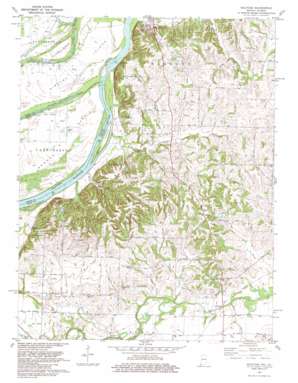
Solitude Topo Map Indiana
To zoom in, hover over the map of Solitude
USGS Topo Quad 38087a8 - 1:24,000 scale
| Topo Map Name: | Solitude |
| USGS Topo Quad ID: | 38087a8 |
| Print Size: | ca. 21 1/4" wide x 27" high |
| Southeast Coordinates: | 38° N latitude / 87.875° W longitude |
| Map Center Coordinates: | 38.0625° N latitude / 87.9375° W longitude |
| U.S. States: | IN, IL |
| Filename: | o38087a8.jpg |
| Download Map JPG Image: | Solitude topo map 1:24,000 scale |
| Map Type: | Topographic |
| Topo Series: | 7.5´ |
| Map Scale: | 1:24,000 |
| Source of Map Images: | United States Geological Survey (USGS) |
| Alternate Map Versions: |
Solitude IN 1959, updated 1961 Download PDF Buy paper map Solitude IN 1959, updated 1969 Download PDF Buy paper map Solitude IN 1981 Download PDF Buy paper map Solitude IN 1981, updated 1981 Download PDF Buy paper map Solitude IN 2010 Download PDF Buy paper map Solitude IN 2013 Download PDF Buy paper map Solitude IN 2016 Download PDF Buy paper map |
1:24,000 Topo Quads surrounding Solitude
> Back to 38087a1 at 1:100,000 scale
> Back to 38086a1 at 1:250,000 scale
> Back to U.S. Topo Maps home
Solitude topo map: Gazetteer
Solitude: Bends
Bowman Bend elevation 110m 360′Solitude: Dams
Pahoka Camp Lake Dam elevation 133m 436′Solitude: Islands
Ribeyre Island elevation 111m 364′Turkey Island elevation 112m 367′
Solitude: Lakes
Russell Pond elevation 109m 357′Weirs Lake elevation 107m 351′
Solitude: Parks
Camp Pahoka elevation 150m 492′Harmonie State Park elevation 138m 452′
Murphy Park elevation 119m 390′
New Harmony State Memorial elevation 137m 449′
The Labyrinth State Memorial elevation 122m 400′
Solitude: Populated Places
Grafton elevation 112m 367′Savah elevation 121m 396′
Solitude elevation 113m 370′
Solitude: Post Offices
Solitude Post Office (historical) elevation 128m 419′Solitude: Reservoirs
Pahoka Camp Lake elevation 133m 436′Solitude: Streams
Alexander Creek elevation 107m 351′Beech Grove Run elevation 104m 341′
Bend Run elevation 107m 351′
Cord Run elevation 122m 400′
Duo Run elevation 117m 383′
Fox River elevation 110m 360′
French Run elevation 116m 380′
Fun Creek elevation 112m 367′
Gin Run elevation 119m 390′
Goad Brook elevation 110m 360′
Ha Brook Creek elevation 112m 367′
Hawthorne Creek elevation 113m 370′
Large Drain elevation 107m 351′
Long Run elevation 116m 380′
Maple Run elevation 110m 360′
Melody Run elevation 125m 410′
Nest Run elevation 112m 367′
Oka Run elevation 113m 370′
Olive Creek elevation 112m 367′
Oliver Run elevation 120m 393′
Pahoka Creek elevation 106m 347′
Road Brook elevation 106m 347′
Rush Creek elevation 106m 347′
Solitude Run elevation 109m 357′
Swift Run elevation 116m 380′
Thorn Run elevation 122m 400′
Thrall Run elevation 113m 370′
Uno Run elevation 116m 380′
Wabash River Old Channel elevation 105m 344′
War Branch elevation 122m 400′
Wilson Brook elevation 113m 370′
Solitude digital topo map on disk
Buy this Solitude topo map showing relief, roads, GPS coordinates and other geographical features, as a high-resolution digital map file on DVD:


