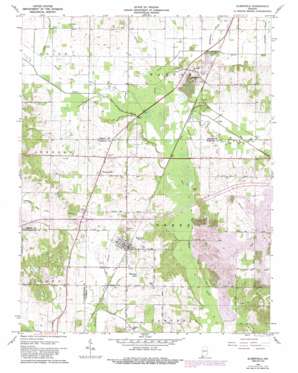
Elberfeld Topo Map Indiana
To zoom in, hover over the map of Elberfeld
USGS Topo Quad 38087b4 - 1:24,000 scale
| Topo Map Name: | Elberfeld |
| USGS Topo Quad ID: | 38087b4 |
| Print Size: | ca. 21 1/4" wide x 27" high |
| Southeast Coordinates: | 38.125° N latitude / 87.375° W longitude |
| Map Center Coordinates: | 38.1875° N latitude / 87.4375° W longitude |
| U.S. State: | IN |
| Filename: | o38087b4.jpg |
| Download Map JPG Image: | Elberfeld topo map 1:24,000 scale |
| Map Type: | Topographic |
| Topo Series: | 7.5´ |
| Map Scale: | 1:24,000 |
| Source of Map Images: | United States Geological Survey (USGS) |
| Alternate Map Versions: |
Elberfeld IN 1961, updated 1963 Download PDF Buy paper map Elberfeld IN 1961, updated 1973 Download PDF Buy paper map Elberfeld IN 1961, updated 1981 Download PDF Buy paper map Elberfeld IN 1961, updated 1989 Download PDF Buy paper map Elberfeld IN 2010 Download PDF Buy paper map Elberfeld IN 2013 Download PDF Buy paper map Elberfeld IN 2016 Download PDF Buy paper map |
1:24,000 Topo Quads surrounding Elberfeld
> Back to 38087a1 at 1:100,000 scale
> Back to 38086a1 at 1:250,000 scale
> Back to U.S. Topo Maps home
Elberfeld topo map: Gazetteer
Elberfeld: Dams
Bell Conservation Lake Dam elevation 146m 479′Elberfeld: Lakes
Warrens Lake elevation 129m 423′Elberfeld: Mines
Elberfeld Mine elevation 133m 436′Elberfeld: Populated Places
Buckskin elevation 140m 459′Elberfeld elevation 138m 452′
Rosebud elevation 122m 400′
Wheatonville elevation 131m 429′
Elberfeld: Post Offices
Oakdam Post Office (historical) elevation 133m 436′Elberfeld: Reservoirs
Bell Conservation Lake elevation 146m 479′Elberfeld: Streams
Big Creek elevation 122m 400′Clear Branch elevation 119m 390′
Donohue Creek elevation 125m 410′
Halfmoon Creek elevation 123m 403′
Smith Fork elevation 122m 400′
Snake Run elevation 122m 400′
Elberfeld: Summits
Lost Hill elevation 132m 433′Elberfeld digital topo map on disk
Buy this Elberfeld topo map showing relief, roads, GPS coordinates and other geographical features, as a high-resolution digital map file on DVD:


