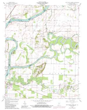
East Mount Carmel Topo Map Indiana
To zoom in, hover over the map of East Mount Carmel
USGS Topo Quad 38087d6 - 1:24,000 scale
| Topo Map Name: | East Mount Carmel |
| USGS Topo Quad ID: | 38087d6 |
| Print Size: | ca. 21 1/4" wide x 27" high |
| Southeast Coordinates: | 38.375° N latitude / 87.625° W longitude |
| Map Center Coordinates: | 38.4375° N latitude / 87.6875° W longitude |
| U.S. States: | IN, IL |
| Filename: | o38087d6.jpg |
| Download Map JPG Image: | East Mount Carmel topo map 1:24,000 scale |
| Map Type: | Topographic |
| Topo Series: | 7.5´ |
| Map Scale: | 1:24,000 |
| Source of Map Images: | United States Geological Survey (USGS) |
| Alternate Map Versions: |
East Mount Carmel IN 1959, updated 1961 Download PDF Buy paper map East Mount Carmel IN 1959, updated 1981 Download PDF Buy paper map East Mount Carmel IN 1959, updated 1989 Download PDF Buy paper map East Mount Carmel IN 2010 Download PDF Buy paper map East Mount Carmel IN 2013 Download PDF Buy paper map East Mount Carmel IN 2016 Download PDF Buy paper map |
1:24,000 Topo Quads surrounding East Mount Carmel
> Back to 38087a1 at 1:100,000 scale
> Back to 38086a1 at 1:250,000 scale
> Back to U.S. Topo Maps home
East Mount Carmel topo map: Gazetteer
East Mount Carmel: Canals
Hull Ditch elevation 121m 396′East Mount Carmel: Cliffs
Hanging Rock elevation 131m 429′East Mount Carmel: Lakes
Claypole Pond elevation 117m 383′Maucks Pond elevation 118m 387′
East Mount Carmel: Populated Places
East Mount Carmel elevation 119m 390′Little Rock elevation 122m 400′
Orrville elevation 131m 429′
Pohaten (historical) elevation 122m 400′
Selma (historical) elevation 119m 390′
East Mount Carmel: Ranges
Gordon Hills elevation 151m 495′Orrville Hills elevation 138m 452′
East Mount Carmel: Rapids
Grand Rapids elevation 113m 370′Kellys Ripple elevation 113m 370′
East Mount Carmel: Streams
White River elevation 113m 370′East Mount Carmel: Swamps
Cypress Swamps elevation 119m 390′East Mount Carmel digital topo map on disk
Buy this East Mount Carmel topo map showing relief, roads, GPS coordinates and other geographical features, as a high-resolution digital map file on DVD:


