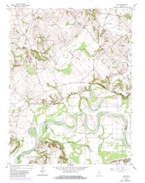
Iona Topo Map Indiana
To zoom in, hover over the map of Iona
USGS Topo Quad 38087e4 - 1:24,000 scale
| Topo Map Name: | Iona |
| USGS Topo Quad ID: | 38087e4 |
| Print Size: | ca. 21 1/4" wide x 27" high |
| Southeast Coordinates: | 38.5° N latitude / 87.375° W longitude |
| Map Center Coordinates: | 38.5625° N latitude / 87.4375° W longitude |
| U.S. State: | IN |
| Filename: | o38087e4.jpg |
| Download Map JPG Image: | Iona topo map 1:24,000 scale |
| Map Type: | Topographic |
| Topo Series: | 7.5´ |
| Map Scale: | 1:24,000 |
| Source of Map Images: | United States Geological Survey (USGS) |
| Alternate Map Versions: |
Iona IN 1944 Download PDF Buy paper map Iona IN 1958, updated 1959 Download PDF Buy paper map Iona IN 1958, updated 1960 Download PDF Buy paper map Iona IN 1958, updated 1981 Download PDF Buy paper map Iona IN 2010 Download PDF Buy paper map Iona IN 2013 Download PDF Buy paper map Iona IN 2016 Download PDF Buy paper map |
1:24,000 Topo Quads surrounding Iona
> Back to 38087e1 at 1:100,000 scale
> Back to 38086a1 at 1:250,000 scale
> Back to U.S. Topo Maps home
Iona topo map: Gazetteer
Iona: Canals
Williams Ditch elevation 134m 439′Iona: Lakes
Half Moon Pond elevation 124m 406′Long Pond elevation 123m 403′
Ten Acre Pond elevation 124m 406′
Iona: Populated Places
Giro elevation 136m 446′Iona elevation 139m 456′
Ridgleville elevation 143m 469′
Iona: Streams
Big Run elevation 143m 469′Conger Creek elevation 122m 400′
Harbin Creek elevation 118m 387′
McCoy Creek elevation 128m 419′
Wilson Creek elevation 119m 390′
Iona digital topo map on disk
Buy this Iona topo map showing relief, roads, GPS coordinates and other geographical features, as a high-resolution digital map file on DVD:


