Lancaster Topo Map Illinois
To zoom in, hover over the map of Lancaster
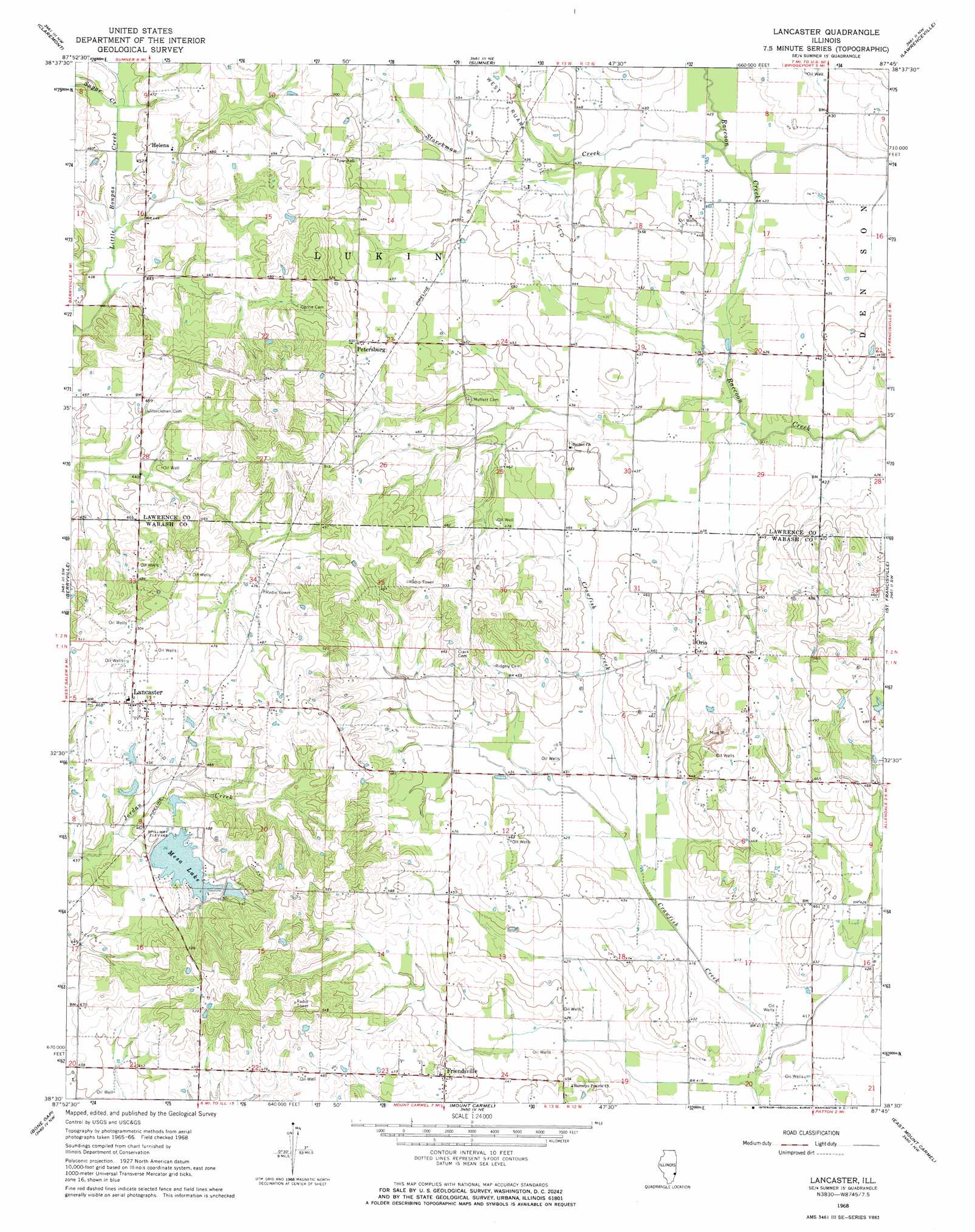
USGS Topo Quad 38087e7 - 1:24,000 scale
| Topo Map Name: | Lancaster |
| USGS Topo Quad ID: | 38087e7 |
| Print Size: | ca. 21 1/4" wide x 27" high |
| Southeast Coordinates: | 38.5° N latitude / 87.75° W longitude |
| Map Center Coordinates: | 38.5625° N latitude / 87.8125° W longitude |
| U.S. State: | IL |
| Filename: | o38087e7.jpg |
| Download Map JPG Image: | Lancaster topo map 1:24,000 scale |
| Map Type: | Topographic |
| Topo Series: | 7.5´ |
| Map Scale: | 1:24,000 |
| Source of Map Images: | United States Geological Survey (USGS) |
| Alternate Map Versions: |
Lancaster IL 1968, updated 1970 Download PDF Buy paper map Lancaster IL 2012 Download PDF Buy paper map Lancaster IL 2015 Download PDF Buy paper map |
1:24,000 Topo Quads surrounding Lancaster
Dundas |
Landes |
Chauncey |
Birds |
Russellville |
Olney |
Claremont |
Sumner |
Lawrenceville |
Vincennes |
West Salem |
Berryville |
Lancaster |
Saint Francisville |
Decker |
Albion North |
Bone Gap |
Mount Carmel |
East Mount Carmel |
Patoka |
Albion South |
Grayville |
Keensburg |
Owensville |
Princeton |
> Back to 38087e1 at 1:100,000 scale
> Back to 38086a1 at 1:250,000 scale
> Back to U.S. Topo Maps home
Lancaster topo map: Gazetteer
Lancaster: Dams
Fish Lake Dam elevation 147m 482′Mesa Lake Dam elevation 143m 469′
Lancaster: Oilfields
West Ruark Oil Field elevation 132m 433′Lancaster: Populated Places
Friendsville elevation 144m 472′Helena elevation 140m 459′
Lancaster elevation 148m 485′
Orio elevation 147m 482′
Petersburg elevation 153m 501′
Lancaster: Post Offices
Lancaster Post Office elevation 149m 488′Lancaster: Reservoirs
Fish Lake elevation 147m 482′Mesa Lake elevation 143m 469′
Lancaster: Streams
Storckman Creek elevation 127m 416′Sugar Creek elevation 137m 449′
Lancaster digital topo map on disk
Buy this Lancaster topo map showing relief, roads, GPS coordinates and other geographical features, as a high-resolution digital map file on DVD: