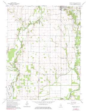
Oblong South Topo Map Illinois
To zoom in, hover over the map of Oblong South
USGS Topo Quad 38087h8 - 1:24,000 scale
| Topo Map Name: | Oblong South |
| USGS Topo Quad ID: | 38087h8 |
| Print Size: | ca. 21 1/4" wide x 27" high |
| Southeast Coordinates: | 38.875° N latitude / 87.875° W longitude |
| Map Center Coordinates: | 38.9375° N latitude / 87.9375° W longitude |
| U.S. State: | IL |
| Filename: | o38087h8.jpg |
| Download Map JPG Image: | Oblong South topo map 1:24,000 scale |
| Map Type: | Topographic |
| Topo Series: | 7.5´ |
| Map Scale: | 1:24,000 |
| Source of Map Images: | United States Geological Survey (USGS) |
| Alternate Map Versions: |
Oblong South IL 1968, updated 1970 Download PDF Buy paper map Oblong South IL 1968, updated 1982 Download PDF Buy paper map Oblong South IL 2012 Download PDF Buy paper map Oblong South IL 2015 Download PDF Buy paper map |
1:24,000 Topo Quads surrounding Oblong South
> Back to 38087e1 at 1:100,000 scale
> Back to 38086a1 at 1:250,000 scale
> Back to U.S. Topo Maps home
Oblong South topo map: Gazetteer
Oblong South: Crossings
Yeager Ford (historical) elevation 136m 446′Oblong South: Lakes
Circle Pond elevation 133m 436′Horseshoe Pond elevation 134m 439′
Oblong South: Populated Places
Green Brier elevation 137m 449′Pierceburg elevation 139m 456′
Oblong South: Streams
Brush Creek elevation 137m 449′Dead River elevation 136m 446′
Dogwood Creek elevation 134m 439′
Freeport Creek elevation 132m 433′
Hickory Creek elevation 139m 456′
Little Creek elevation 132m 433′
North Fork Embarras River elevation 140m 459′
Oblong South digital topo map on disk
Buy this Oblong South topo map showing relief, roads, GPS coordinates and other geographical features, as a high-resolution digital map file on DVD:


