Bungay Topo Map Illinois
To zoom in, hover over the map of Bungay
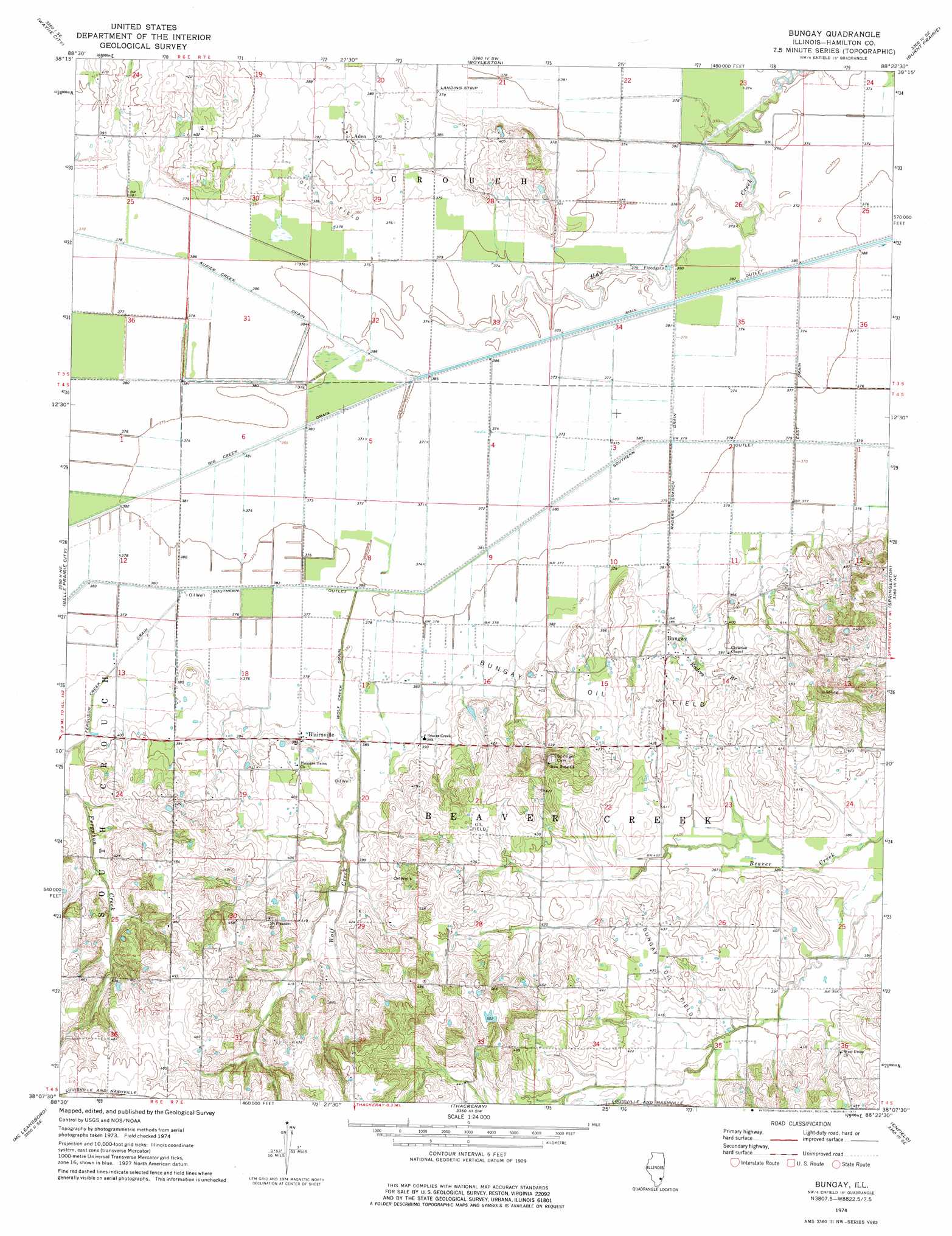
USGS Topo Quad 38088b4 - 1:24,000 scale
| Topo Map Name: | Bungay |
| USGS Topo Quad ID: | 38088b4 |
| Print Size: | ca. 21 1/4" wide x 27" high |
| Southeast Coordinates: | 38.125° N latitude / 88.375° W longitude |
| Map Center Coordinates: | 38.1875° N latitude / 88.4375° W longitude |
| U.S. State: | IL |
| Filename: | o38088b4.jpg |
| Download Map JPG Image: | Bungay topo map 1:24,000 scale |
| Map Type: | Topographic |
| Topo Series: | 7.5´ |
| Map Scale: | 1:24,000 |
| Source of Map Images: | United States Geological Survey (USGS) |
| Alternate Map Versions: |
Bungay IL 1974, updated 1977 Download PDF Buy paper map Bungay IL 2012 Download PDF Buy paper map Bungay IL 2015 Download PDF Buy paper map |
1:24,000 Topo Quads surrounding Bungay
Shields |
Crisp |
Geff |
Fairfield |
Albion Nw |
Bluford |
Wayne City |
Boylestown |
Burnt Prairie |
Golden Gate |
Dahlgren |
Belle Prairie City |
Bungay |
Springerton |
Centerville |
Macedonia |
Mcleansboro |
Thackeray |
Enfield |
Carmi |
Akin |
Walpole |
Broughton |
Norris City |
New Haven |
> Back to 38088a1 at 1:100,000 scale
> Back to 38088a1 at 1:250,000 scale
> Back to U.S. Topo Maps home
Bungay topo map: Gazetteer
Bungay: Airports
Moulton Farms Airport elevation 115m 377′Bungay: Canals
Big Creek Drain elevation 114m 374′Ferguson Creek Drain elevation 117m 383′
Raders Branch Drain elevation 114m 374′
Southern Outlet elevation 113m 370′
Wolf Creek Drain elevation 115m 377′
Bungay: Oilfields
Bungay Oil Field elevation 126m 413′Bungay: Populated Places
Aden elevation 122m 400′Blairsville elevation 117m 383′
Bungay elevation 122m 400′
Jefferson City (historical) elevation 134m 439′
New London (historical) elevation 130m 426′
Bungay: Post Offices
Lower Mill Post Office (historical) elevation 121m 396′Bungay: Streams
Big Creek elevation 113m 370′Ferguson Creek elevation 114m 374′
Raders Branch elevation 112m 367′
Wolf Creek elevation 113m 370′
Bungay digital topo map on disk
Buy this Bungay topo map showing relief, roads, GPS coordinates and other geographical features, as a high-resolution digital map file on DVD: