Belle Prairie City Topo Map Illinois
To zoom in, hover over the map of Belle Prairie City
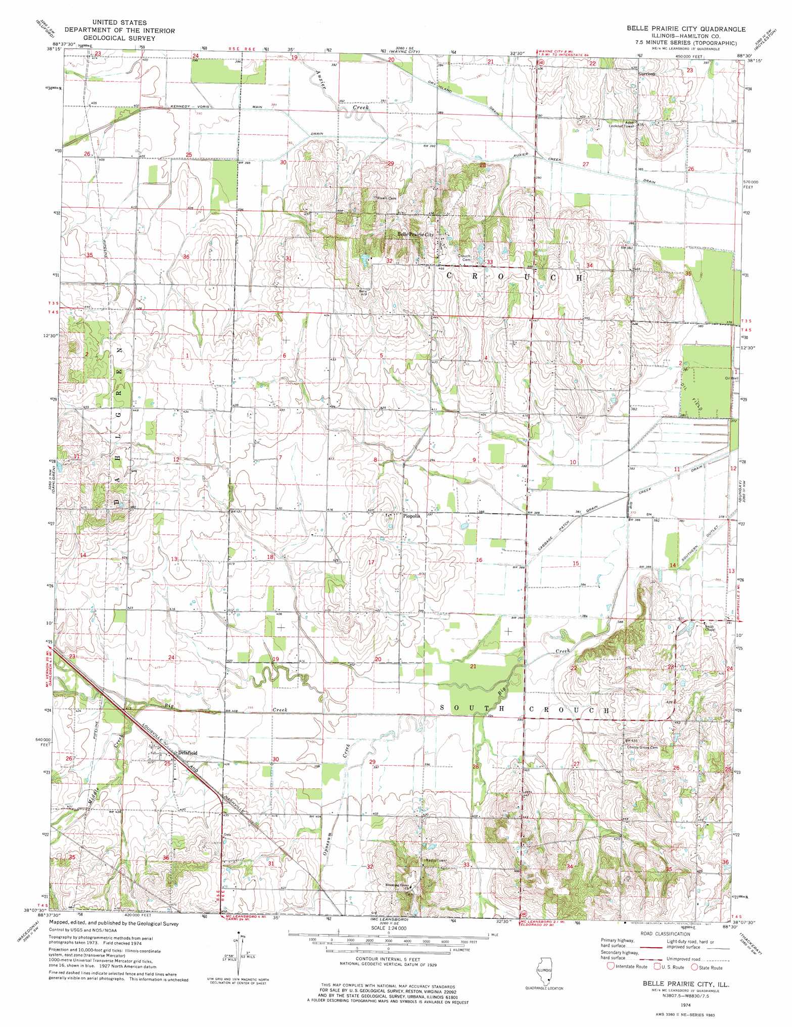
USGS Topo Quad 38088b5 - 1:24,000 scale
| Topo Map Name: | Belle Prairie City |
| USGS Topo Quad ID: | 38088b5 |
| Print Size: | ca. 21 1/4" wide x 27" high |
| Southeast Coordinates: | 38.125° N latitude / 88.5° W longitude |
| Map Center Coordinates: | 38.1875° N latitude / 88.5625° W longitude |
| U.S. State: | IL |
| Filename: | o38088b5.jpg |
| Download Map JPG Image: | Belle Prairie City topo map 1:24,000 scale |
| Map Type: | Topographic |
| Topo Series: | 7.5´ |
| Map Scale: | 1:24,000 |
| Source of Map Images: | United States Geological Survey (USGS) |
| Alternate Map Versions: |
Belle Prairie City IL 1974, updated 1977 Download PDF Buy paper map Belle Prairie City IL 2012 Download PDF Buy paper map Belle Prairie City IL 2015 Download PDF Buy paper map |
1:24,000 Topo Quads surrounding Belle Prairie City
Harmony |
Shields |
Crisp |
Geff |
Fairfield |
Opdyke |
Bluford |
Wayne City |
Boylestown |
Burnt Prairie |
Spring Garden |
Dahlgren |
Belle Prairie City |
Bungay |
Springerton |
Ewing |
Macedonia |
Mcleansboro |
Thackeray |
Enfield |
Thompsonville |
Akin |
Walpole |
Broughton |
Norris City |
> Back to 38088a1 at 1:100,000 scale
> Back to 38088a1 at 1:250,000 scale
> Back to U.S. Topo Maps home
Belle Prairie City topo map: Gazetteer
Belle Prairie City: Canals
Auxier Creek Drain elevation 114m 374′Cabbage Patch Drain elevation 115m 377′
Dry Island Drain elevation 116m 380′
Kennedy-Voris Main Drain elevation 117m 383′
Belle Prairie City: Parks
Karchers Post Oak Woods Nature Preserve elevation 138m 452′Belle Prairie City: Populated Places
Belle Prairie City elevation 145m 475′Delafield elevation 126m 413′
Garrison elevation 133m 436′
Piopolis elevation 125m 410′
Belle Prairie City: Streams
Auxier Creek elevation 117m 383′Black Branch elevation 114m 374′
Middle Creek elevation 123m 403′
Opossum Creek elevation 118m 387′
Shelton Creek elevation 119m 390′
Belle Prairie City digital topo map on disk
Buy this Belle Prairie City topo map showing relief, roads, GPS coordinates and other geographical features, as a high-resolution digital map file on DVD: