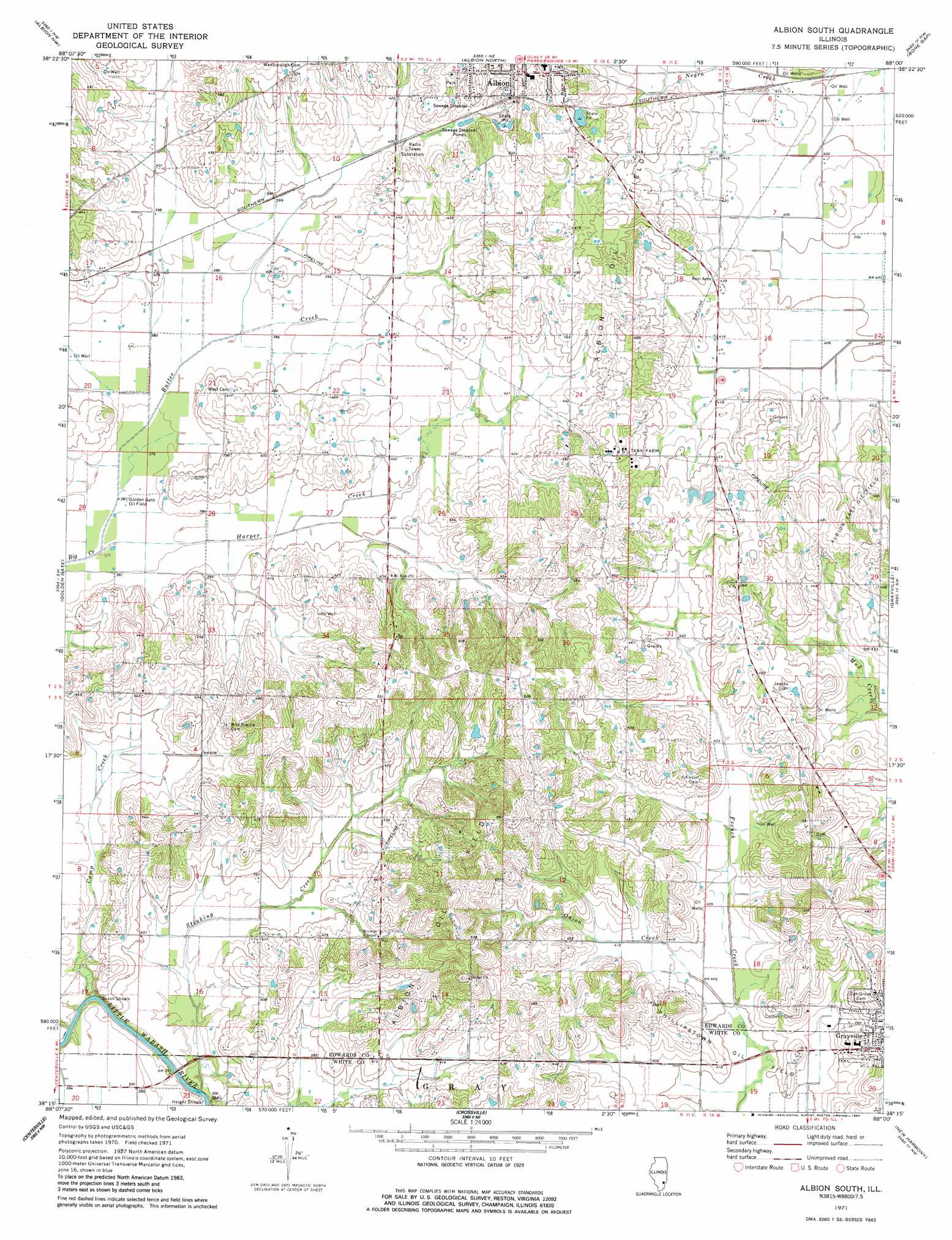
Albion South Topo Map Illinois
To zoom in, hover over the map of Albion South
USGS Topo Quad 38088c1 - 1:24,000 scale
| Topo Map Name: | Albion South |
| USGS Topo Quad ID: | 38088c1 |
| Print Size: | ca. 21 1/4" wide x 27" high |
| Southeast Coordinates: | 38.25° N latitude / 88° W longitude |
| Map Center Coordinates: | 38.3125° N latitude / 88.0625° W longitude |
| U.S. State: | IL |
| Filename: | o38088c1.jpg |
| Download Map JPG Image: | Albion South topo map 1:24,000 scale |
| Map Type: | Topographic |
| Topo Series: | 7.5´ |
| Map Scale: | 1:24,000 |
| Source of Map Images: | United States Geological Survey (USGS) |
| Alternate Map Versions: |
Albion South IL 1971, updated 1973 Download PDF Buy paper map Albion South IL 1971, updated 1984 Download PDF Buy paper map Albion South IL 2012 Download PDF Buy paper map Albion South IL 2015 Download PDF Buy paper map |
1:24,000 Topo Quads surrounding Albion South
Enterprise |
Mount Erie |
West Salem |
Berryville |
Lancaster |
Fairfield |
Albion Nw |
Albion North |
Bone Gap |
Mount Carmel |
Burnt Prairie |
Golden Gate |
Albion South |
Grayville |
Keensburg |
Springerton |
Centerville |
Crossville |
New Harmony |
Poseyville |
Enfield |
Carmi |
Maunie |
Solitude |
Wadesville |
> Back to 38088a1 at 1:100,000 scale
> Back to 38088a1 at 1:250,000 scale
> Back to U.S. Topo Maps home
Albion South topo map: Gazetteer
Albion South: Areas
English Prairie elevation 125m 410′Long Prairie elevation 125m 410′
Albion South: Bars
Dixon Shoals elevation 109m 357′Height Shoals elevation 109m 357′
Albion South: Bridges
Height Shoals Bridge (historical) elevation 108m 354′Albion South: Oilfields
Albion East Oil Field elevation 140m 459′Albion Oil Field elevation 155m 508′
Albion South: Populated Places
Red Top elevation 128m 419′Albion South: Streams
Butter Creek elevation 113m 370′Camp Creek elevation 109m 357′
Harper Creek elevation 113m 370′
Onion Creek elevation 120m 393′
Stinking Creek elevation 113m 370′
Albion South digital topo map on disk
Buy this Albion South topo map showing relief, roads, GPS coordinates and other geographical features, as a high-resolution digital map file on DVD: