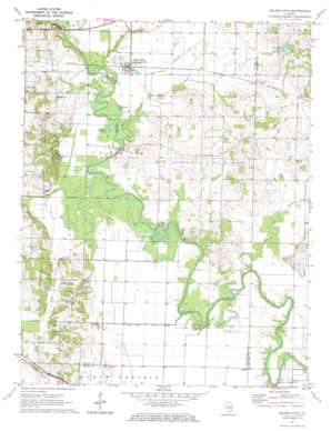
Golden Gate Topo Map Illinois
To zoom in, hover over the map of Golden Gate
USGS Topo Quad 38088c2 - 1:24,000 scale
| Topo Map Name: | Golden Gate |
| USGS Topo Quad ID: | 38088c2 |
| Print Size: | ca. 21 1/4" wide x 27" high |
| Southeast Coordinates: | 38.25° N latitude / 88.125° W longitude |
| Map Center Coordinates: | 38.3125° N latitude / 88.1875° W longitude |
| U.S. State: | IL |
| Filename: | o38088c2.jpg |
| Download Map JPG Image: | Golden Gate topo map 1:24,000 scale |
| Map Type: | Topographic |
| Topo Series: | 7.5´ |
| Map Scale: | 1:24,000 |
| Source of Map Images: | United States Geological Survey (USGS) |
| Alternate Map Versions: |
Golden Gate IL 1971, updated 1973 Download PDF Buy paper map Golden Gate IL 2012 Download PDF Buy paper map Golden Gate IL 2015 Download PDF Buy paper map |
1:24,000 Topo Quads surrounding Golden Gate
> Back to 38088a1 at 1:100,000 scale
> Back to 38088a1 at 1:250,000 scale
> Back to U.S. Topo Maps home
Golden Gate topo map: Gazetteer
Golden Gate: Areas
Burks Prairie elevation 130m 426′Golden Gate: Bridges
Hodgson Bridge elevation 109m 357′Old Iron Bridge elevation 114m 374′
Saxe Bridge (historical) elevation 111m 364′
Tait Bridge elevation 109m 357′
Golden Gate: Canals
Gum Road Ditch elevation 115m 377′Golden Gate: Cliffs
Beech Bluff elevation 119m 390′Golden Gate: Guts
Hortin Slough elevation 113m 370′Golden Gate: Lakes
Half Moon Pond elevation 115m 377′Hay Pond elevation 113m 370′
Horseshoe Pond elevation 115m 377′
Old River Pond elevation 113m 370′
Golden Gate: Oilfields
Golden Gate Oil Field elevation 124m 406′Golden Gate: Populated Places
Ellery elevation 131m 429′Golden Gate elevation 121m 396′
Scottsville elevation 134m 439′
Golden Gate: Post Offices
Ellery Post Office elevation 131m 429′Golden Gate: Streams
Big Creek elevation 109m 357′Briar Branch elevation 113m 370′
Freds Creek elevation 116m 380′
Ham Creek elevation 113m 370′
King Creek elevation 113m 370′
Little Pond Creek elevation 110m 360′
Pond Creek elevation 110m 360′
White Oak Slough elevation 113m 370′
Golden Gate digital topo map on disk
Buy this Golden Gate topo map showing relief, roads, GPS coordinates and other geographical features, as a high-resolution digital map file on DVD:


