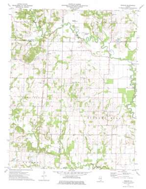
Shields Topo Map Illinois
To zoom in, hover over the map of Shields
USGS Topo Quad 38088d6 - 1:24,000 scale
| Topo Map Name: | Shields |
| USGS Topo Quad ID: | 38088d6 |
| Print Size: | ca. 21 1/4" wide x 27" high |
| Southeast Coordinates: | 38.375° N latitude / 88.625° W longitude |
| Map Center Coordinates: | 38.4375° N latitude / 88.6875° W longitude |
| U.S. State: | IL |
| Filename: | o38088d6.jpg |
| Download Map JPG Image: | Shields topo map 1:24,000 scale |
| Map Type: | Topographic |
| Topo Series: | 7.5´ |
| Map Scale: | 1:24,000 |
| Source of Map Images: | United States Geological Survey (USGS) |
| Alternate Map Versions: |
Shields IL 1973, updated 1975 Download PDF Buy paper map Shields IL 2012 Download PDF Buy paper map Shields IL 2015 Download PDF Buy paper map |
1:24,000 Topo Quads surrounding Shields
> Back to 38088a1 at 1:100,000 scale
> Back to 38088a1 at 1:250,000 scale
> Back to U.S. Topo Maps home
Shields topo map: Gazetteer
Shields: Bridges
Garrison Bridge elevation 127m 416′Gettins Bridge elevation 123m 403′
Mud Bridge elevation 128m 419′
Shields: Crossings
Greathouse Ford elevation 123m 403′Shields: Dams
O'Daniel Lodge Lake Dam Number 1 elevation 135m 442′O'Daniel Lodge Lake Dam Number 2 elevation 129m 423′
Shields: Guts
Horseshoe Slough elevation 129m 423′Shields: Oilfields
Coil Oil Field elevation 146m 479′Coil West Oil Field elevation 149m 488′
Orchardville Oil Field elevation 144m 472′
Shields: Parks
Miller Shrub Swamp Nature Preserve elevation 135m 442′Shields: Populated Places
Keenesville elevation 141m 462′Shields elevation 150m 492′
Stratton elevation 148m 485′
Shields: Post Offices
Logansville Post Office (historical) elevation 152m 498′Shields: Reservoirs
O'Daniel Lodge Lake elevation 135m 442′O'Daniel Lodge Lake elevation 129m 423′
Shields: Streams
Brush Creek elevation 123m 403′Elm Creek elevation 128m 419′
Gregory Branch elevation 125m 410′
Lick Branch elevation 128m 419′
Paddy Creek elevation 122m 400′
Possum Creek elevation 121m 396′
Puncheon Creek elevation 125m 410′
Turner Creek elevation 125m 410′
Shields: Summits
Little Potatoe Hill elevation 135m 442′Potatoe Hill elevation 141m 462′
Shields digital topo map on disk
Buy this Shields topo map showing relief, roads, GPS coordinates and other geographical features, as a high-resolution digital map file on DVD:


