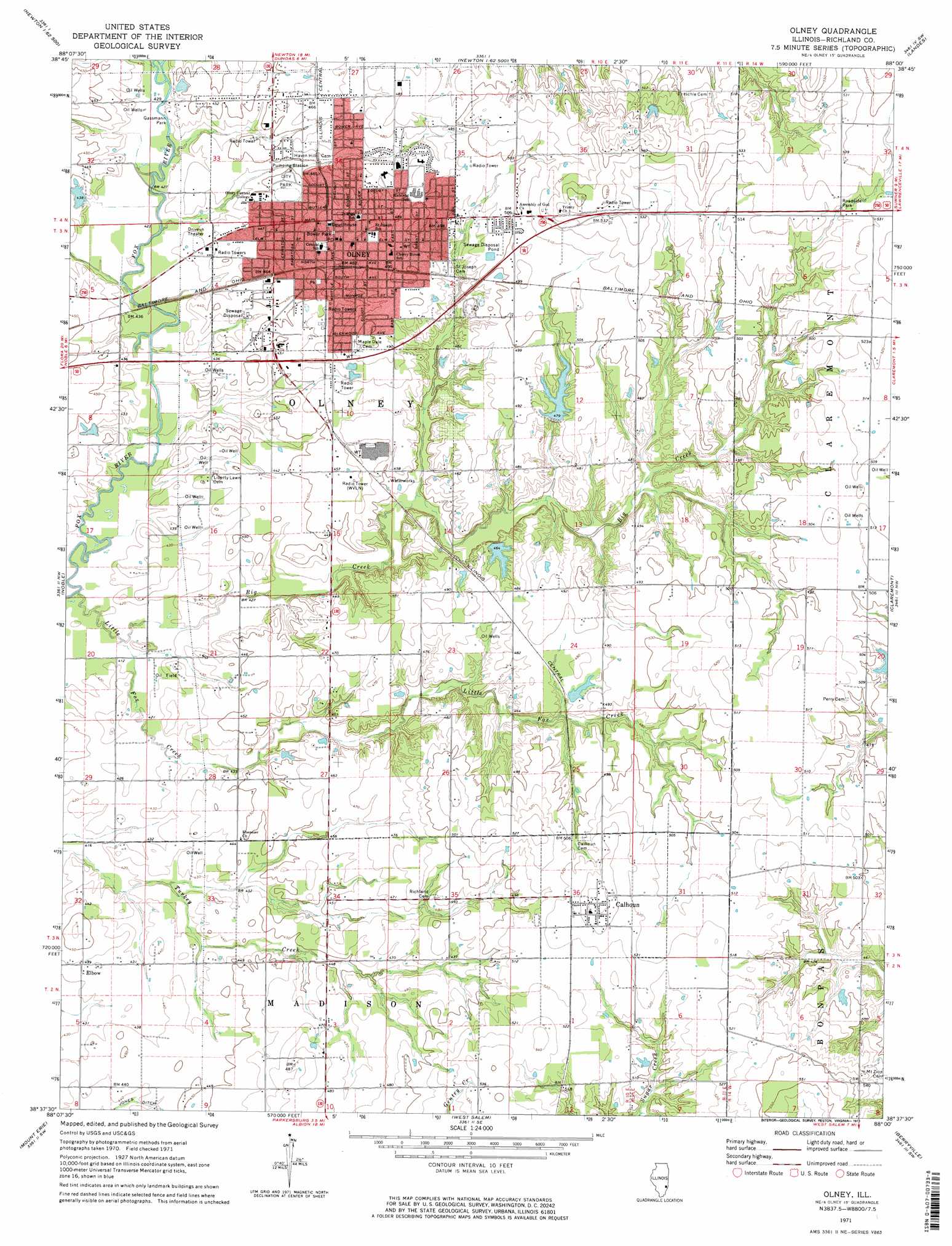
Olney Topo Map Illinois
To zoom in, hover over the map of Olney
USGS Topo Quad 38088f1 - 1:24,000 scale
| Topo Map Name: | Olney |
| USGS Topo Quad ID: | 38088f1 |
| Print Size: | ca. 21 1/4" wide x 27" high |
| Southeast Coordinates: | 38.625° N latitude / 88° W longitude |
| Map Center Coordinates: | 38.6875° N latitude / 88.0625° W longitude |
| U.S. State: | IL |
| Filename: | o38088f1.jpg |
| Download Map JPG Image: | Olney topo map 1:24,000 scale |
| Map Type: | Topographic |
| Topo Series: | 7.5´ |
| Map Scale: | 1:24,000 |
| Source of Map Images: | United States Geological Survey (USGS) |
| Alternate Map Versions: |
Olney IL 1971, updated 1973 Download PDF Buy paper map Olney IL 1971, updated 1973 Download PDF Buy paper map Olney IL 2012 Download PDF Buy paper map Olney IL 2015 Download PDF Buy paper map |
1:24,000 Topo Quads surrounding Olney
Latona |
Newton |
Sainte Marie |
Oblong South |
Stoy |
Sailor Springs |
Wakefield |
Dundas |
Landes |
Chauncey |
Clay City |
Noble |
Olney |
Claremont |
Sumner |
Enterprise |
Mount Erie |
West Salem |
Berryville |
Lancaster |
Fairfield |
Albion Nw |
Albion North |
Bone Gap |
Mount Carmel |
> Back to 38088e1 at 1:100,000 scale
> Back to 38088a1 at 1:250,000 scale
> Back to U.S. Topo Maps home
Olney topo map: Gazetteer
Olney: Airports
Richland Memorial Hospital Heliport elevation 145m 475′Olney: Dams
Hahn Lake Dam elevation 137m 449′Illinois No Name Number 2037 Dam elevation 133m 436′
Jordan Lake Dam elevation 148m 485′
Millers Lake Dam elevation 146m 479′
Olney: Parks
Big Creek Woods Memorial Nature Preserve elevation 133m 436′Bower Park elevation 147m 482′
City Park elevation 138m 452′
Elliott Street Historic District elevation 150m 492′
Gassmann Park elevation 131m 429′
Olney: Populated Places
Calhoun elevation 166m 544′Elbow elevation 134m 439′
Olney elevation 146m 479′
Watertown (historical) elevation 134m 439′
Olney: Post Offices
Olney Post Office elevation 147m 482′Olney: Reservoirs
Hahn Lake elevation 137m 449′Illinois No Name Number 2037 Reservoir elevation 133m 436′
Jordan Lake elevation 148m 485′
Millers Lake elevation 146m 479′
Olney: Streams
Big Creek elevation 125m 410′Little Fox Creek elevation 125m 410′
Olney digital topo map on disk
Buy this Olney topo map showing relief, roads, GPS coordinates and other geographical features, as a high-resolution digital map file on DVD: