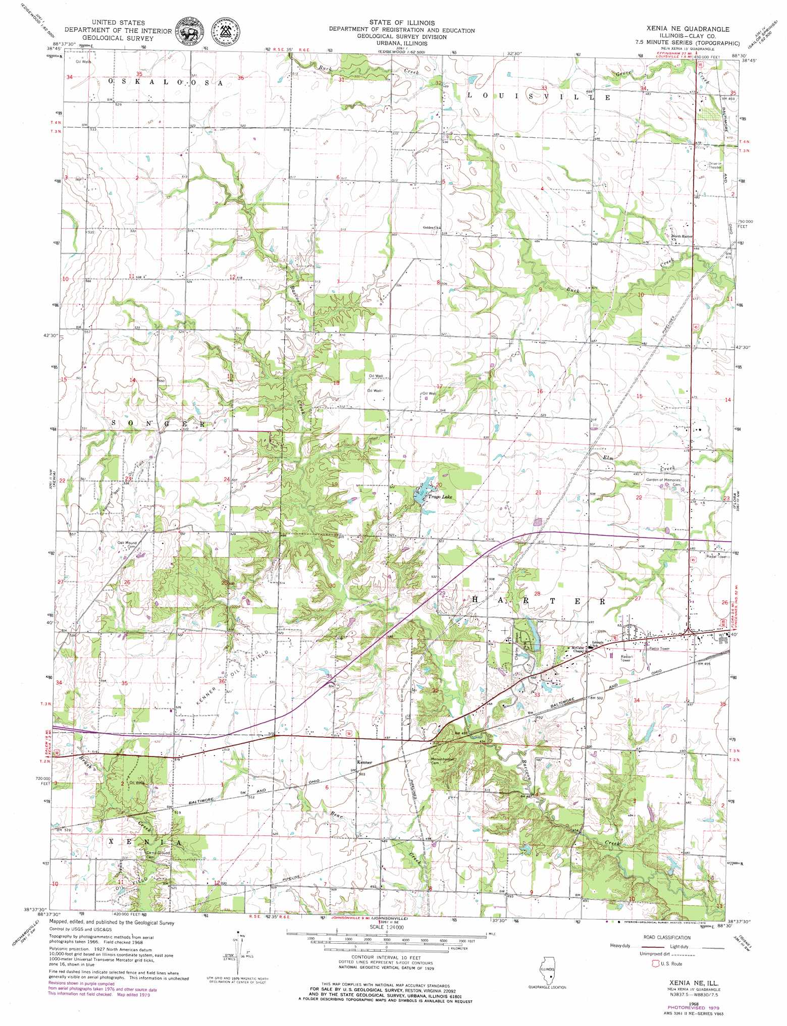
Xenia Ne Topo Map Illinois
To zoom in, hover over the map of Xenia Ne
USGS Topo Quad 38088f5 - 1:24,000 scale
| Topo Map Name: | Xenia Ne |
| USGS Topo Quad ID: | 38088f5 |
| Print Size: | ca. 21 1/4" wide x 27" high |
| Southeast Coordinates: | 38.625° N latitude / 88.5° W longitude |
| Map Center Coordinates: | 38.6875° N latitude / 88.5625° W longitude |
| U.S. State: | IL |
| Filename: | o38088f5.jpg |
| Download Map JPG Image: | Xenia Ne topo map 1:24,000 scale |
| Map Type: | Topographic |
| Topo Series: | 7.5´ |
| Map Scale: | 1:24,000 |
| Source of Map Images: | United States Geological Survey (USGS) |
| Alternate Map Versions: |
Xenia NE IL 1968, updated 1970 Download PDF Buy paper map Xenia NE IL 1968, updated 1979 Download PDF Buy paper map Xenia NE IL 2012 Download PDF Buy paper map Xenia NE IL 2015 Download PDF Buy paper map |
1:24,000 Topo Quads surrounding Xenia Ne
Loogootee |
Edgewood |
Hord |
Eberle |
Latona |
Kinmundy |
Oskaloosa |
Louisville West |
Louisville East |
Sailor Springs |
Omega |
Xenia |
Xenia Ne |
Flora |
Clay City |
Iuka |
Orchardville |
Johnsonville |
Cisne |
Enterprise |
Harmony |
Shields |
Crisp |
Geff |
Fairfield |
> Back to 38088e1 at 1:100,000 scale
> Back to 38088a1 at 1:250,000 scale
> Back to U.S. Topo Maps home
Xenia Ne topo map: Gazetteer
Xenia Ne: Dams
Charley Brown Park Lake Dam elevation 144m 472′Trago Lake Dam elevation 159m 521′
Xenia Ne: Oilfields
Kenner Oil Field elevation 159m 521′Kenner West Oil Field elevation 161m 528′
North Kenner Oil Field elevation 160m 524′
South Kenner Oil Field elevation 152m 498′
Xenia Ne: Parks
Charley Brown Park elevation 149m 488′Martin T Snyder Memorial Nature Preserve elevation 139m 456′
Xenia Ne: Populated Places
Kenner elevation 152m 498′Xenia Ne: Reservoirs
Charley Brown Park Lake elevation 144m 472′Trago Lake elevation 159m 521′
Xenia Ne digital topo map on disk
Buy this Xenia Ne topo map showing relief, roads, GPS coordinates and other geographical features, as a high-resolution digital map file on DVD: