Omega Topo Map Illinois
To zoom in, hover over the map of Omega
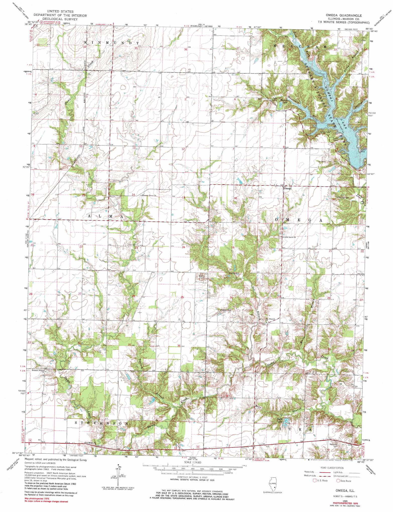
USGS Topo Quad 38088f7 - 1:24,000 scale
| Topo Map Name: | Omega |
| USGS Topo Quad ID: | 38088f7 |
| Print Size: | ca. 21 1/4" wide x 27" high |
| Southeast Coordinates: | 38.625° N latitude / 88.75° W longitude |
| Map Center Coordinates: | 38.6875° N latitude / 88.8125° W longitude |
| U.S. State: | IL |
| Filename: | o38088f7.jpg |
| Download Map JPG Image: | Omega topo map 1:24,000 scale |
| Map Type: | Topographic |
| Topo Series: | 7.5´ |
| Map Scale: | 1:24,000 |
| Source of Map Images: | United States Geological Survey (USGS) |
| Alternate Map Versions: |
Omega IL 1965, updated 1968 Download PDF Buy paper map Omega IL 1965, updated 1981 Download PDF Buy paper map Omega IL 2012 Download PDF Buy paper map Omega IL 2015 Download PDF Buy paper map |
1:24,000 Topo Quads surrounding Omega
Vandalia |
Brownstown |
Loogootee |
Edgewood |
Hord |
Patoka |
Saint Paul |
Kinmundy |
Oskaloosa |
Louisville West |
Fairman |
Salem North |
Omega |
Xenia |
Xenia Ne |
Centralia East |
Salem South |
Iuka |
Orchardville |
Johnsonville |
Walnut Hill |
Kell |
Harmony |
Shields |
Crisp |
> Back to 38088e1 at 1:100,000 scale
> Back to 38088a1 at 1:250,000 scale
> Back to U.S. Topo Maps home
Omega topo map: Gazetteer
Omega: Beaches
Rocky Point Beach elevation 156m 511′Omega: Dams
Neffs Lake Dam elevation 165m 541′Omega: Lakes
Neffs Lake elevation 152m 498′Omega: Parks
Stephen A Forbes State Park elevation 168m 551′Omega: Populated Places
Omega elevation 169m 554′Omega: Reservoirs
Boston Lake elevation 170m 557′Neffs Lake elevation 165m 541′
Omega: Streams
Bear Branch elevation 140m 459′Bee Branch elevation 144m 472′
Mountain Branch elevation 156m 511′
Phillips Branch elevation 156m 511′
Rocky Branch elevation 156m 511′
Tadlock Branch elevation 146m 479′
White Oak Branch elevation 142m 465′
Omega digital topo map on disk
Buy this Omega topo map showing relief, roads, GPS coordinates and other geographical features, as a high-resolution digital map file on DVD: