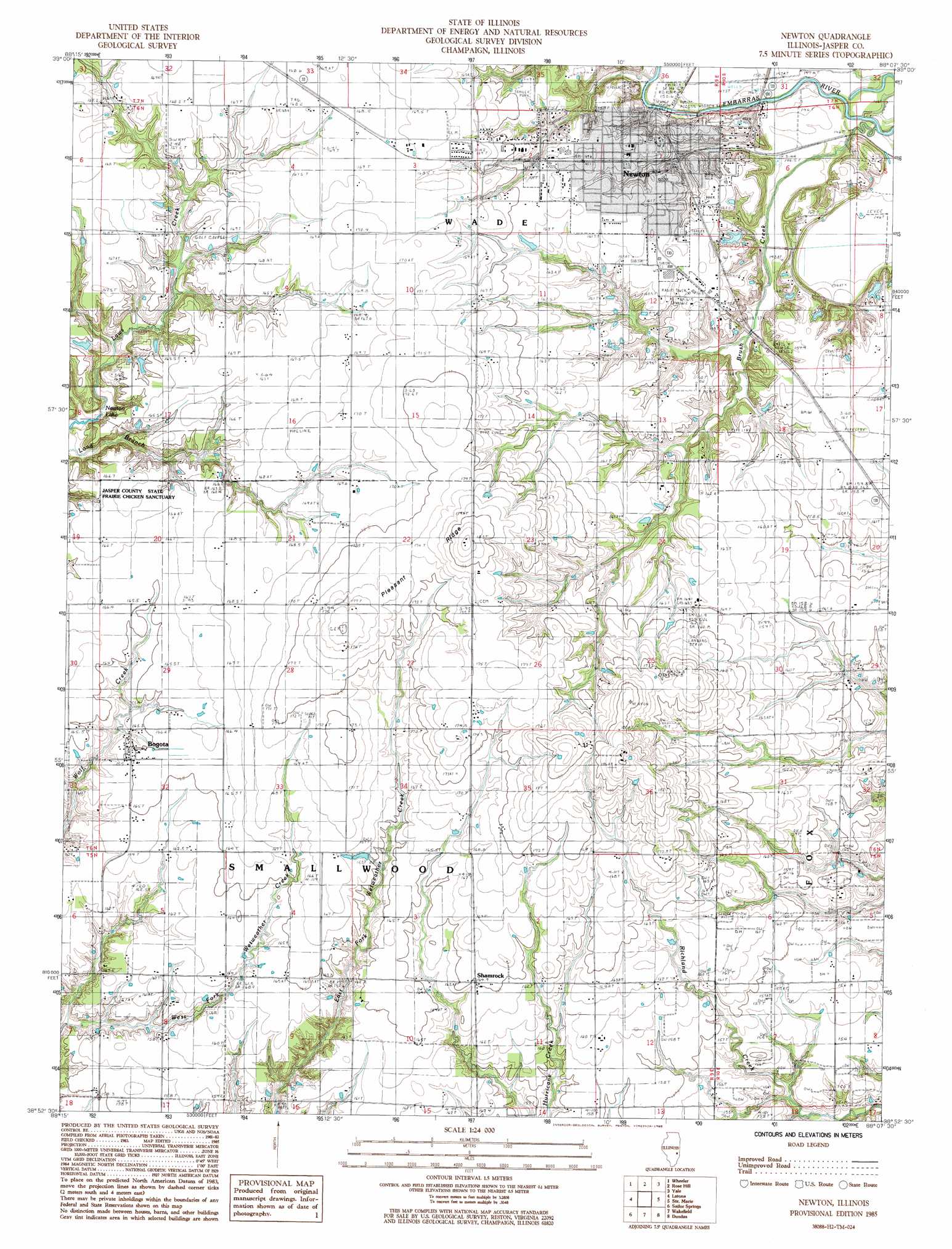
Newton Topo Map Illinois
To zoom in, hover over the map of Newton
USGS Topo Quad 38088h2 - 1:24,000 scale
| Topo Map Name: | Newton |
| USGS Topo Quad ID: | 38088h2 |
| Print Size: | ca. 21 1/4" wide x 27" high |
| Southeast Coordinates: | 38.875° N latitude / 88.125° W longitude |
| Map Center Coordinates: | 38.9375° N latitude / 88.1875° W longitude |
| U.S. State: | IL |
| Filename: | o38088h2.jpg |
| Download Map JPG Image: | Newton topo map 1:24,000 scale |
| Map Type: | Topographic |
| Topo Series: | 7.5´ |
| Map Scale: | 1:24,000 |
| Source of Map Images: | United States Geological Survey (USGS) |
| Alternate Map Versions: |
Newton IL 1985, updated 1985 Download PDF Buy paper map Newton IL 2012 Download PDF Buy paper map Newton IL 2015 Download PDF Buy paper map |
1:24,000 Topo Quads surrounding Newton
Teutopolis |
Woodbury |
Greenup |
Hazel Dell |
Moriah |
Dieterich |
Wheeler |
Rose Hill |
Yale |
Oblong North |
Eberle |
Latona |
Newton |
Sainte Marie |
Oblong South |
Louisville East |
Sailor Springs |
Wakefield |
Dundas |
Landes |
Flora |
Clay City |
Noble |
Olney |
Claremont |
> Back to 38088e1 at 1:100,000 scale
> Back to 38088a1 at 1:250,000 scale
> Back to U.S. Topo Maps home
Newton topo map: Gazetteer
Newton: Airports
Jasper County Flying Club Airport elevation 168m 551′Jasper County Safety Council Heliport elevation 163m 534′
Newton: Populated Places
Bogota elevation 165m 541′Newton elevation 163m 534′
Shamrock elevation 165m 541′
Newton: Post Offices
Bogota Post Office elevation 165m 541′Newton Post Office elevation 163m 534′
Newton: Ridges
Pleasant Ridge elevation 173m 567′Newton digital topo map on disk
Buy this Newton topo map showing relief, roads, GPS coordinates and other geographical features, as a high-resolution digital map file on DVD: