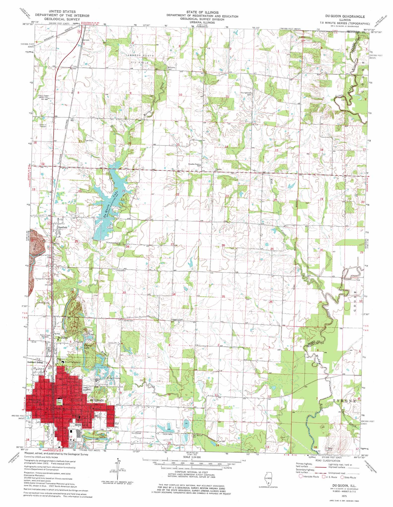
Du Quoin Topo Map Illinois
To zoom in, hover over the map of Du Quoin
USGS Topo Quad 38089a2 - 1:24,000 scale
| Topo Map Name: | Du Quoin |
| USGS Topo Quad ID: | 38089a2 |
| Print Size: | ca. 21 1/4" wide x 27" high |
| Southeast Coordinates: | 38° N latitude / 89.125° W longitude |
| Map Center Coordinates: | 38.0625° N latitude / 89.1875° W longitude |
| U.S. State: | IL |
| Filename: | o38089a2.jpg |
| Download Map JPG Image: | Du Quoin topo map 1:24,000 scale |
| Map Type: | Topographic |
| Topo Series: | 7.5´ |
| Map Scale: | 1:24,000 |
| Source of Map Images: | United States Geological Survey (USGS) |
| Alternate Map Versions: |
Du Quoin IL 1975, updated 1977 Download PDF Buy paper map Du Quoin IL 2012 Download PDF Buy paper map Du Quoin IL 2015 Download PDF Buy paper map |
1:24,000 Topo Quads surrounding Du Quoin
Nashville |
Beaucoup |
Ashley |
Woodlawn |
Mount Vernon |
Winkle |
Todds Mill |
Tamaroa |
Waltonville |
Ina |
Pinckneyville |
Pyatts |
Du Quoin |
Sesser |
Rend Lake Dam |
Ava |
Vergennes |
Elkville |
Christopher |
West Frankfort |
Oraville |
Murphysboro |
Desoto |
Herrin |
Johnston City |
> Back to 38089a1 at 1:100,000 scale
> Back to 38088a1 at 1:250,000 scale
> Back to U.S. Topo Maps home
Du Quoin topo map: Gazetteer
Du Quoin: Airports
Marshall Browning Hospital Heliport elevation 138m 452′Du Quoin: Bridges
Jackson Bridge elevation 118m 387′Du Quoin: Dams
Lake Duquoin Dam elevation 134m 439′New Cherry Lake Dam elevation 130m 426′
Du Quoin: Lakes
Cherry Lake elevation 129m 423′Du Quoin: Mines
Gayle Mine elevation 134m 439′Number 2 Mine elevation 142m 465′
Paradise Mine elevation 125m 410′
Du Quoin: Oilfields
Tamaroa South Oil Field elevation 142m 465′Du Quoin: Parks
Keys Park elevation 141m 462′Du Quoin: Populated Places
Du Quoin elevation 142m 465′Holden elevation 137m 449′
Saint Johns elevation 142m 465′
Sunfield elevation 139m 456′
Du Quoin: Post Offices
Du Quoin Post Office elevation 141m 462′Du Quoin: Reservoirs
Du Quoin Lake elevation 134m 439′Illinois Central Reservoir elevation 129m 423′
New Cherry Lake elevation 130m 426′
Du Quoin: Streams
Cane Creek elevation 119m 390′Hog Creek elevation 119m 390′
Du Quoin digital topo map on disk
Buy this Du Quoin topo map showing relief, roads, GPS coordinates and other geographical features, as a high-resolution digital map file on DVD: