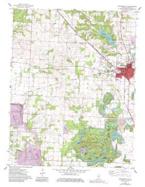
Pinckneyville Topo Map Illinois
To zoom in, hover over the map of Pinckneyville
USGS Topo Quad 38089a4 - 1:24,000 scale
| Topo Map Name: | Pinckneyville |
| USGS Topo Quad ID: | 38089a4 |
| Print Size: | ca. 21 1/4" wide x 27" high |
| Southeast Coordinates: | 38° N latitude / 89.375° W longitude |
| Map Center Coordinates: | 38.0625° N latitude / 89.4375° W longitude |
| U.S. State: | IL |
| Filename: | o38089a4.jpg |
| Download Map JPG Image: | Pinckneyville topo map 1:24,000 scale |
| Map Type: | Topographic |
| Topo Series: | 7.5´ |
| Map Scale: | 1:24,000 |
| Source of Map Images: | United States Geological Survey (USGS) |
| Alternate Map Versions: |
Pinckneyville IL 1974, updated 1978 Download PDF Buy paper map Pinckneyville IL 1974, updated 1982 Download PDF Buy paper map Pinckneyville IL 2012 Download PDF Buy paper map Pinckneyville IL 2015 Download PDF Buy paper map |
1:24,000 Topo Quads surrounding Pinckneyville
> Back to 38089a1 at 1:100,000 scale
> Back to 38088a1 at 1:250,000 scale
> Back to U.S. Topo Maps home
Pinckneyville topo map: Gazetteer
Pinckneyville: Airports
Lambert Airport elevation 167m 547′Pinckneyville: Channels
Wesseln Cut elevation 130m 426′Pinckneyville: Dams
Pinckneyville Reservoir Dam elevation 134m 439′Yearhing Lake Dam elevation 125m 410′
Pinckneyville: Lakes
Ash Lake elevation 130m 426′Beehive Lake elevation 130m 426′
Big Beaver Lake elevation 123m 403′
Blackberry Lake elevation 131m 429′
Boulder Lake elevation 132m 433′
Cedar Lake elevation 125m 410′
Chain Lakes elevation 134m 439′
Clear Lake elevation 130m 426′
Cottonwood Lake elevation 131m 429′
Crescent Lake elevation 125m 410′
Crystal Lake elevation 127m 416′
Elm Lake elevation 131m 429′
Heron Lake elevation 130m 426′
Hidden Lake elevation 130m 426′
Hook Lake elevation 131m 429′
Little Beaver Lake elevation 124m 406′
Little Pond elevation 134m 439′
Lost Lake elevation 131m 429′
Marsh Lake elevation 131m 429′
Oak Lake elevation 129m 423′
Pine Lake elevation 131m 429′
Plum Lake elevation 130m 426′
Reed Lake elevation 131m 429′
Ridge Lake elevation 124m 406′
Serene Lake elevation 127m 416′
Spring Lake elevation 125m 410′
Stump Pond elevation 132m 433′
Willow Lake elevation 125m 410′
Pinckneyville: Parks
Pyramid State Park elevation 136m 446′Pinckneyville: Populated Places
Conant elevation 140m 459′Layfield elevation 163m 534′
Pinckneyville elevation 132m 433′
Pinckneyville: Post Offices
Four Mile Prairie Post Office (historical) elevation 128m 419′Pinckneyville Post Office elevation 133m 436′
Pinckneyville: Reservoirs
Pinckneyville Reservoir elevation 134m 439′Yearhing Lake elevation 125m 410′
Pinckneyville: Streams
Opossum Creek elevation 122m 400′Pinckneyville digital topo map on disk
Buy this Pinckneyville topo map showing relief, roads, GPS coordinates and other geographical features, as a high-resolution digital map file on DVD:


