Walsh Topo Map Illinois
To zoom in, hover over the map of Walsh
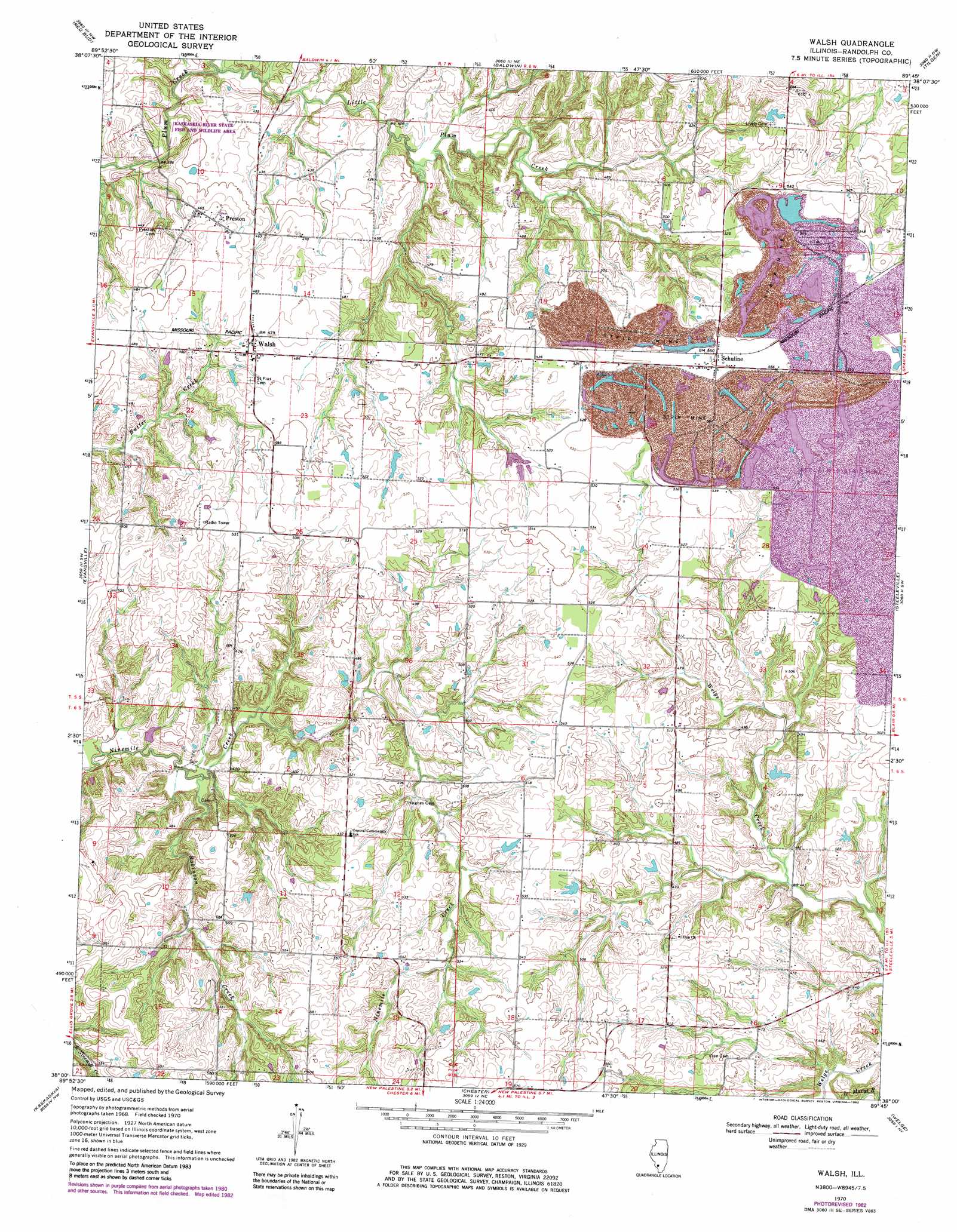
USGS Topo Quad 38089a7 - 1:24,000 scale
| Topo Map Name: | Walsh |
| USGS Topo Quad ID: | 38089a7 |
| Print Size: | ca. 21 1/4" wide x 27" high |
| Southeast Coordinates: | 38° N latitude / 89.75° W longitude |
| Map Center Coordinates: | 38.0625° N latitude / 89.8125° W longitude |
| U.S. State: | IL |
| Filename: | o38089a7.jpg |
| Download Map JPG Image: | Walsh topo map 1:24,000 scale |
| Map Type: | Topographic |
| Topo Series: | 7.5´ |
| Map Scale: | 1:24,000 |
| Source of Map Images: | United States Geological Survey (USGS) |
| Alternate Map Versions: |
Walsh IL 1970, updated 1972 Download PDF Buy paper map Walsh IL 1970, updated 1982 Download PDF Buy paper map Walsh IL 1970, updated 1982 Download PDF Buy paper map Walsh IL 2012 Download PDF Buy paper map Walsh IL 2015 Download PDF Buy paper map |
1:24,000 Topo Quads surrounding Walsh
Paderborn |
New Athens West |
New Athens East |
Saint Libory |
Oakdale |
Ames |
Red Bud |
Baldwin |
Tilden |
Coulterville |
Prairie Du Rocher |
Evansville |
Walsh |
Steeleville |
Percy |
Sainte Genevieve |
Kaskaskia |
Chester |
Welge |
Willisville |
Minnith |
Lithium |
Belgique |
Rockwood |
Raddle |
> Back to 38089a1 at 1:100,000 scale
> Back to 38088a1 at 1:250,000 scale
> Back to U.S. Topo Maps home
Walsh topo map: Gazetteer
Walsh: Airports
Korando Airport elevation 166m 544′Walsh: Dams
Langford Pond Dam elevation 169m 554′Walsh: Populated Places
Preston elevation 143m 469′Schuline elevation 168m 551′
Walsh elevation 146m 479′
Walsh: Reservoirs
Langford Pond elevation 169m 554′Walsh: Streams
Little Plum Creek elevation 115m 377′Robinson Creek elevation 122m 400′
Walsh digital topo map on disk
Buy this Walsh topo map showing relief, roads, GPS coordinates and other geographical features, as a high-resolution digital map file on DVD: