Coulterville Topo Map Illinois
To zoom in, hover over the map of Coulterville
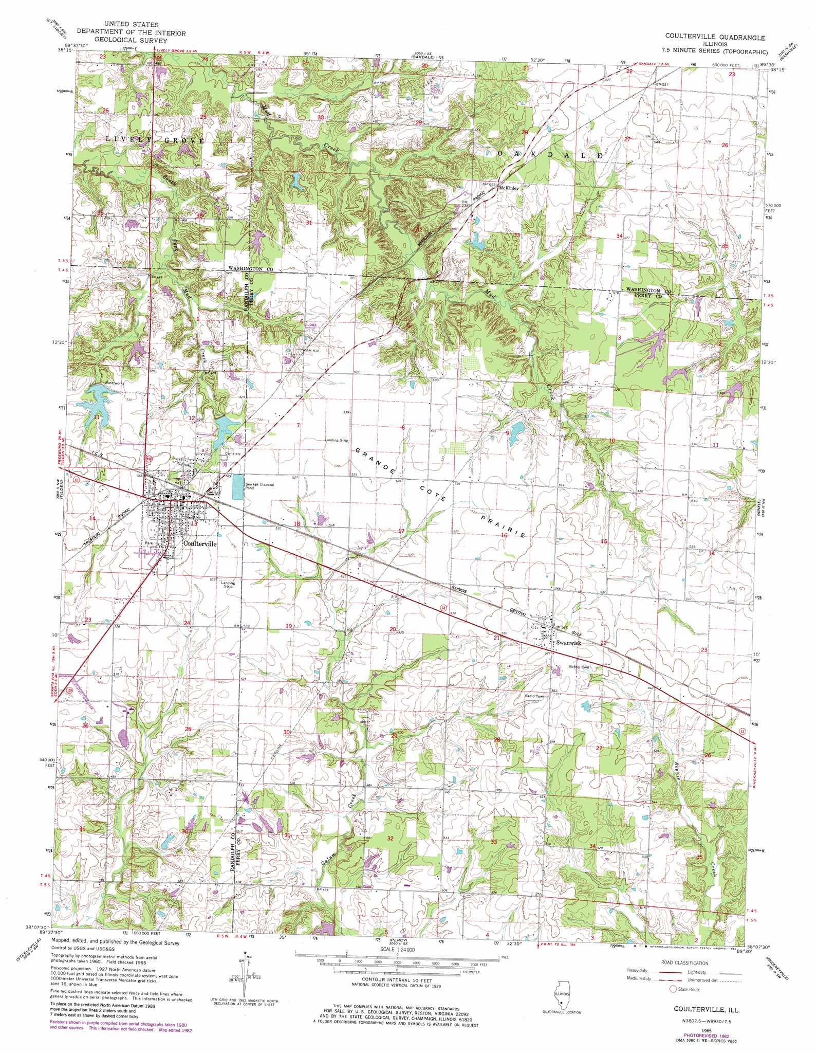
USGS Topo Quad 38089b5 - 1:24,000 scale
| Topo Map Name: | Coulterville |
| USGS Topo Quad ID: | 38089b5 |
| Print Size: | ca. 21 1/4" wide x 27" high |
| Southeast Coordinates: | 38.125° N latitude / 89.5° W longitude |
| Map Center Coordinates: | 38.1875° N latitude / 89.5625° W longitude |
| U.S. State: | IL |
| Filename: | o38089b5.jpg |
| Download Map JPG Image: | Coulterville topo map 1:24,000 scale |
| Map Type: | Topographic |
| Topo Series: | 7.5´ |
| Map Scale: | 1:24,000 |
| Source of Map Images: | United States Geological Survey (USGS) |
| Alternate Map Versions: |
Coulterville IL 1965, updated 1966 Download PDF Buy paper map Coulterville IL 1965, updated 1982 Download PDF Buy paper map Coulterville IL 2012 Download PDF Buy paper map Coulterville IL 2015 Download PDF Buy paper map |
1:24,000 Topo Quads surrounding Coulterville
Mascoutah |
Venedy |
Okawville |
Addieville |
Hoyleton |
New Athens East |
Saint Libory |
Oakdale |
Nashville |
Beaucoup |
Baldwin |
Tilden |
Coulterville |
Winkle |
Todds Mill |
Walsh |
Steeleville |
Percy |
Pinckneyville |
Pyatts |
Chester |
Welge |
Willisville |
Ava |
Vergennes |
> Back to 38089a1 at 1:100,000 scale
> Back to 38088a1 at 1:250,000 scale
> Back to U.S. Topo Maps home
Coulterville topo map: Gazetteer
Coulterville: Airports
Hurst Aviation Heliport elevation 160m 524′Coulterville: Dams
City Reservoir Dam elevation 155m 508′Foertch Pond Dam elevation 151m 495′
Lake Coulterville Dam elevation 156m 511′
Coulterville: Flats
Grande Cote Prairie elevation 170m 557′Coulterville: Populated Places
Coulterville elevation 169m 554′McKinley elevation 168m 551′
Swanwick elevation 174m 570′
Coulterville: Post Offices
Swanwick Post Office elevation 174m 570′Coulterville: Reservoirs
City Reservoir elevation 155m 508′Foertch Pond elevation 151m 495′
Lake Coulterville elevation 156m 511′
The Lake elevation 153m 501′
Coulterville digital topo map on disk
Buy this Coulterville topo map showing relief, roads, GPS coordinates and other geographical features, as a high-resolution digital map file on DVD: