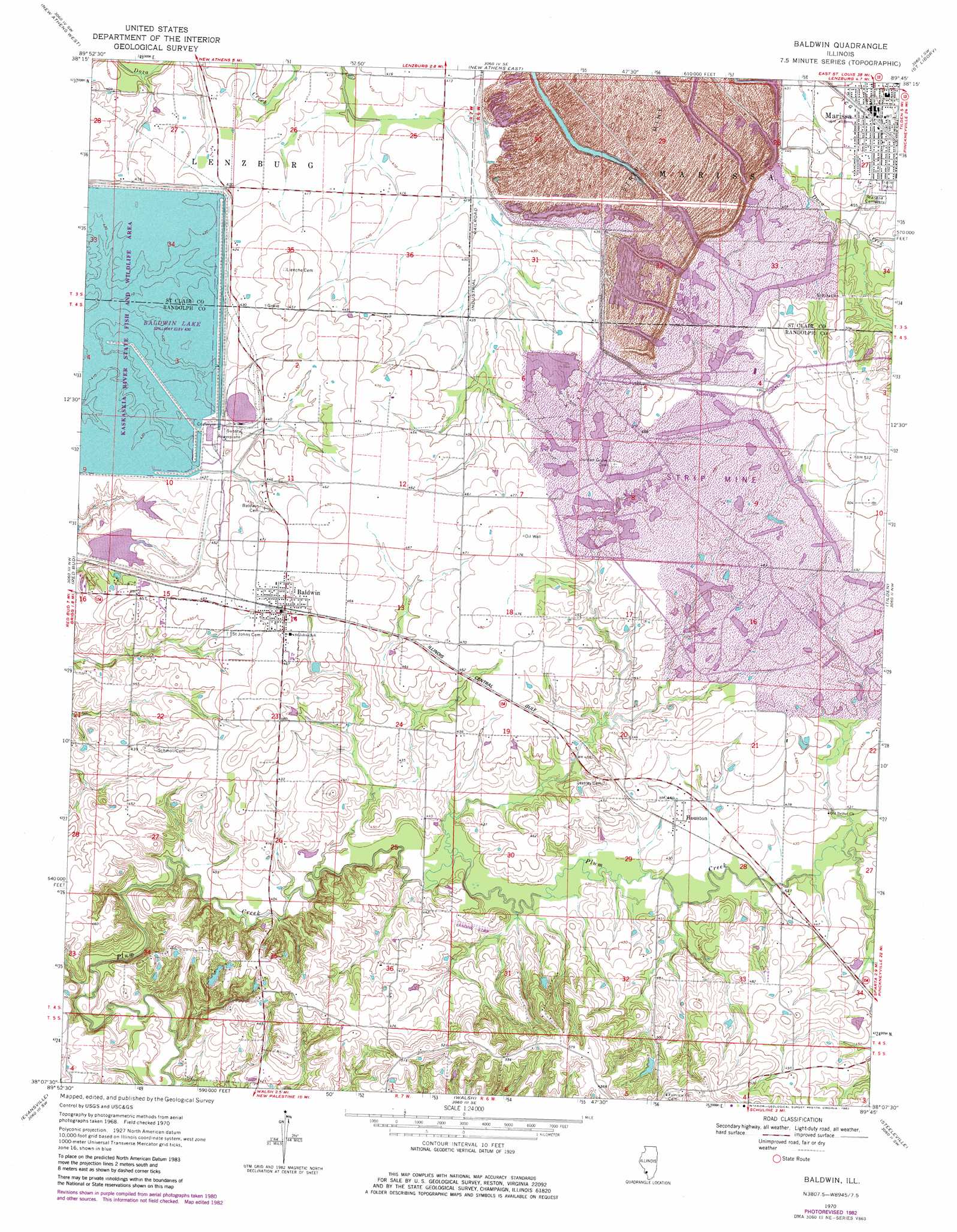
Baldwin Topo Map Illinois
To zoom in, hover over the map of Baldwin
USGS Topo Quad 38089b7 - 1:24,000 scale
| Topo Map Name: | Baldwin |
| USGS Topo Quad ID: | 38089b7 |
| Print Size: | ca. 21 1/4" wide x 27" high |
| Southeast Coordinates: | 38.125° N latitude / 89.75° W longitude |
| Map Center Coordinates: | 38.1875° N latitude / 89.8125° W longitude |
| U.S. State: | IL |
| Filename: | o38089b7.jpg |
| Download Map JPG Image: | Baldwin topo map 1:24,000 scale |
| Map Type: | Topographic |
| Topo Series: | 7.5´ |
| Map Scale: | 1:24,000 |
| Source of Map Images: | United States Geological Survey (USGS) |
| Alternate Map Versions: |
Baldwin IL 1970, updated 1972 Download PDF Buy paper map Baldwin IL 1970, updated 1982 Download PDF Buy paper map Baldwin IL 2012 Download PDF Buy paper map Baldwin IL 2015 Download PDF Buy paper map |
1:24,000 Topo Quads surrounding Baldwin
Millstadt |
Freeburg |
Mascoutah |
Venedy |
Okawville |
Paderborn |
New Athens West |
New Athens East |
Saint Libory |
Oakdale |
Ames |
Red Bud |
Baldwin |
Tilden |
Coulterville |
Prairie Du Rocher |
Evansville |
Walsh |
Steeleville |
Percy |
Sainte Genevieve |
Kaskaskia |
Chester |
Welge |
Willisville |
> Back to 38089a1 at 1:100,000 scale
> Back to 38088a1 at 1:250,000 scale
> Back to U.S. Topo Maps home
Baldwin topo map: Gazetteer
Baldwin: Airports
Peabody-Pit 6-New Shop Heliport elevation 140m 459′Redpath RLA Airport elevation 145m 475′
Baldwin: Dams
Taphorn Pond Dam elevation 137m 449′Baldwin: Mines
River King Mine Number 6 elevation 143m 469′Baldwin: Parks
Baldwin Lake State Fish and Wildlife Area elevation 131m 429′Marissa Woods Nature Preserve elevation 144m 472′
Baldwin: Populated Places
Baldwin elevation 141m 462′Houston elevation 134m 439′
Baldwin: Post Offices
Jordans Grove Post Office (historical) elevation 140m 459′Baldwin: Reservoirs
Taphorn Pond elevation 137m 449′Baldwin digital topo map on disk
Buy this Baldwin topo map showing relief, roads, GPS coordinates and other geographical features, as a high-resolution digital map file on DVD: