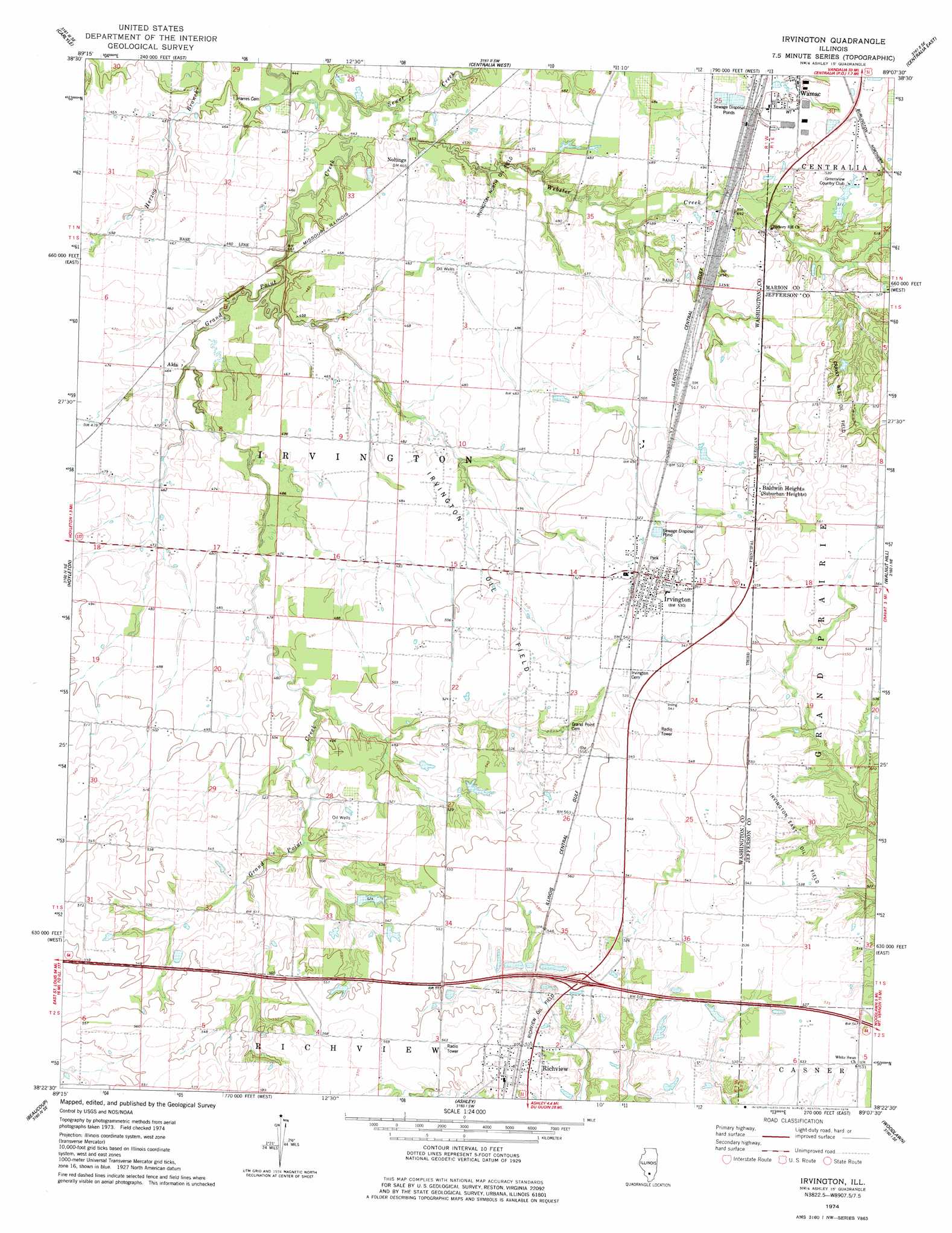
Irvington Topo Map Illinois
To zoom in, hover over the map of Irvington
USGS Topo Quad 38089d2 - 1:24,000 scale
| Topo Map Name: | Irvington |
| USGS Topo Quad ID: | 38089d2 |
| Print Size: | ca. 21 1/4" wide x 27" high |
| Southeast Coordinates: | 38.375° N latitude / 89.125° W longitude |
| Map Center Coordinates: | 38.4375° N latitude / 89.1875° W longitude |
| U.S. State: | IL |
| Filename: | o38089d2.jpg |
| Download Map JPG Image: | Irvington topo map 1:24,000 scale |
| Map Type: | Topographic |
| Topo Series: | 7.5´ |
| Map Scale: | 1:24,000 |
| Source of Map Images: | United States Geological Survey (USGS) |
| Alternate Map Versions: |
Irvington IL 1974, updated 1978 Download PDF Buy paper map Irvington IL 2012 Download PDF Buy paper map Irvington IL 2015 Download PDF Buy paper map |
1:24,000 Topo Quads surrounding Irvington
Stolletown |
Keyesport |
Boulder |
Fairman |
Salem North |
Beckemeyer |
Carlyle |
Centralia West |
Centralia East |
Salem South |
Addieville |
Hoyleton |
Irvington |
Walnut Hill |
Kell |
Nashville |
Beaucoup |
Ashley |
Woodlawn |
Mount Vernon |
Winkle |
Todds Mill |
Tamaroa |
Waltonville |
Ina |
> Back to 38089a1 at 1:100,000 scale
> Back to 38088a1 at 1:250,000 scale
> Back to U.S. Topo Maps home
Irvington topo map: Gazetteer
Irvington: Airports
Prairie Airport elevation 165m 541′Irvington: Crossings
Interchange 61 elevation 164m 538′Irvington: Dams
Greenview Country Club Pond One Dam elevation 149m 488′Irvington: Oilfields
Cravat West Oil Field elevation 168m 551′Irvington East Oil Field elevation 160m 524′
Irvington North Oil Field elevation 139m 456′
Irvington Oil Field elevation 150m 492′
Richview Oil Field elevation 164m 538′
Irvington: Populated Places
Alda elevation 141m 462′Baldwin Heights elevation 169m 554′
Irvington elevation 162m 531′
Noltings elevation 140m 459′
Richview elevation 165m 541′
Irvington: Reservoirs
Greenview Country Club Pond One elevation 149m 488′Irvington: Streams
Grand Point Creek elevation 134m 439′Sewer Creek elevation 134m 439′
Webster Creek elevation 134m 439′
Irvington digital topo map on disk
Buy this Irvington topo map showing relief, roads, GPS coordinates and other geographical features, as a high-resolution digital map file on DVD: