Hoyleton Topo Map Illinois
To zoom in, hover over the map of Hoyleton
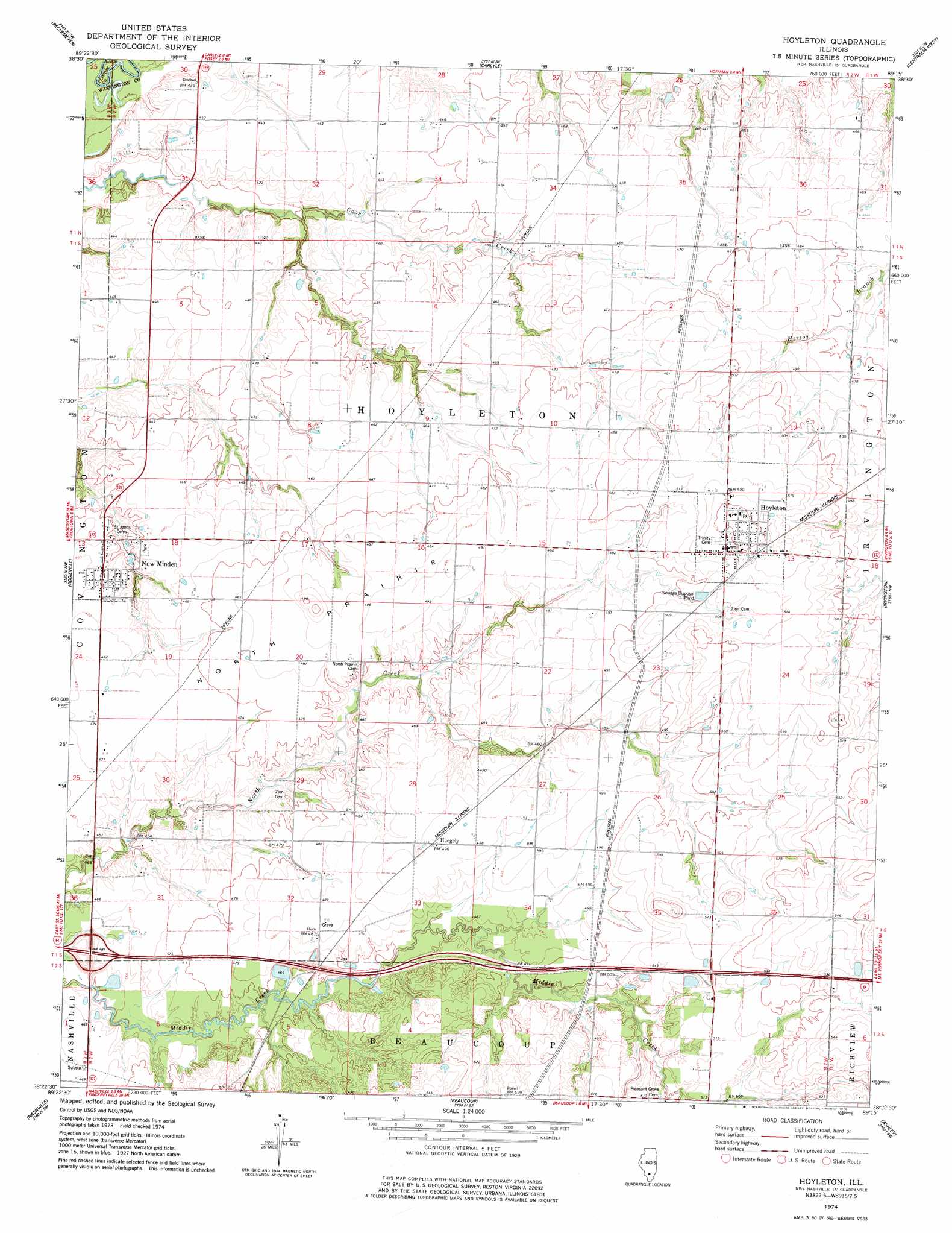
USGS Topo Quad 38089d3 - 1:24,000 scale
| Topo Map Name: | Hoyleton |
| USGS Topo Quad ID: | 38089d3 |
| Print Size: | ca. 21 1/4" wide x 27" high |
| Southeast Coordinates: | 38.375° N latitude / 89.25° W longitude |
| Map Center Coordinates: | 38.4375° N latitude / 89.3125° W longitude |
| U.S. State: | IL |
| Filename: | o38089d3.jpg |
| Download Map JPG Image: | Hoyleton topo map 1:24,000 scale |
| Map Type: | Topographic |
| Topo Series: | 7.5´ |
| Map Scale: | 1:24,000 |
| Source of Map Images: | United States Geological Survey (USGS) |
| Alternate Map Versions: |
Hoyleton IL 1974, updated 1978 Download PDF Buy paper map Hoyleton IL 2012 Download PDF Buy paper map Hoyleton IL 2015 Download PDF Buy paper map |
1:24,000 Topo Quads surrounding Hoyleton
Saint Rose |
Stolletown |
Keyesport |
Boulder |
Fairman |
Breese |
Beckemeyer |
Carlyle |
Centralia West |
Centralia East |
Okawville |
Addieville |
Hoyleton |
Irvington |
Walnut Hill |
Oakdale |
Nashville |
Beaucoup |
Ashley |
Woodlawn |
Coulterville |
Winkle |
Todds Mill |
Tamaroa |
Waltonville |
> Back to 38089a1 at 1:100,000 scale
> Back to 38088a1 at 1:250,000 scale
> Back to U.S. Topo Maps home
Hoyleton topo map: Gazetteer
Hoyleton: Crossings
Interchange 50 elevation 141m 462′Hoyleton: Flats
North Prairie elevation 145m 475′Hoyleton: Populated Places
Hoyleton elevation 158m 518′Huegely elevation 151m 495′
New Minden elevation 138m 452′
Hoyleton: Post Offices
Hoyleton Post Office elevation 159m 521′Hoyleton digital topo map on disk
Buy this Hoyleton topo map showing relief, roads, GPS coordinates and other geographical features, as a high-resolution digital map file on DVD: