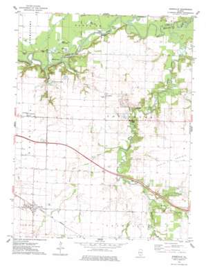
Addieville Topo Map Illinois
To zoom in, hover over the map of Addieville
USGS Topo Quad 38089d4 - 1:24,000 scale
| Topo Map Name: | Addieville |
| USGS Topo Quad ID: | 38089d4 |
| Print Size: | ca. 21 1/4" wide x 27" high |
| Southeast Coordinates: | 38.375° N latitude / 89.375° W longitude |
| Map Center Coordinates: | 38.4375° N latitude / 89.4375° W longitude |
| U.S. State: | IL |
| Filename: | o38089d4.jpg |
| Download Map JPG Image: | Addieville topo map 1:24,000 scale |
| Map Type: | Topographic |
| Topo Series: | 7.5´ |
| Map Scale: | 1:24,000 |
| Source of Map Images: | United States Geological Survey (USGS) |
| Alternate Map Versions: |
Addieville IL 1974, updated 1978 Download PDF Buy paper map Addieville IL 2012 Download PDF Buy paper map Addieville IL 2015 Download PDF Buy paper map |
1:24,000 Topo Quads surrounding Addieville
> Back to 38089a1 at 1:100,000 scale
> Back to 38088a1 at 1:250,000 scale
> Back to U.S. Topo Maps home
Addieville topo map: Gazetteer
Addieville: Bridges
Covington Bridge elevation 123m 403′Addieville: Lakes
Big Flat Lake elevation 125m 410′Big Forked Lake elevation 124m 406′
Horseshoe Lake elevation 125m 410′
Little Flat Lake elevation 125m 410′
RC Kremmers Lake elevation 131m 429′
Round Lake elevation 125m 410′
Turkey Lake elevation 126m 413′
Wildcat Lake elevation 125m 410′
Addieville: Populated Places
Addieville elevation 143m 469′Covington elevation 144m 472′
Frogtown elevation 137m 449′
Addieville: Streams
Beaver Pond Creek elevation 131m 429′Buckingham Branch elevation 123m 403′
Coon Creek elevation 125m 410′
Crooked Creek elevation 123m 403′
Little Crooked Creek elevation 123m 403′
Lunte Creek elevation 137m 449′
Middle Creek elevation 133m 436′
Nashville Creek elevation 133m 436′
North Creek elevation 132m 433′
Willow Creek elevation 131m 429′
Addieville digital topo map on disk
Buy this Addieville topo map showing relief, roads, GPS coordinates and other geographical features, as a high-resolution digital map file on DVD:


