Boulder Topo Map Illinois
To zoom in, hover over the map of Boulder
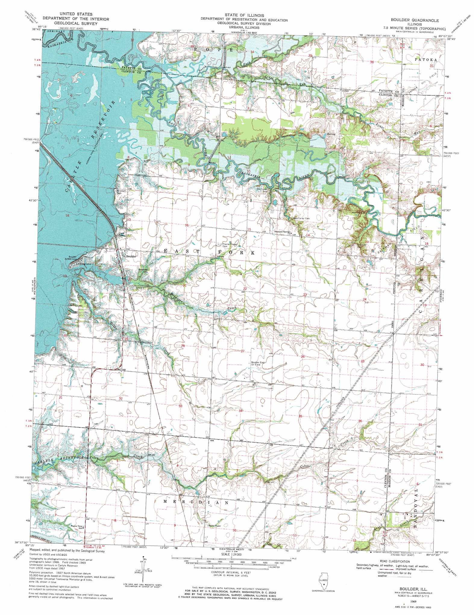
USGS Topo Quad 38089f2 - 1:24,000 scale
| Topo Map Name: | Boulder |
| USGS Topo Quad ID: | 38089f2 |
| Print Size: | ca. 21 1/4" wide x 27" high |
| Southeast Coordinates: | 38.625° N latitude / 89.125° W longitude |
| Map Center Coordinates: | 38.6875° N latitude / 89.1875° W longitude |
| U.S. State: | IL |
| Filename: | o38089f2.jpg |
| Download Map JPG Image: | Boulder topo map 1:24,000 scale |
| Map Type: | Topographic |
| Topo Series: | 7.5´ |
| Map Scale: | 1:24,000 |
| Source of Map Images: | United States Geological Survey (USGS) |
| Alternate Map Versions: |
Boulder IL 1969, updated 1971 Download PDF Buy paper map Boulder IL 2012 Download PDF Buy paper map Boulder IL 2015 Download PDF Buy paper map |
1:24,000 Topo Quads surrounding Boulder
Greenville |
Mulberry Grove |
Hagarstown |
Vandalia |
Brownstown |
Beaver Creek |
Pleasant Mound |
Wildcat Lake |
Patoka |
Saint Paul |
Stolletown |
Keyesport |
Boulder |
Fairman |
Salem North |
Beckemeyer |
Carlyle |
Centralia West |
Centralia East |
Salem South |
Addieville |
Hoyleton |
Irvington |
Walnut Hill |
Kell |
> Back to 38089e1 at 1:100,000 scale
> Back to 38088a1 at 1:250,000 scale
> Back to U.S. Topo Maps home
Boulder topo map: Gazetteer
Boulder: Dams
Weiss Lake Dam elevation 148m 485′Boulder: Flats
Boulder Bottoms (historical) elevation 136m 446′Boulder: Oilfields
Boulder East Oil Field elevation 150m 492′Fairman Oil Field elevation 143m 469′
Boulder: Populated Places
Boulder elevation 142m 465′Boulder: Reservoirs
Weiss Lake elevation 148m 485′Boulder: Springs
Watson Springs elevation 143m 469′Boulder: Streams
Brewster Creek elevation 136m 446′Gibbs Creek elevation 136m 446′
Louse Run elevation 137m 449′
North Fork East Fork Kaskaskia River elevation 136m 446′
Boulder digital topo map on disk
Buy this Boulder topo map showing relief, roads, GPS coordinates and other geographical features, as a high-resolution digital map file on DVD: