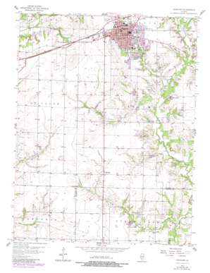
Highland Topo Map Illinois
To zoom in, hover over the map of Highland
USGS Topo Quad 38089f6 - 1:24,000 scale
| Topo Map Name: | Highland |
| USGS Topo Quad ID: | 38089f6 |
| Print Size: | ca. 21 1/4" wide x 27" high |
| Southeast Coordinates: | 38.625° N latitude / 89.625° W longitude |
| Map Center Coordinates: | 38.6875° N latitude / 89.6875° W longitude |
| U.S. State: | IL |
| Filename: | o38089f6.jpg |
| Download Map JPG Image: | Highland topo map 1:24,000 scale |
| Map Type: | Topographic |
| Topo Series: | 7.5´ |
| Map Scale: | 1:24,000 |
| Source of Map Images: | United States Geological Survey (USGS) |
| Alternate Map Versions: |
Highland IL 1957, updated 1958 Download PDF Buy paper map Highland IL 1957, updated 1981 Download PDF Buy paper map Highland IL 2012 Download PDF Buy paper map Highland IL 2015 Download PDF Buy paper map |
1:24,000 Topo Quads surrounding Highland
> Back to 38089e1 at 1:100,000 scale
> Back to 38088a1 at 1:250,000 scale
> Back to U.S. Topo Maps home
Highland topo map: Gazetteer
Highland: Dams
Diebert-Hortsman Dam elevation 149m 488′Sportsman Lake Dam elevation 146m 479′
Highland: Lakes
Heavenly Hills Lake elevation 147m 482′Highland: Parks
Hoffman Park elevation 159m 521′Kaeser Park elevation 155m 508′
Lindenthal Park elevation 149m 488′
Madison County Fairgrounds elevation 150m 492′
Merwin Park elevation 165m 541′
Spindler Park elevation 162m 531′
Water Tower Park elevation 167m 547′
Highland: Populated Places
Highland elevation 161m 528′Saint Morgan elevation 154m 505′
Highland: Post Offices
Highland Post Office elevation 167m 547′Highland: Reservoirs
Diebert-Hortsman Lake elevation 149m 488′Lake Wanda elevation 161m 528′
Ron Lake elevation 146m 479′
Sportsman Lake elevation 146m 479′
Highland: Streams
Buckeye Branch elevation 140m 459′Corlock Branch elevation 143m 469′
Highland digital topo map on disk
Buy this Highland topo map showing relief, roads, GPS coordinates and other geographical features, as a high-resolution digital map file on DVD:


