Sorento South Topo Map Illinois
To zoom in, hover over the map of Sorento South
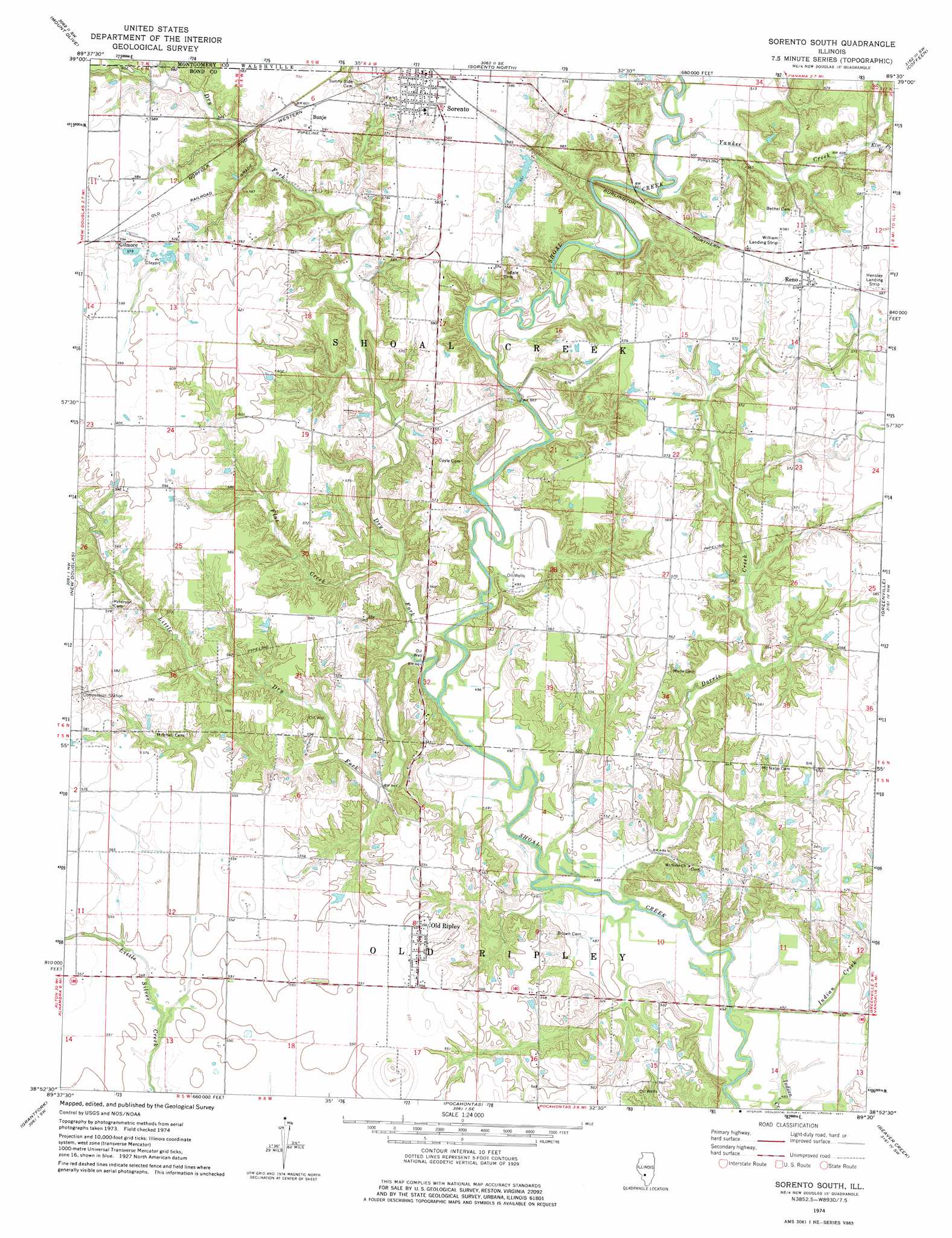
USGS Topo Quad 38089h5 - 1:24,000 scale
| Topo Map Name: | Sorento South |
| USGS Topo Quad ID: | 38089h5 |
| Print Size: | ca. 21 1/4" wide x 27" high |
| Southeast Coordinates: | 38.875° N latitude / 89.5° W longitude |
| Map Center Coordinates: | 38.9375° N latitude / 89.5625° W longitude |
| U.S. State: | IL |
| Filename: | o38089h5.jpg |
| Download Map JPG Image: | Sorento South topo map 1:24,000 scale |
| Map Type: | Topographic |
| Topo Series: | 7.5´ |
| Map Scale: | 1:24,000 |
| Source of Map Images: | United States Geological Survey (USGS) |
| Alternate Map Versions: |
Sorento South IL 1974, updated 1977 Download PDF Buy paper map Sorento South IL 2012 Download PDF Buy paper map Sorento South IL 2015 Download PDF Buy paper map |
1:24,000 Topo Quads surrounding Sorento South
Gillespie North |
Litchfield |
Butler |
Hillsboro |
Bald Knob |
Gillespie South |
Mount Olive |
Sorento North |
Coffeen |
Fillmore |
Worden |
New Douglas |
Sorento South |
Greenville |
Mulberry Grove |
Marine |
Grantfork |
Pocahontas |
Beaver Creek |
Pleasant Mound |
Saint Jacob |
Highland |
Saint Rose |
Stolletown |
Keyesport |
> Back to 38089e1 at 1:100,000 scale
> Back to 38088a1 at 1:250,000 scale
> Back to U.S. Topo Maps home
Sorento South topo map: Gazetteer
Sorento South: Airports
Nance Airport elevation 170m 557′Sorento South: Dams
Sorento Reservoir Dam elevation 166m 544′Sorento South: Populated Places
Bunje elevation 180m 590′Gilmore elevation 180m 590′
Old Ripley elevation 171m 561′
Reno elevation 176m 577′
Sorento elevation 178m 583′
Sorento South: Post Offices
Pleasant Prairie Post Office (historical) elevation 178m 583′Sorento South: Reservoirs
Sorento Reservoir elevation 166m 544′Sorento South: Streams
Dorris Creek elevation 148m 485′Dry Fork elevation 148m 485′
Elm Point Branch elevation 160m 524′
Flat Creek elevation 149m 488′
Indian Creek elevation 145m 475′
Little Dry Fork elevation 149m 488′
Yankee Creek elevation 152m 498′
Sorento South digital topo map on disk
Buy this Sorento South topo map showing relief, roads, GPS coordinates and other geographical features, as a high-resolution digital map file on DVD: