Cyclone Hollow Topo Map Missouri
To zoom in, hover over the map of Cyclone Hollow
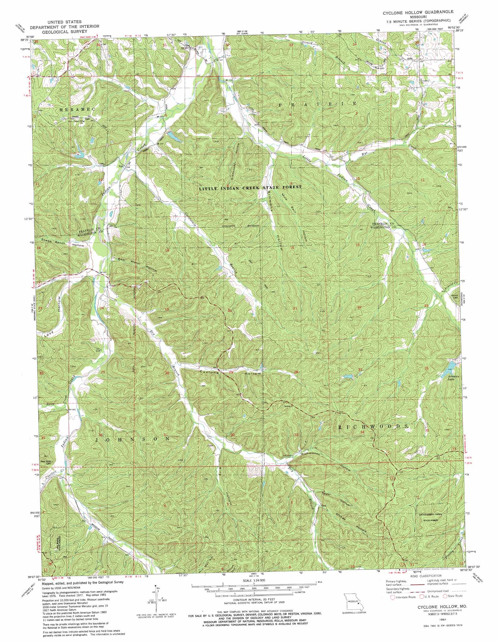
USGS Topo Quad 38090b8 - 1:24,000 scale
| Topo Map Name: | Cyclone Hollow |
| USGS Topo Quad ID: | 38090b8 |
| Print Size: | ca. 21 1/4" wide x 27" high |
| Southeast Coordinates: | 38.125° N latitude / 90.875° W longitude |
| Map Center Coordinates: | 38.1875° N latitude / 90.9375° W longitude |
| U.S. State: | MO |
| Filename: | o38090b8.jpg |
| Download Map JPG Image: | Cyclone Hollow topo map 1:24,000 scale |
| Map Type: | Topographic |
| Topo Series: | 7.5´ |
| Map Scale: | 1:24,000 |
| Source of Map Images: | United States Geological Survey (USGS) |
| Alternate Map Versions: |
Cyclone Hollow MO 1981, updated 1981 Download PDF Buy paper map Cyclone Hollow MO 2012 Download PDF Buy paper map Cyclone Hollow MO 2015 Download PDF Buy paper map |
1:24,000 Topo Quads surrounding Cyclone Hollow
Leslie |
Union |
Moselle |
Gray Summit |
Pacific |
Spring Bluff |
Stanton |
Saint Clair |
Lonedell |
Cedar Hill |
Sullivan |
Meramec State Park |
Cyclone Hollow |
Richwoods |
Fletcher |
Onondaga Cave |
Anthonies Mill |
Ebo |
Old Mines |
Tiff |
Huzzah |
Berryman |
Shirley |
Potosi |
Mineral Point |
> Back to 38090a1 at 1:100,000 scale
> Back to 38090a1 at 1:250,000 scale
> Back to U.S. Topo Maps home
Cyclone Hollow topo map: Gazetteer
Cyclone Hollow: Dams
Artesian Lake Dam elevation 220m 721′Baha Trail Lake Dam elevation 231m 757′
George Lake Dam elevation 172m 564′
Ruhl Lake Dam elevation 188m 616′
Cyclone Hollow: Populated Places
George (historical) elevation 164m 538′Huff elevation 245m 803′
Cyclone Hollow: Reservoirs
Artesian Lake elevation 220m 721′Cyclone Hollow: Streams
Arnold Creek elevation 196m 643′California Branch elevation 171m 561′
Dry Branch elevation 177m 580′
Jules Creek elevation 185m 606′
Little Courtois Creek elevation 192m 629′
Little Indian Creek elevation 162m 531′
Rye Creek elevation 177m 580′
Cyclone Hollow: Valleys
Bear Water Hollow elevation 176m 577′Bolton Hollow elevation 213m 698′
Cyclone Hollow elevation 200m 656′
Egger Hollow elevation 233m 764′
Granddaddy Hollow elevation 170m 557′
Levy Hollow elevation 179m 587′
Levy Hollow elevation 177m 580′
McKee Hollow elevation 237m 777′
Mule Barn Hollow elevation 181m 593′
Richwoods Hollow elevation 222m 728′
Ring Hollow elevation 207m 679′
Sheep Ranch Hollow elevation 175m 574′
Simmons Hollow elevation 172m 564′
Cyclone Hollow digital topo map on disk
Buy this Cyclone Hollow topo map showing relief, roads, GPS coordinates and other geographical features, as a high-resolution digital map file on DVD: