Saint Clair Topo Map Missouri
To zoom in, hover over the map of Saint Clair
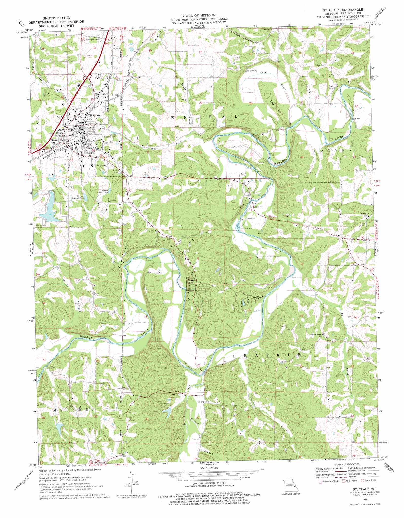
USGS Topo Quad 38090c8 - 1:24,000 scale
| Topo Map Name: | Saint Clair |
| USGS Topo Quad ID: | 38090c8 |
| Print Size: | ca. 21 1/4" wide x 27" high |
| Southeast Coordinates: | 38.25° N latitude / 90.875° W longitude |
| Map Center Coordinates: | 38.3125° N latitude / 90.9375° W longitude |
| U.S. State: | MO |
| Filename: | o38090c8.jpg |
| Download Map JPG Image: | Saint Clair topo map 1:24,000 scale |
| Map Type: | Topographic |
| Topo Series: | 7.5´ |
| Map Scale: | 1:24,000 |
| Source of Map Images: | United States Geological Survey (USGS) |
| Alternate Map Versions: |
St. Clair MO 1969, updated 1971 Download PDF Buy paper map St. Clair MO 1969, updated 1978 Download PDF Buy paper map St. Clair MO 1980, updated 1982 Download PDF Buy paper map Saint Clair MO 2012 Download PDF Buy paper map Saint Clair MO 2015 Download PDF Buy paper map |
1:24,000 Topo Quads surrounding Saint Clair
New Haven |
Washington West |
Washington East |
Labadie |
Eureka |
Leslie |
Union |
Moselle |
Gray Summit |
Pacific |
Spring Bluff |
Stanton |
Saint Clair |
Lonedell |
Cedar Hill |
Sullivan |
Meramec State Park |
Cyclone Hollow |
Richwoods |
Fletcher |
Onondaga Cave |
Anthonies Mill |
Ebo |
Old Mines |
Tiff |
> Back to 38090a1 at 1:100,000 scale
> Back to 38090a1 at 1:250,000 scale
> Back to U.S. Topo Maps home
Saint Clair topo map: Gazetteer
Saint Clair: Airports
Saint Clair Regional Airport elevation 196m 643′Saint Clair: Dams
Carved Lake Dam elevation 174m 570′Crescent Lake Dam elevation 208m 682′
Heil Lake Dam elevation 188m 616′
Lake Saint Clair Number One Dam elevation 206m 675′
Lake Saint Clair Number Two Dam elevation 218m 715′
Lake Thunderbird Dam elevation 171m 561′
Peters Lake Dam elevation 221m 725′
Smith Lake Dam elevation 191m 626′
Saint Clair: Mines
Virginia Mines elevation 184m 603′Virginia Mines (historical) elevation 184m 603′
Saint Clair: Populated Places
Parkway elevation 222m 728′Piney Park elevation 227m 744′
Plum Ford elevation 164m 538′
Saint Clair elevation 234m 767′
Saint Clair: Reservoirs
Carved Lake elevation 174m 570′Saint Clair: Springs
Cove Spring elevation 173m 567′Saint Clair: Streams
Brush Creek elevation 153m 501′Cove Creek elevation 150m 492′
Gibson Creek elevation 153m 501′
Gibson Creek elevation 153m 501′
Girard Branch elevation 155m 508′
Hoosier Creek elevation 159m 521′
Indian Creek elevation 156m 511′
Rye Creek elevation 152m 498′
West Fork Brush Creek elevation 150m 492′
Saint Clair: Summits
Lost Hill elevation 194m 636′Saint Clair digital topo map on disk
Buy this Saint Clair topo map showing relief, roads, GPS coordinates and other geographical features, as a high-resolution digital map file on DVD: