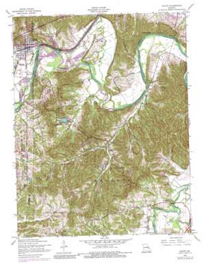
Pacific Topo Map Missouri
To zoom in, hover over the map of Pacific
USGS Topo Quad 38090d6 - 1:24,000 scale
| Topo Map Name: | Pacific |
| USGS Topo Quad ID: | 38090d6 |
| Print Size: | ca. 21 1/4" wide x 27" high |
| Southeast Coordinates: | 38.375° N latitude / 90.625° W longitude |
| Map Center Coordinates: | 38.4375° N latitude / 90.6875° W longitude |
| U.S. State: | MO |
| Filename: | o38090d6.jpg |
| Download Map JPG Image: | Pacific topo map 1:24,000 scale |
| Map Type: | Topographic |
| Topo Series: | 7.5´ |
| Map Scale: | 1:24,000 |
| Source of Map Images: | United States Geological Survey (USGS) |
| Alternate Map Versions: |
Pacific MO 1937 Download PDF Buy paper map Pacific MO 1937, updated 1939 Download PDF Buy paper map Pacific MO 1954, updated 1959 Download PDF Buy paper map Pacific MO 1954, updated 1968 Download PDF Buy paper map Pacific MO 1954, updated 1969 Download PDF Buy paper map Pacific MO 1954, updated 1975 Download PDF Buy paper map Pacific MO 1954, updated 1984 Download PDF Buy paper map Pacific MO 2012 Download PDF Buy paper map Pacific MO 2015 Download PDF Buy paper map |
1:24,000 Topo Quads surrounding Pacific
> Back to 38090a1 at 1:100,000 scale
> Back to 38090a1 at 1:250,000 scale
> Back to U.S. Topo Maps home
Pacific topo map: Gazetteer
Pacific: Areas
La Barque Hills elevation 224m 734′Pacific: Dams
Alfred Buhl, Junior Lake Dam elevation 170m 557′Camp Solidarity Lake Dam elevation 146m 479′
Crystal Lake Dam elevation 174m 570′
Duncan Lake Dam elevation 164m 538′
First Central Services Lake Dam elevation 152m 498′
Fun Valley Dam elevation 153m 501′
Gem Lake Dam elevation 180m 590′
Lake Tekawitha Dam elevation 160m 524′
Lynch Lake Dam elevation 202m 662′
Rustic Hills Lake Dam elevation 215m 705′
Woodcliff Lake Dam elevation 146m 479′
Zeman Lake Dam elevation 156m 511′
Pacific: Populated Places
Ashland (historical) elevation 148m 485′Byrnesville elevation 147m 482′
Pacific elevation 142m 465′
Pacific: Reservoirs
Buhl Lake elevation 170m 557′Car Lake elevation 146m 479′
Fun Valley Lake elevation 153m 501′
Gem Lake elevation 180m 590′
Lake Tekakwitha elevation 162m 531′
Lake Tekawitha elevation 160m 524′
Lynch Lake elevation 202m 662′
Rustic Hills Lake elevation 215m 705′
Pacific: Streams
Brush Creek elevation 132m 433′Buck Creek elevation 141m 462′
Clear Creek elevation 132m 433′
Fox Creek elevation 130m 426′
La Barque Creek elevation 129m 423′
McFall Creek elevation 129m 423′
Sand Creek elevation 137m 449′
Pacific: Summits
Bald Hill elevation 200m 656′Lost Hill elevation 182m 597′
Pacific: Valleys
Catawissa Hollow elevation 177m 580′Pacific digital topo map on disk
Buy this Pacific topo map showing relief, roads, GPS coordinates and other geographical features, as a high-resolution digital map file on DVD:


