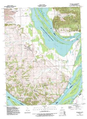
Brussels Topo Map Illinois
To zoom in, hover over the map of Brussels
USGS Topo Quad 38090h5 - 1:24,000 scale
| Topo Map Name: | Brussels |
| USGS Topo Quad ID: | 38090h5 |
| Print Size: | ca. 21 1/4" wide x 27" high |
| Southeast Coordinates: | 38.875° N latitude / 90.5° W longitude |
| Map Center Coordinates: | 38.9375° N latitude / 90.5625° W longitude |
| U.S. States: | IL, MO |
| Filename: | o38090h5.jpg |
| Download Map JPG Image: | Brussels topo map 1:24,000 scale |
| Map Type: | Topographic |
| Topo Series: | 7.5´ |
| Map Scale: | 1:24,000 |
| Source of Map Images: | United States Geological Survey (USGS) |
| Alternate Map Versions: |
Brussels IL 1954, updated 1959 Download PDF Buy paper map Brussels IL 1954, updated 1969 Download PDF Buy paper map Brussels IL 1954, updated 1977 Download PDF Buy paper map Brussels IL 1990, updated 1995 Download PDF Buy paper map Brussels IL 2012 Download PDF Buy paper map Brussels IL 2015 Download PDF Buy paper map |
1:24,000 Topo Quads surrounding Brussels
> Back to 38090e1 at 1:100,000 scale
> Back to 38090a1 at 1:250,000 scale
> Back to U.S. Topo Maps home
Brussels topo map: Gazetteer
Brussels: Capes
Calhoun Point elevation 130m 426′Brussels: Cliffs
Goat Cliff elevation 207m 679′Brussels: Guts
Murphy Slough elevation 128m 419′Sixmile Slough elevation 129m 423′
Brussels: Islands
Bolter Island elevation 130m 426′Iowa Island elevation 129m 423′
Island 518 elevation 130m 426′
Sixmile Island elevation 128m 419′
Brussels: Lakes
Deep Lake elevation 128m 419′Flat Lake (historical) elevation 128m 419′
Gilbert Lake elevation 128m 419′
Lower Stump Lake elevation 128m 419′
Royal Lake elevation 128m 419′
Swan Lake elevation 128m 419′
Upper Stump Lake elevation 128m 419′
Brussels: Parks
Pere Marquette State Park elevation 230m 754′Brussels: Populated Places
Brussels elevation 159m 521′Centerville elevation 162m 531′
Conrad elevation 190m 623′
Deer Plain elevation 138m 452′
Golden Eagle elevation 205m 672′
Marshall Landing elevation 127m 416′
Meppen elevation 139m 456′
The Crossroads elevation 196m 643′
Vans Camp elevation 130m 426′
Winneberger elevation 201m 659′
Brussels: Springs
Twin Springs elevation 132m 433′Brussels: Streams
Metz Creek elevation 131m 429′Brussels: Summits
Knolle Hill elevation 186m 610′Lone Tree Indian Mound elevation 161m 528′
McAdams Peak elevation 245m 803′
Tucker Knob elevation 268m 879′
Two Story Hill elevation 188m 616′
Brussels: Valleys
Deer Lick Hollow elevation 133m 436′Greenbay Hollow elevation 142m 465′
Two Branch Hollow elevation 129m 423′
Williams Hollow elevation 129m 423′
Brussels digital topo map on disk
Buy this Brussels topo map showing relief, roads, GPS coordinates and other geographical features, as a high-resolution digital map file on DVD:


