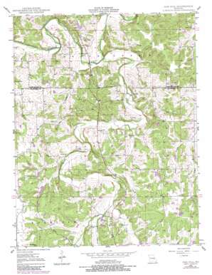
Oak Hill Topo Map Missouri
To zoom in, hover over the map of Oak Hill
USGS Topo Quad 38091b4 - 1:24,000 scale
| Topo Map Name: | Oak Hill |
| USGS Topo Quad ID: | 38091b4 |
| Print Size: | ca. 21 1/4" wide x 27" high |
| Southeast Coordinates: | 38.125° N latitude / 91.375° W longitude |
| Map Center Coordinates: | 38.1875° N latitude / 91.4375° W longitude |
| U.S. State: | MO |
| Filename: | o38091b4.jpg |
| Download Map JPG Image: | Oak Hill topo map 1:24,000 scale |
| Map Type: | Topographic |
| Topo Series: | 7.5´ |
| Map Scale: | 1:24,000 |
| Source of Map Images: | United States Geological Survey (USGS) |
| Alternate Map Versions: |
Oak Hill MO 1948, updated 1960 Download PDF Buy paper map Oak Hill MO 1948, updated 1973 Download PDF Buy paper map Oak Hill MO 1948, updated 1980 Download PDF Buy paper map Oak Hill MO 1949 Download PDF Buy paper map Oak Hill MO 1949 Download PDF Buy paper map Oak Hill MO 2012 Download PDF Buy paper map Oak Hill MO 2015 Download PDF Buy paper map |
1:24,000 Topo Quads surrounding Oak Hill
> Back to 38091a1 at 1:100,000 scale
> Back to 38090a1 at 1:250,000 scale
> Back to U.S. Topo Maps home
Oak Hill topo map: Gazetteer
Oak Hill: Dams
Alexander Lake Dam elevation 268m 879′Eickhoff Lake Dam elevation 295m 967′
Forester Lake Dam elevation 251m 823′
Frerichs Lake Section 4 Dam elevation 295m 967′
Frerichs Section 22 Lake Dam elevation 269m 882′
Frericks Section 34 Lake Dam elevation 228m 748′
Hickory Lake Dam elevation 246m 807′
Holmstrom South Lake Dam elevation 274m 898′
Kozlowski Lake Dam elevation 263m 862′
Krekder Lake Dam elevation 264m 866′
Neill Lake Dam elevation 292m 958′
Skinner-Sorth-Koch-Kreider Lake Dam elevation 263m 862′
Stubblefield Lake Dam elevation 283m 928′
Walker North Lake Dam elevation 250m 820′
Walker South Lake Dam elevation 254m 833′
Worthington Lake Dam elevation 252m 826′
Oak Hill: Mines
Taylor Iron Mine elevation 283m 928′Oak Hill: Populated Places
Oak Hill elevation 229m 751′Vieman (historical) elevation 282m 925′
Oak Hill: Reservoirs
Alexander Lake elevation 268m 879′Eickhoff Lake elevation 295m 967′
Forester Lake elevation 251m 823′
Frerichs Lake Section 22 elevation 269m 882′
Frerichs Lake Section 4 elevation 295m 967′
Hickory Lake elevation 246m 807′
Holmstrom South Lake elevation 274m 898′
Kozlowski Lake elevation 263m 862′
Krekder Lake elevation 264m 866′
Neill Lake elevation 292m 958′
Skinner-Sorth-Koch-Kreider Lake elevation 263m 862′
Stubblefield Lake elevation 283m 928′
Walker North Lake elevation 250m 820′
Walker South Lake elevation 254m 833′
Oak Hill: Streams
Big River Creek elevation 234m 767′Brush Creek elevation 220m 721′
Gal Branch elevation 224m 734′
Hamby Branch elevation 223m 731′
Pleasant Valley Creek elevation 248m 813′
Prairie Creek elevation 246m 807′
Souder Creek elevation 237m 777′
West Branch Threemile Creek elevation 246m 807′
Oak Hill digital topo map on disk
Buy this Oak Hill topo map showing relief, roads, GPS coordinates and other geographical features, as a high-resolution digital map file on DVD:


