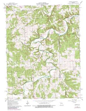
Redbird Topo Map Missouri
To zoom in, hover over the map of Redbird
USGS Topo Quad 38091b5 - 1:24,000 scale
| Topo Map Name: | Redbird |
| USGS Topo Quad ID: | 38091b5 |
| Print Size: | ca. 21 1/4" wide x 27" high |
| Southeast Coordinates: | 38.125° N latitude / 91.5° W longitude |
| Map Center Coordinates: | 38.1875° N latitude / 91.5625° W longitude |
| U.S. State: | MO |
| Filename: | o38091b5.jpg |
| Download Map JPG Image: | Redbird topo map 1:24,000 scale |
| Map Type: | Topographic |
| Topo Series: | 7.5´ |
| Map Scale: | 1:24,000 |
| Source of Map Images: | United States Geological Survey (USGS) |
| Alternate Map Versions: |
Redbird MO 1962, updated 1964 Download PDF Buy paper map Redbird MO 1962, updated 1980 Download PDF Buy paper map Redbird MO 2012 Download PDF Buy paper map Redbird MO 2015 Download PDF Buy paper map |
1:24,000 Topo Quads surrounding Redbird
> Back to 38091a1 at 1:100,000 scale
> Back to 38090a1 at 1:250,000 scale
> Back to U.S. Topo Maps home
Redbird topo map: Gazetteer
Redbird: Areas
Eastern Ozarks elevation 307m 1007′Redbird: Dams
Lerwick Lake Dam elevation 265m 869′McCloskey Lake Dam elevation 258m 846′
Pueschel Lake Dam elevation 268m 879′
Redbird: Populated Places
Arthur Spring Ford elevation 235m 770′Glaser Ford elevation 229m 751′
Jake Prairie elevation 281m 921′
Leduc (historical) elevation 271m 889′
Redbird elevation 257m 843′
Royal elevation 294m 964′
Sewell Ford elevation 238m 780′
Redbird: Post Offices
Margaret Post Office (historical) elevation 279m 915′Redbird: Reservoirs
Fritz Pueschel Lake elevation 268m 879′McCloskey Lake elevation 258m 846′
Redbird: Springs
Arthur Spring elevation 238m 780′Mint Spring elevation 241m 790′
Redbird: Streams
Bowen Creek elevation 243m 797′Lanes Fork elevation 249m 816′
Price Creek elevation 238m 780′
Reisobel Branch elevation 238m 780′
Wallace Creek elevation 246m 807′
Redbird digital topo map on disk
Buy this Redbird topo map showing relief, roads, GPS coordinates and other geographical features, as a high-resolution digital map file on DVD:


