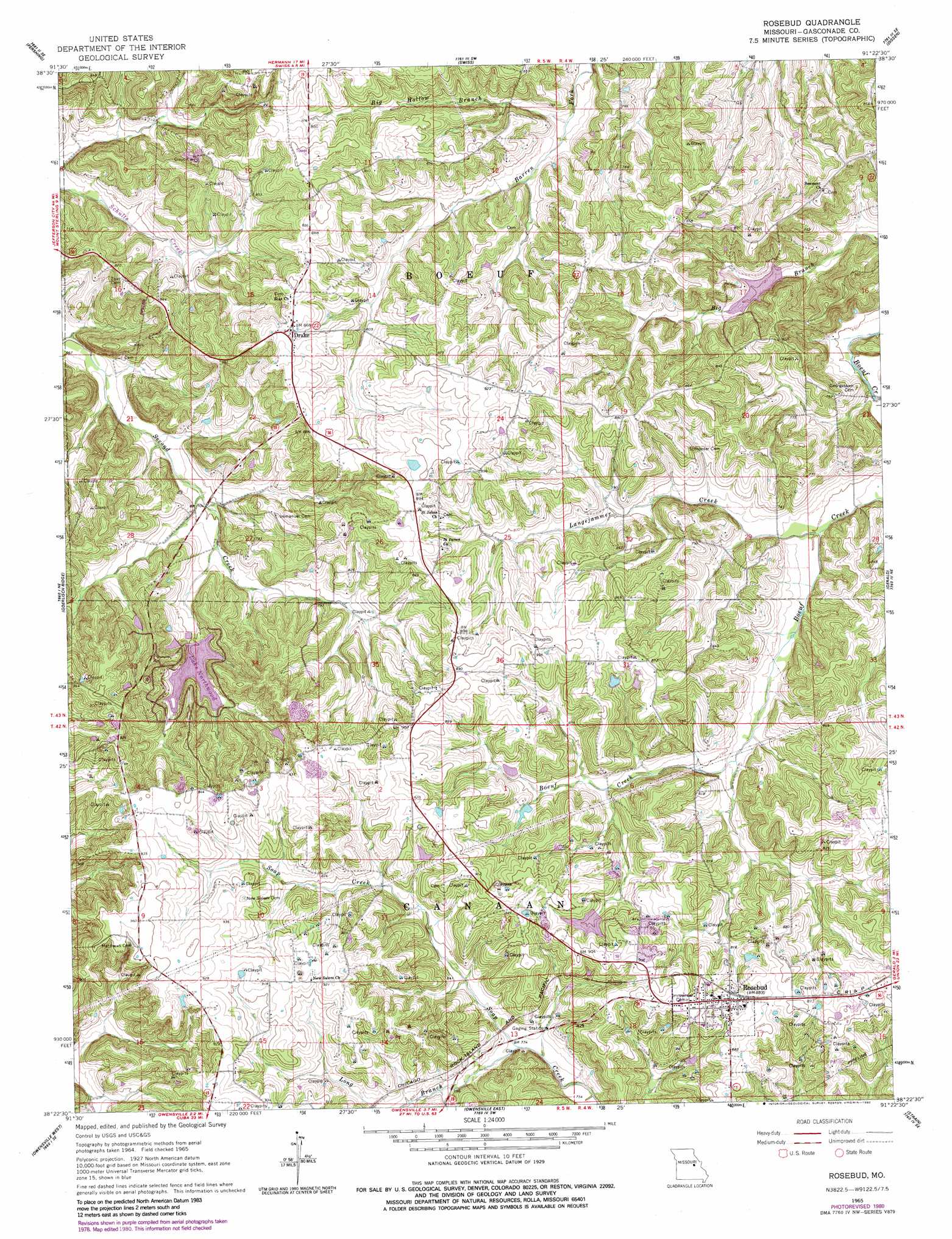
Rosebud Topo Map Missouri
To zoom in, hover over the map of Rosebud
USGS Topo Quad 38091d4 - 1:24,000 scale
| Topo Map Name: | Rosebud |
| USGS Topo Quad ID: | 38091d4 |
| Print Size: | ca. 21 1/4" wide x 27" high |
| Southeast Coordinates: | 38.375° N latitude / 91.375° W longitude |
| Map Center Coordinates: | 38.4375° N latitude / 91.4375° W longitude |
| U.S. State: | MO |
| Filename: | o38091d4.jpg |
| Download Map JPG Image: | Rosebud topo map 1:24,000 scale |
| Map Type: | Topographic |
| Topo Series: | 7.5´ |
| Map Scale: | 1:24,000 |
| Source of Map Images: | United States Geological Survey (USGS) |
| Alternate Map Versions: |
Rosebud MO 1965, updated 1967 Download PDF Buy paper map Rosebud MO 1965, updated 1980 Download PDF Buy paper map Rosebud MO 2012 Download PDF Buy paper map Rosebud MO 2015 Download PDF Buy paper map |
1:24,000 Topo Quads surrounding Rosebud
Morrison |
Gasconade |
Hermann |
Berger |
Treloar |
Fredericksburg |
Pershing |
Swiss |
Dissen |
New Haven |
Cooper Hill |
Coerlisch Ridge |
Rosebud |
Gerald |
Leslie |
Belle |
Owensville West |
Owensville East |
Strain |
Spring Bluff |
High Gate |
Redbird |
Oak Hill |
Argo |
Sullivan |
> Back to 38091a1 at 1:100,000 scale
> Back to 38090a1 at 1:250,000 scale
> Back to U.S. Topo Maps home
Rosebud topo map: Gazetteer
Rosebud: Dams
Ahmad Lake Dam elevation 232m 761′Becker Lake Dam elevation 281m 921′
Boston Lake Dam elevation 260m 853′
Brandt Lake Dam elevation 253m 830′
Daizy Valley Lake Dam elevation 216m 708′
Jackson Lake Dam elevation 246m 807′
Lake Northwoods Dam elevation 230m 754′
Lake Northwoods West Dam elevation 230m 754′
Langenberg Lake Dam elevation 260m 853′
Laury Lake Dam elevation 259m 849′
Limberg Lake Dam elevation 264m 866′
Sunswept Lake Dam elevation 258m 846′
Rosebud: Populated Places
Drake elevation 262m 859′Rosebud elevation 273m 895′
Wiffenberg elevation 277m 908′
Rosebud: Reservoirs
Daizy Vally Reservoir elevation 216m 708′Fishing Lake elevation 230m 754′
Lake Northwood elevation 237m 777′
Lake Northwoods elevation 230m 754′
Rosebud: Streams
Big Hollow Branch elevation 216m 708′Langejammer Creek elevation 211m 692′
Long Branch elevation 245m 803′
Rosebud digital topo map on disk
Buy this Rosebud topo map showing relief, roads, GPS coordinates and other geographical features, as a high-resolution digital map file on DVD: